 |
|
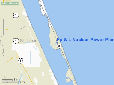
Florida Power and Light Co Nuclear Power Plant Heliport |
Location
& QuickFacts
|
FAA Information Effective: |
2007-01-18 |
|
Airport
Identifier: |
75FD |
|
Airport
Status: |
Operational |
|
Longitude/Latitude: |
080-14-42.1720W/27-21-06.1520N
-80.245048/27.351709 (Estimated) |
|
Elevation: |
17 ft / 5.18 m (Estimated) |
|
Land: |
0 acres |
|
From
nearest city: |
6 nautical miles SE of Fort Pierce, FL |
|
Location: |
St Lucie County, FL |
|
Magnetic Variation: |
04W (1990) |
Owner
& Manager
|
Ownership: |
Privately owned |
|
Owner: |
Florida Power & Light Co |
|
Address: |
P.o. Box 128
Ft. Pierce, FL 33414 |
|
Phone
number: |
407-461-7220 |
|
Manager: |
Gary L Bouska |
|
Address: |
P.o. Box 1691
Jensen Beach, FL 34958 |
|
Phone number: |
407-461-7220 |
Airport
Operations and Facilities
|
Airport Use: |
Private |
|
Segmented
Circle: |
No |
|
Control
Tower: |
No |
|
Sectional
chart: |
Miami |
|
Region: |
ASO - Southern |
|
Boundary
ARTCC: |
ZMA - Miami |
|
Tie-in
FSS: |
PIE - Saint Petersburg |
|
FSS
Toll Free: |
1-800-WX-BRIEF |
|
Runway Information
Helipad H1
|
Dimension: |
60 x 60 ft / 18.3 x 18.3 m |
|
Surface: |
CONC, |
|
|
Runway H1 |
Runway |
|
Traffic
Pattern: |
Left |
Left |
|
Radio Navigation
Aids
|
ID |
Type |
Name |
Ch |
Freq |
Var |
Dist |
|
FPR |
NDB |
Fort Pierce |
|
275.00 |
04W |
10.6 nm |
|
VEP |
NDB |
Vero Beach |
|
392.00 |
04W |
21.0 nm |
|
UTX |
NDB |
United |
|
405.00 |
03W |
27.0 nm |
|
PB |
NDB |
Rubin |
|
356.00 |
03W |
40.0 nm |
|
MLB |
VOR/DME |
Melbourne |
037X |
110.00 |
02W |
49.8 nm |
|
VRB |
VORTAC |
Vero Beach |
120X |
117.30 |
04W |
23.6 nm |
|
PBI |
VORTAC |
Palm Beach |
104X |
115.70 |
03W |
41.3 nm |
|
PHK |
VORTAC |
Pahokee |
101X |
115.40 |
00E |
41.7 nm |
|
VRB |
VOT |
Vero Beach |
|
111.00 |
|
20.3 nm |
|
PBI |
VOT |
Palm Beach |
|
109.00 |
|
40.6 nm |
Remarks
- PRVDD
VFR PVT USE; APCH/DEP RTE OPS FM 160 TO 310 TKOF/LDG AREA & WIND
INDICATOR IS MAINTAINED.
Florida Power & Light Co Nuclear Power
Plant Heliport
Address:
St Lucie County, FL
Tel:
407-461-7220
Images
and information placed above are from
http://www.airport-data.com/airport/75FD/
We
thank them for the data!
| General
Info |
| Country |
United
States |
| State |
FLORIDA
|
| FAA ID |
75FD
|
| Latitude |
27-21-06.152N
|
| Longitude |
080-14-42.172W
|
| Elevation |
17 feet
|
| Near City |
FORT PIERCE
|
We don't guarantee the information is fresh and accurate. The data may
be wrong or outdated.
For more up-to-date information please refer to other sources.
|
|


