 |
|
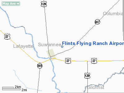
Flints Flying Ranch Airport |
Location
& QuickFacts
|
FAA Information Effective: |
2007-01-18 |
|
Airport
Identifier: |
2FD0 |
|
Airport
Status: |
Operational |
|
Longitude/Latitude: |
082-54-26.4580W/29-58-32.8260N
-82.907349/29.975785 (Estimated) |
|
Elevation: |
45 ft / 13.72 m (Estimated) |
|
Land: |
20 acres |
|
From
nearest city: |
2 nautical miles NE of Branford, FL |
|
Location: |
Suwannee County, FL |
|
Magnetic Variation: |
02W (1985) |
Owner
& Manager
|
Ownership: |
Privately owned |
|
Owner: |
Gilbert Flint |
|
Address: |
Rt 3 Box 312
Branford, FL 32008 |
|
Phone number: |
904-935-3846 |
|
Manager: |
Gilbert Flint |
|
Address: |
Rt 3 Box 312
Branford, FL 32008 |
|
Phone number: |
904-935-3846 |
Airport
Operations and Facilities
|
Airport Use: |
Private |
|
Wind
indicator: |
Yes |
|
Segmented
Circle: |
No |
|
Control
Tower: |
No |
|
Landing
fee charge: |
Yes |
|
Sectional
chart: |
Jacksonville |
|
Region: |
ASO - Southern |
|
Boundary
ARTCC: |
ZJX - Jacksonville |
|
Tie-in
FSS: |
GNV - Gainesville |
|
FSS
Phone: |
850-377-3291 |
|
FSS
Toll Free: |
1-800-WX-BRIEF |
|
Runway Information
Runway 18/36
|
Dimension: |
3335 x 50 ft / 1016.5 x 15.2 m |
|
Surface: |
TURF, Good Condition |
|
|
Runway 18 |
Runway 36 |
|
Traffic
Pattern: |
Left |
Left |
|
Displaced
threshold: |
1250.00 ft |
545.00 ft |
|
Obstruction: |
65 ft trees, 55.0 ft from runway |
30 ft pline, 50.0 ft from runway |
|
Radio Navigation
Aids
|
ID |
Type |
Name |
Ch |
Freq |
Var |
Dist |
|
LCQ |
NDB |
Lake City |
|
204.00 |
03W |
21.2 nm |
|
FPY |
NDB |
Foley |
|
254.00 |
03W |
35.4 nm |
|
GN |
NDB |
Wynds |
|
269.00 |
04W |
42.5 nm |
|
CTY |
VORTAC |
Cross City |
057X |
112.00 |
02W |
23.8 nm |
|
TAY |
VORTAC |
Taylor |
076X |
112.90 |
03W |
36.7 nm |
|
GNV |
VORTAC |
Gators |
109X |
116.20 |
04W |
37.2 nm |
Remarks
Based Aircraft
|
Aircraft
based on field: |
3 |
|
Single
Engine Airplanes: |
3 |
Flints Flying Ranch Airport
Address:
Suwannee County, FL
Tel:
904-935-3846
Images
and information placed above are from
http://www.airport-data.com/airport/2FD0/
We
thank them for the data!
| General
Info |
| Country |
United
States |
| State |
FLORIDA
|
| FAA ID |
2FD0
|
| Latitude |
29-58-32.826N
|
| Longitude |
082-54-26.458W
|
| Elevation |
45 feet
|
| Near City |
BRANFORD
|
We don't guarantee the information is fresh and accurate. The data may
be wrong or outdated.
For more up-to-date information please refer to other sources.
|
|


