 |
|
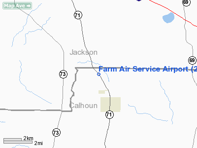
Location
& QuickFacts
|
FAA Information Effective: |
2007-01-18 |
|
Airport
Identifier: |
22FL |
|
Airport
Status: |
Operational |
|
Longitude/Latitude: |
085-08-23.7230W/30-36-06.6980N
-85.139923/30.601861 (Estimated) |
|
Elevation: |
150 ft / 45.72 m (Estimated) |
|
Land: |
0 acres |
|
From
nearest city: |
2 nautical miles N of Altha, FL |
|
Location: |
Calhoun County, FL |
|
Magnetic Variation: |
01W (1985) |
Owner
& Manager
|
Ownership: |
Privately owned |
|
Owner: |
C. C. Bodiford, Jr. |
|
Address: |
Route 2, Box 33
Altha, FL 32421 |
|
Phone number: |
904-762-8320 |
|
Address: |
|
Airport
Operations and Facilities
|
Airport Use: |
Private |
|
Wind
indicator: |
Yes |
|
Segmented
Circle: |
No |
|
Control
Tower: |
No |
|
Landing
fee charge: |
No |
|
Sectional
chart: |
New Orleans |
|
Region: |
ASO - Southern |
|
Boundary
ARTCC: |
ZJX - Jacksonville |
|
Tie-in
FSS: |
GNV - Gainesville |
|
FSS
on Airport: |
No |
|
FSS
Phone: |
850-377-3291 |
|
FSS
Toll Free: |
1-800-WX-BRIEF |
|
Runway Information
Runway 18/36
|
Dimension: |
1900 x 70 ft / 579.1 x 21.3 m |
|
Surface: |
ASPH-TURF, |
|
|
Runway 18 |
Runway 36 |
|
Traffic
Pattern: |
Left |
Left |
|
Radio Navigation
Aids
|
ID |
Type |
Name |
Ch |
Freq |
Var |
Dist |
|
SMY |
NDB |
Soyya |
|
329.00 |
02W |
16.8 nm |
|
BKK |
NDB |
Tri County |
|
275.00 |
02W |
28.2 nm |
|
LYZ |
NDB |
Willis |
|
359.00 |
01W |
38.8 nm |
|
TL |
NDB |
Wakul |
|
379.00 |
01W |
43.8 nm |
|
PAM |
TACAN |
Tyndall |
124X |
|
00W |
38.9 nm |
|
FYL |
VOR |
Tri County |
|
108.40 |
08W |
28.2 nm |
|
MAI |
VORTAC |
Marianna |
087X |
114.00 |
00E |
11.1 nm |
|
PFN |
VORTAC |
Panama City |
090X |
114.30 |
00W |
36.4 nm |
|
SZW |
VORTAC |
Seminole |
122X |
117.50 |
02E |
39.7 nm |
|
RRS |
VORTAC |
Wiregrass |
053X |
111.60 |
02E |
43.7 nm |
|
TLH |
VOT |
Tallahassee Muni |
|
111.00 |
|
42.4 nm |
Remarks
- VFR;
PRIVATE USE; TRAFFIC PATTERNS ARE FLOWN ON WEST SIDE OF AIRPORT; CONTACT
IS MADE WITH AIR TRAFFIC AUTHORITIES AT TYNDALL APPROACH CONTROL TO
EXCHANGE INFORMATION REGARDING YOUR RESPECTIVE FLIGHT OPERATIONS.
Farm Air Service Airport
Address:
Calhoun County, FL
Tel:
904-762-8320
Images
and information placed above are from
http://www.airport-data.com/airport/22FL/
We
thank them for the data!
| General
Info |
| Country |
United
States |
| State |
FLORIDA
|
| FAA ID |
22FL
|
| Latitude |
30-36-06.698N
|
| Longitude |
085-08-23.723W
|
| Elevation |
150 feet
|
| Near City |
ALTHA
|
We don't guarantee the information is fresh and accurate. The data may
be wrong or outdated.
For more up-to-date information please refer to other sources.
|
|


