|
 |
|
||||
|
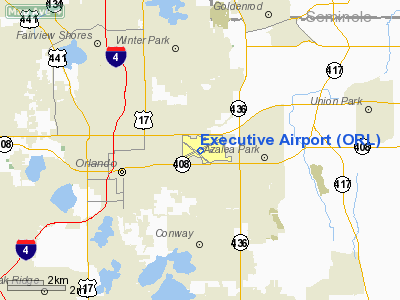
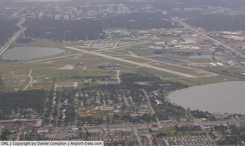
Orlando Executive Airport (IATA: ORL, ICAO: KORL, FAA LID: ORL) is a public-use airport located three nautical miles (6 km) east of the central business district of Orlando, a city in Orange County, Florida, United States. It is owned by the Greater Orlando Aviation Authority. It primarily serves the general aviation community. Overview
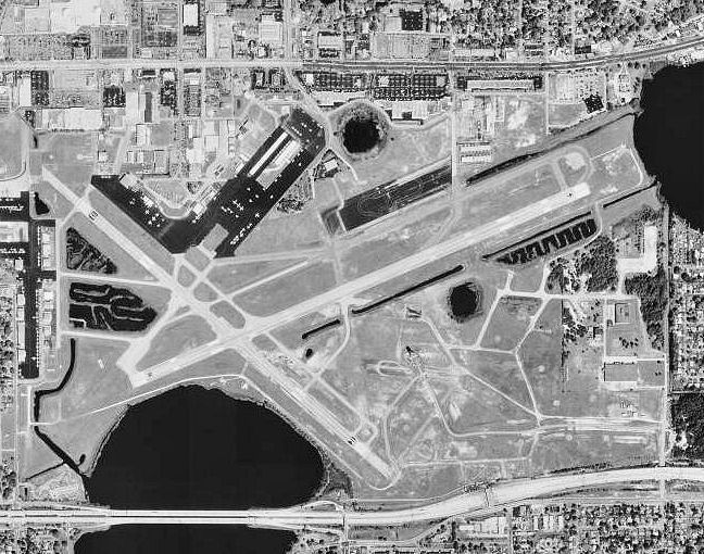
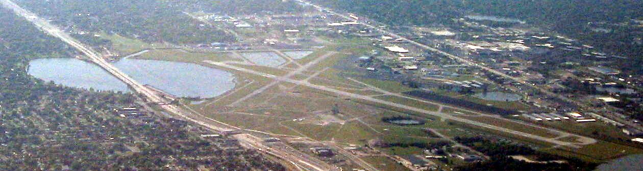
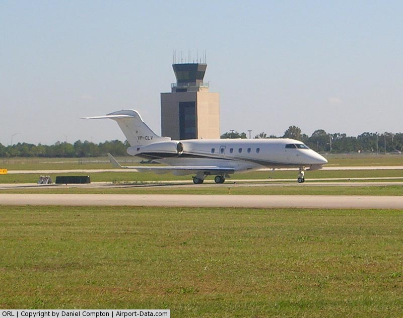
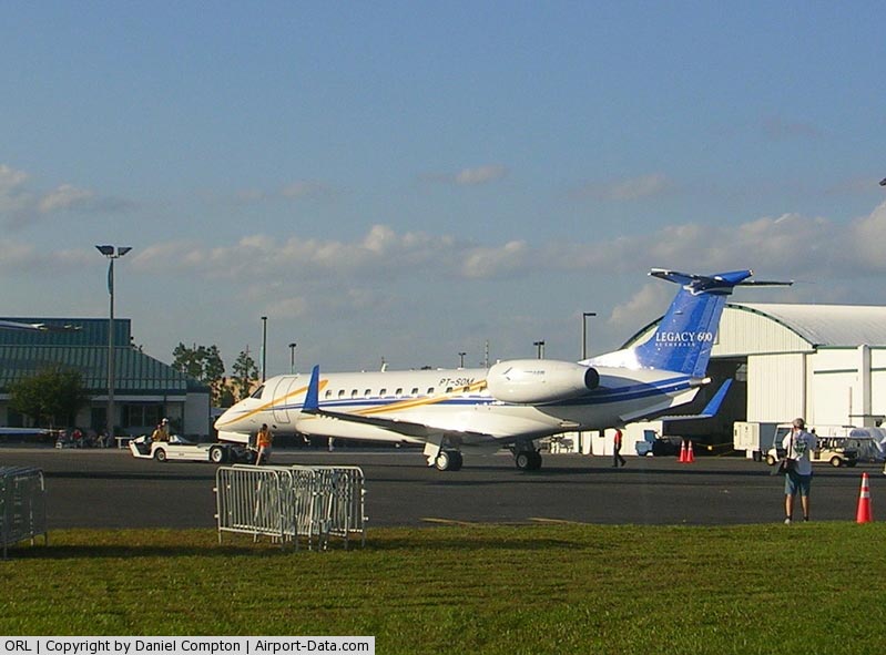
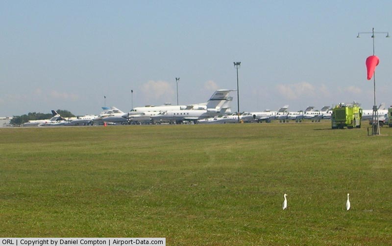
Orlando Executive Airport serves as a general aviation and corporate aviation airport for the greater Orlando area. Its proximity to the State Road 408 East-West Expressway as well as downtown Orlando makes it a popular airport for private business and pleasure travelers alike. However, the airport is still considered the "minor" airport of Orlando, Florida, as the Orlando International Airport remains the primary airport for both domestic and international flights, drawing significantly more passengers every year. The airport has been used for special air industry events and showcases included the National Business Aviation Association (NBAA) Convention which was held in 2008, and scheduled to be held again in 2009. The airport has also been used since the 1990s as a landing site and staging site by Marine Helicopter Squadron One (VMX-1) for Marine One and other supporting VMX-1 helicopter operations during Presidential visits to Orlando. However the primary arrival method for Presidential visits is still via Air Force One, which lands at Orlando International Airport (MCO). Facilities and aircraftExecutive Airport covers an area of 1,055 acres (427 ha) at an elevation of 113 feet (34 m) above mean sea level. It has two asphalt paved runways: 7/25 is 6,003 by 150 feet (1,830 x 46 m) and 13/31 is 4,638 by 100 feet (1,414 x 30 m). For the 12-month period ending December 31, 2001, the airport had 218,162 aircraft operations, an average of 597 per day: 94% general aviation, 5% air taxi and <1% military. At that time there were 242 aircraft based at this airport: 67% single-engine, 20% multi-engine, 9% jet and 5% helicopter. HistoryOpened in 1928 as the Orlando Municipal Airport, the airport was the first commercial airport in central Florida. The United States Postal Service started airmail service to Orlando the following year.
The United States Army Air Corps took control of the airport in 1940 for use as a training facility and renamed it the Orlando Army Air Base. For the next six years, the airport remained under military control. In June 1941, the Army Air Corps became the United States Army Air Forces and beginning in late 1941 through mid-1943, Orlando Army Air Base was used by I Bomber Command and later by units of the Army Air Forces Antisubmarine Command (AAFAC) to fly antisubmarine patrols along both the east coast as well as over the Gulf of Mexico and the Florida Straits. With the lessening of the U-Boat threat, Orlando AAB became the home of the Army Air Force School of Applied Tactics (AAFSAT) and subsequently as the Army Air Forces Tactical Center (AAFTC). In 1943, the AAFSAT began training units in Night Fighter operations. the 481st Night Fighter Group was established, equipped with the Douglas P-70, a variation of the A-20 Havoc attack aircraft used for training. Squadrons attached to the group in 1943 and 1944 were the 348th, 349th, 420th, 423d, 425th, 426th and 427th Night Fighter Squadrons, which, after completion of training were sent overseas to either the Pacific or European Theaters for combat. In 1946, the airfield was released back to the city of Orlando, while the military support facilities to the north and northeast of the airport remained under US Army Air Forces control as a non-flying administrative and technical training installation. With the establishment of the United States Air Force as a separate service in 1947, this installation was renamed Orlando Air Force Base, serving as a technical training facility for the Air Training Command and Tactical Air Command, and as a headquarters installation for the Military Air Transport Service (later Military Airlift Command) and the Air Rescue Service. In 1968, the installation was transferred to the United States Navy and renamed Naval Training Center Orlando. The installation served as one of three Navy enlisted recruit training centers (boot camps) and as home to various technical training schools, to include the Navy Nuclear Power School for officer and enlisted personnel. The 1993 Base Realignment and Closure Commission (BRAC 1993) directed that NTC Orlando be closed no later than 1 October 1999. The base property was sold to the City of Orlando, which in turn sold it to private developers. Most of the installation was demolished and residential and commercial properties developed on the site, renamed Baldwin Park. In 1946, commercial service with National Airlines and Eastern Air Lines began at the now civilian Orlando Municipal Airport. Just five years later, the airport built its main terminal, a two-story structure with a built-in control tower. This terminal building stood until late 1999. In 1961 the airport was renamed again, this time called the Herndon Airport, the name change being in preparation for moving commercial air service to the new Orlando Jetport at McCoy that was collocated at McCoy AFB eight miles to the south, the facility which is known today as the Orlando International Airport. By 1968, commercial airlines no longer served Herndon and it became primarily a general aviation and corporate flight facility. In 1976, the City of Orlando gave up control of the airport and transferred the property, its former City of Orlando Aviation Department, and all operational responsibilities to the newly-established Greater Orlando Aviation Authority (GOAA), chartered by the Florida State Legislature to operate and manage all publicly-owned airports in Orange County, Florida. GOAA renamed the airport as Orlando Executive Airport in 1982 and renamed it again to its present name of Executive Airport in 1998. The above content comes from Wikipedia and is published under free licenses – click here to read more.
Runway InformationRunway 07/25
Runway 13/31
Radio Navigation Aids
Remarks
Based Aircraft
Operational StatisticsTime Period: 2001-01-01 - 2001-12-31
Executive Airport Address: Orange County, FL Tel: 407-825-2001, 407-894-9831 Images
and information placed above are from We thank them for the data!
We don't guarantee the information is fresh and accurate. The data may
be wrong or outdated.
|
||||||||||||||||||||||||||||||||||||||||||||||||||||||||||||||||||||||||||||||||||||||||||||||||||||||||||||||||||||||||||||||||||||||||||||||||||||||||||||||||||||||||||||||||||||||||||||||||||||||||||||||||||||||||||||||||||||||||||||||||||||||||||||||||||||||||||||||||||||||||||||||||||||||||||||||||||||||||||||||||||||||||||||||||||||||||||||||||||||||||||||||||||||||||||||||||||||||||||||||||||||||||||||||||||||||||||||||||||||||||||||||||||||||||||||

 |
|
Copyright 2004-2026 © by Airports-Worldwide.com, Vyshenskoho st. 36, Lviv 79010, Ukraine Legal Disclaimer |