 |
|
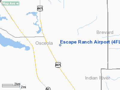
Location
& QuickFacts
|
FAA Information Effective: |
2007-01-18 |
|
Airport
Identifier: |
4FL1 |
|
Airport
Status: |
Operational |
|
Longitude/Latitude: |
080-57-29.0000W/27-51-46.0000N
-80.958056/27.862778 (Estimated) |
|
Elevation: |
71 ft / 21.64 m (Estimated) |
|
Land: |
20 acres |
|
From
nearest city: |
2 nautical miles W of Kenansville, FL |
|
Location: |
Osceola County, FL |
|
Magnetic Variation: |
04W (1995) |
Owner
& Manager
|
Ownership: |
Privately owned |
|
Owner: |
Escape Ranch, L.c. |
|
Address: |
1580 Fellsmere Road, P.o. Box 58
Kenansville, FL 34739 |
|
Phone
number: |
407-436-1564 |
|
Manager: |
James R. Fowler, Jr. |
|
Address: |
1580 Fellsmere Road, P.o. Box 58
Kenansville, FL 34739 |
|
Phone number: |
407-436-1564 |
Airport
Operations and Facilities
|
Airport Use: |
Private |
|
Wind
indicator: |
Yes |
|
Segmented
Circle: |
No |
|
Control
Tower: |
No |
|
Sectional
chart: |
Miami |
|
Region: |
ASO - Southern |
|
Boundary
ARTCC: |
ZMA - Miami |
|
Tie-in
FSS: |
PIE - Saint Petersburg |
|
FSS
Toll Free: |
1-800-WX-BRIEF |
|
Runway Information
Runway 18/36
|
Dimension: |
2500 x 250 ft / 762.0 x 76.2 m |
|
Surface: |
TURF, |
|
|
Runway 18 |
Runway 36 |
|
Traffic
Pattern: |
Left |
Left |
|
Obstruction: |
30 ft pline, 200.0 ft from runway |
30 ft trees, 200.0 ft from runway |
|
Radio Navigation
Aids
|
ID |
Type |
Name |
Ch |
Freq |
Var |
Dist |
|
SQT |
NDB |
Satellite |
|
257.00 |
03W |
19.7 nm |
|
VEP |
NDB |
Vero Beach |
|
392.00 |
04W |
31.0 nm |
|
COI |
NDB |
Merritt Island |
|
247.00 |
05W |
32.1 nm |
|
ISM |
NDB |
Kissimmee |
|
329.00 |
05W |
36.0 nm |
|
FPR |
NDB |
Fort Pierce |
|
275.00 |
04W |
38.5 nm |
|
GGL |
NDB |
Geiger Lake |
|
375.00 |
05W |
44.5 nm |
|
COF |
TACAN |
Patrick |
097X |
|
04W |
29.1 nm |
|
TTS |
TACAN |
Kennedy Space Center |
059Y |
|
00E |
47.9 nm |
|
MLB |
VOR/DME |
Melbourne |
037X |
110.00 |
02W |
22.5 nm |
|
VRB |
VORTAC |
Vero Beach |
120X |
117.30 |
04W |
27.3 nm |
|
ORL |
VORTAC |
Orlando |
059X |
112.20 |
00E |
45.5 nm |
|
VRB |
VOT |
Vero Beach |
|
111.00 |
|
31.4 nm |
Remarks
Based Aircraft
|
Aircraft
based on field: |
1 |
|
Single
Engine Airplanes: |
1 |
Escape Ranch Airport
Address:
Osceola County, FL
Tel:
407-436-1564
Images
and information placed above are from
http://www.airport-data.com/airport/4FL1/
We
thank them for the data!
| General
Info |
| Country |
United
States |
| State |
FLORIDA
|
| FAA ID |
4FL1
|
| Latitude |
27-51-46.000N
|
| Longitude |
080-57-29.000W
|
| Elevation |
71 feet
|
| Near City |
KENANSVILLE
|
We don't guarantee the information is fresh and accurate. The data may
be wrong or outdated.
For more up-to-date information please refer to other sources.
|
|


