 |
|
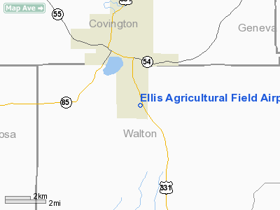
Ellis Agricultural Field Airport |
Location
& QuickFacts
|
FAA Information Effective: |
2007-01-18 |
|
Airport
Identifier: |
34FL |
|
Airport
Status: |
Operational |
|
Longitude/Latitude: |
086-18-09.8040W/30-57-55.6520N
-86.302723/30.965459 (Estimated) |
|
Elevation: |
324 ft / 98.76 m (Surveyed) |
|
Land: |
0 acres |
|
From
nearest city: |
1 nautical miles S of Paxton, FL |
|
Location: |
Walton County, FL |
|
Magnetic Variation: |
00E (1985) |
Owner
& Manager
|
Ownership: |
Privately owned |
|
Owner: |
Janet L Simpson |
|
Address: |
P.o.box 135
Florala, AL 36442 |
|
Phone
number: |
904-834-2418 |
|
Manager: |
Wilford A. Simpson |
|
Address: |
P.o. Box 135
Florala, AL 36442 |
|
Phone number: |
904-834-2418 |
Airport
Operations and Facilities
|
Airport Use: |
Private |
|
Wind
indicator: |
No |
|
Segmented
Circle: |
No |
|
Control
Tower: |
No |
|
Landing
fee charge: |
No |
|
Sectional
chart: |
New Orleans |
|
Region: |
ASO - Southern |
|
Boundary
ARTCC: |
ZJX - Jacksonville |
|
Tie-in
FSS: |
GNV - Gainesville |
|
FSS
on Airport: |
No |
|
FSS
Phone: |
850-377-3291 |
|
FSS
Toll Free: |
1-800-WX-BRIEF |
|
Runway Information
Runway 14/32
|
Dimension: |
2300 x 50 ft / 701.0 x 15.2 m |
|
Surface: |
ASPH-TURF, |
|
|
Runway 14 |
Runway 32 |
|
Traffic
Pattern: |
Left |
Left |
|
Radio Navigation
Aids
|
ID |
Type |
Name |
Ch |
Freq |
Var |
Dist |
|
JUY |
NDB |
Judd |
|
264.00 |
02W |
20.9 nm |
|
BVG |
NDB |
Boll Weevil |
|
352.00 |
03E |
27.7 nm |
|
OZ |
NDB |
Ruckr |
|
212.00 |
00E |
29.5 nm |
|
DTS |
NDB |
Destin |
|
254.00 |
01W |
34.8 nm |
|
XBR |
NDB |
Brantley |
|
410.00 |
00E |
35.9 nm |
|
BKK |
NDB |
Tri County |
|
275.00 |
02W |
36.8 nm |
|
LOR |
NDB |
Lowe |
|
269.00 |
03W |
37.3 nm |
|
HYE |
NDB |
Hanchey |
|
221.00 |
00E |
41.3 nm |
|
XNE |
NDB |
Spring Hill |
|
281.00 |
00E |
46.4 nm |
|
DWG |
TACAN |
Warrington |
002X |
|
00E |
31.4 nm |
|
HRT |
TACAN |
Hurlburt |
045X |
|
00E |
38.0 nm |
|
NGS |
TACAN |
Santa Rosa |
063X |
|
01E |
39.0 nm |
|
NSE |
TACAN |
Whiting |
070X |
|
01E |
39.7 nm |
|
UIA |
VOR |
Andalusia |
|
110.20 |
00E |
21.2 nm |
|
EDN |
VOR |
Enterprise |
|
116.60 |
03W |
28.6 nm |
|
FYL |
VOR |
Tri County |
|
108.40 |
08W |
36.6 nm |
|
HEY |
VOR |
Hanchey |
|
110.60 |
02E |
41.5 nm |
|
OZR |
VOR/DME |
Cairns |
049X |
111.20 |
02E |
34.8 nm |
|
CEW |
VORTAC |
Crestview |
106X |
115.90 |
03E |
21.1 nm |
|
RRS |
VORTAC |
Wiregrass |
053X |
111.60 |
02E |
48.8 nm |
Remarks
Based Aircraft
|
Aircraft
based on field: |
2 |
|
Single
Engine Airplanes: |
2 |
Ellis Agricultural Field Airport
Address:
Walton County, FL
Tel:
904-834-2418
Images
and information placed above are from
http://www.airport-data.com/airport/34FL/
We
thank them for the data!
| General
Info |
| Country |
United
States |
| State |
FLORIDA
|
| FAA ID |
34FL
|
| Latitude |
30-57-55.652N
|
| Longitude |
086-18-09.804W
|
| Elevation |
324 feet
|
| Near City |
PAXTON
|
We don't guarantee the information is fresh and accurate. The data may
be wrong or outdated.
For more up-to-date information please refer to other sources.
|
|


