 |
|
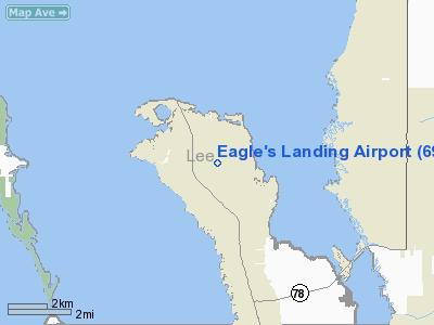
Location
& QuickFacts
|
FAA Information Effective: |
2007-01-18 |
|
Airport
Identifier: |
69FL |
|
Airport
Status: |
Operational |
|
Longitude/Latitude: |
082-08-11.3320W/26-40-38.2590N
-82.136481/26.677294 (Estimated) |
|
Elevation: |
10 ft / 3.05 m (Estimated) |
|
Land: |
43 acres |
|
From
nearest city: |
15 nautical miles NW of Fort Myers, FL |
|
Location: |
Lee County, FL |
|
Magnetic Variation: |
02W (1985) |
Owner
& Manager
|
Ownership: |
Privately owned |
|
Owner: |
Stebil Corp |
|
Address: |
P.o. Box 105
N Sutton, NH 03260 |
|
Phone number: |
603-927-4749 |
|
Manager: |
Alexander M. Gluhareff |
|
Address: |
Po Box 66
Matlacha, FL 33909-0066 |
|
Phone number: |
813-283-0220 |
Airport
Operations and Facilities
|
Airport Use: |
Private |
|
Wind
indicator: |
Yes |
|
Segmented
Circle: |
No |
|
Control
Tower: |
No |
|
Landing
fee charge: |
No |
|
Sectional
chart: |
Miami |
|
Region: |
ASO - Southern |
|
Boundary
ARTCC: |
ZMA - Miami |
|
Tie-in
FSS: |
MIA - Miami |
|
FSS
on Airport: |
No |
|
FSS
Phone: |
305-233-2600 |
|
FSS
Toll Free: |
1-800-WX-BRIEF |
|
Runway Information
Runway 09/27
|
Dimension: |
2300 x 150 ft / 701.0 x 45.7 m |
|
Surface: |
TURF, |
|
|
Runway 09 |
Runway 27 |
|
Traffic
Pattern: |
Left |
Right |
|
Displaced
threshold: |
0.00
ft |
300.00 ft |
|
Radio Navigation
Aids
|
ID |
Type |
Name |
Ch |
Freq |
Var |
Dist |
|
VNC |
NDB |
Venice |
|
206.00 |
02W |
28.0 nm |
|
APF |
NDB |
Naples |
|
201.00 |
03W |
36.9 nm |
|
PGD |
VOR |
Punta Gorda |
|
110.20 |
03W |
16.4 nm |
|
CYY |
VOR/DME |
Cypress |
023X |
108.60 |
03W |
36.9 nm |
|
RSW |
VORTAC |
Lee County |
055X |
111.80 |
02W |
21.3 nm |
|
LBV |
VORTAC |
La Belle |
041X |
110.40 |
01E |
41.0 nm |
|
SRQ |
VORTAC |
Sarasota |
099X |
115.20 |
02W |
48.7 nm |
Remarks
- VFR,
PRIVATE USE ONLY; ALL TRAFFIC PATTERNS FLOWN ON NORTH SIDE OF RUNWAY
CENTERLINE.
Based Aircraft
|
Aircraft
based on field: |
1 |
|
Single
Engine Airplanes: |
1 |
Eagle's Landing Airport
Address:
Lee County, FL
Tel:
603-927-4749, 813-283-0220
Images
and information placed above are from
http://www.airport-data.com/airport/69FL/
We
thank them for the data!
| General
Info |
| Country |
United
States |
| State |
FLORIDA
|
| FAA ID |
69FL
|
| Latitude |
26-40-38.259N
|
| Longitude |
082-08-11.332W
|
| Elevation |
10 feet
|
| Near City |
FORT MYERS
|
We don't guarantee the information is fresh and accurate. The data may
be wrong or outdated.
For more up-to-date information please refer to other sources.
|
|


