 |
|
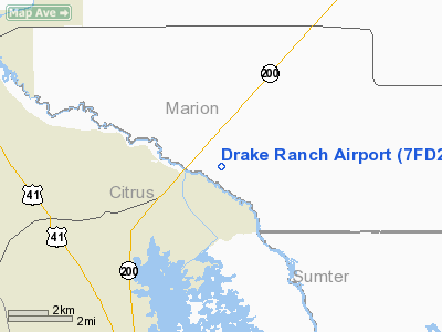
Location
& QuickFacts
|
FAA Information Effective: |
2007-01-18 |
|
Airport
Identifier: |
7FD2 |
|
Airport
Status: |
Operational |
|
Longitude/Latitude: |
082-19-49.3440W/28-59-24.9230N
-82.330373/28.990256 (Estimated) |
|
Elevation: |
50 ft / 15.24 m (Estimated) |
|
Land: |
0 acres |
|
From
nearest city: |
6 nautical miles NE of Hernando, FL |
|
Location: |
Marion County, FL |
|
Magnetic Variation: |
02W (1985) |
Owner
& Manager
|
Ownership: |
Privately owned |
|
Owner: |
George Drake |
|
Address: |
13590 Sw Hwy 200
Dunnellon, FL 34432 |
|
Phone number: |
352-237-7333 |
|
Manager: |
George Drake |
|
Address: |
13590 Sw Hwy 200
Dunnellon, FL 34432 |
|
Phone number: |
352-237-7333 |
Airport
Operations and Facilities
|
Airport Use: |
Private |
|
Segmented
Circle: |
No |
|
Control
Tower: |
No |
|
Sectional
chart: |
Jacksonville |
|
Region: |
ASO - Southern |
|
Boundary
ARTCC: |
ZJX - Jacksonville |
|
Responsible
ARTCC: |
ZMA - Miami |
|
Tie-in
FSS: |
PIE - Saint Petersburg |
|
FSS
Toll Free: |
1-800-WX-BRIEF |
|
Runway Information
Runway 06/24
|
Dimension: |
2100 x 100 ft / 640.1 x 30.5 m |
|
Surface: |
TURF, |
|
|
Runway 06 |
Runway 24 |
|
Traffic
Pattern: |
Left |
Left |
|
Obstruction: |
60 ft trees, 10.0 ft from runway |
60 ft trees, 10.0 ft from runway |
|
Runway 16/34
|
Dimension: |
2000 x 100 ft / 609.6 x 30.5 m |
|
Surface: |
TURF, |
|
|
Runway 16 |
Runway 34 |
|
Traffic
Pattern: |
Left |
Left |
|
Obstruction: |
60 ft trees, 10.0 ft from runway |
60 ft trees, 10.0 ft from runway |
|
Radio Navigation
Aids
|
ID |
Type |
Name |
Ch |
Freq |
Var |
Dist |
|
LEE |
NDB |
Leesburg |
|
335.00 |
04W |
29.4 nm |
|
GN |
NDB |
Wynds |
|
269.00 |
04W |
41.7 nm |
|
RHZ |
NDB |
Zephyrhills |
|
253.00 |
03W |
46.8 nm |
|
IAK |
NDB |
Palatka |
|
243.00 |
05W |
48.2 nm |
|
OCF |
VORTAC |
Ocala |
084X |
113.70 |
00E |
12.5 nm |
|
GNV |
VORTAC |
Gators |
109X |
116.20 |
04W |
42.3 nm |
Remarks
Based Aircraft
|
Aircraft
based on field: |
1 |
|
Single
Engine Airplanes: |
1 |
Drake Ranch Airport
Address:
Marion County, FL
Tel:
352-237-7333
Images
and information placed above are from
http://www.airport-data.com/airport/7FD2/
We
thank them for the data!
| General
Info |
| Country |
United
States |
| State |
FLORIDA
|
| FAA ID |
7FD2
|
| Latitude |
28-59-24.923N
|
| Longitude |
082-19-49.344W
|
| Elevation |
50 feet
|
| Near City |
HERNANDO
|
We don't guarantee the information is fresh and accurate. The data may
be wrong or outdated.
For more up-to-date information please refer to other sources.
|
|


