 |
|
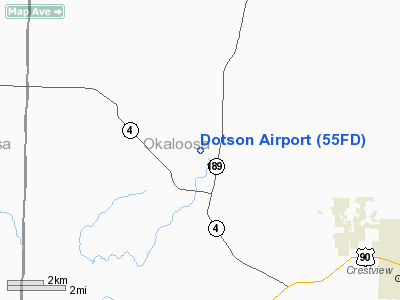
Location
& QuickFacts
|
FAA Information Effective: |
2007-01-18 |
|
Airport
Identifier: |
55FD |
|
Airport
Status: |
Operational |
|
Longitude/Latitude: |
086-41-16.8390W/30-49-06.6720N
-86.688011/30.818520 (Estimated) |
|
Elevation: |
251 ft / 76.50 m (Estimated) |
|
Land: |
7 acres |
|
From
nearest city: |
2 nautical miles N of Baker, FL |
|
Location: |
Okaloosa County, FL |
|
Magnetic Variation: |
00E (1990) |
Owner
& Manager
|
Ownership: |
Privately owned |
|
Owner: |
Glen Dotson |
|
Address: |
1250 Highway C4a
Baker, FL 32531 |
|
Phone number: |
850-537-5941 |
|
Address: |
|
Airport
Operations and Facilities
|
Airport Use: |
Private
PERSONAL USE. |
|
Segmented
Circle: |
No |
|
Control
Tower: |
No |
|
Sectional
chart: |
New Orleans |
|
Region: |
ASO - Southern |
|
Boundary
ARTCC: |
ZJX - Jacksonville |
|
Tie-in
FSS: |
GNV - Gainesville |
|
FSS
on Airport: |
No |
|
FSS
Phone: |
850-377-3291 |
|
FSS
Toll Free: |
1-800-WX-BRIEF |
|
Runway Information
Runway 09/27
|
Dimension: |
2120 x 100 ft / 646.2 x 30.5 m |
|
Surface: |
TURF, Good Condition |
|
|
Runway 09 |
Runway 27 |
|
Traffic
Pattern: |
Left |
Left |
|
Displaced
threshold: |
750.00 ft |
0.00
ft |
|
Obstruction: |
40 ft pline, 50.0 ft from runway |
|
|
Radio Navigation
Aids
|
ID |
Type |
Name |
Ch |
Freq |
Var |
Dist |
|
DTS |
NDB |
Destin |
|
254.00 |
01W |
27.2 nm |
|
JUY |
NDB |
Judd |
|
264.00 |
02W |
33.0 nm |
|
PKZ |
NDB |
Pickens |
|
326.00 |
01E |
34.2 nm |
|
BVG |
NDB |
Boll Weevil |
|
352.00 |
03E |
47.8 nm |
|
XBR |
NDB |
Brantley |
|
410.00 |
00E |
49.1 nm |
|
NGS |
TACAN |
Santa Rosa |
063X |
|
01E |
17.8 nm |
|
NSE |
TACAN |
Whiting |
070X |
|
01E |
18.0 nm |
|
DWG |
TACAN |
Warrington |
002X |
|
00E |
22.2 nm |
|
HRT |
TACAN |
Hurlburt |
045X |
|
00E |
23.5 nm |
|
NPA |
TACAN |
Pensacola |
119X |
|
01E |
42.7 nm |
|
UIA |
VOR |
Andalusia |
|
110.20 |
00E |
33.2 nm |
|
NUN |
VOR |
Saufley |
|
108.80 |
01E |
39.4 nm |
|
EDN |
VOR |
Enterprise |
|
116.60 |
03W |
49.6 nm |
|
CEW |
VORTAC |
Crestview |
106X |
115.90 |
03E |
0.6 nm |
Remarks
- VFR
WX CONDS; PVT USE; LANDING RESTRICTED TO N SIDE.
Based Aircraft
|
Aircraft
based on field: |
1 |
|
Single
Engine Airplanes: |
1 |
Dotson Airport
Address:
Okaloosa County, FL
Tel:
850-537-5941
Images
and information placed above are from
http://www.airport-data.com/airport/55FD/
We
thank them for the data!
| General
Info |
| Country |
United
States |
| State |
FLORIDA
|
| FAA ID |
55FD
|
| Latitude |
30-49-06.672N
|
| Longitude |
086-41-16.839W
|
| Elevation |
251 feet
|
| Near City |
BAKER
|
We don't guarantee the information is fresh and accurate. The data may
be wrong or outdated.
For more up-to-date information please refer to other sources.
|
|


