 |
|
Doral Resort and Country Club Heliport |
|
|
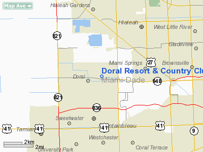
Location
& QuickFacts
|
FAA Information Effective: |
2007-01-18 |
|
Airport
Identifier: |
0FA0 |
|
Airport
Status: |
Operational |
|
Longitude/Latitude: |
080-20-20.1870W/25-48-46.3530N
-80.338941/25.812876 (Estimated) |
|
Elevation: |
6 ft / 1.83 m (Estimated) |
|
Land: |
1 acres |
|
From
nearest city: |
8 nautical miles NW of Miami, FL |
|
Location: |
Dade County, FL |
|
Magnetic Variation: |
03W (1985) |
Owner
& Manager
|
Ownership: |
Privately owned |
|
Owner: |
Ksl Corporation |
|
Address: |
4400 Nw 87th Avenue
Miami, FL 33178 |
|
Phone
number: |
305-883-4848 |
|
Manager: |
Scott Smith, Dir Of Security |
|
Address: |
4400 Nw 87th Avenue
Miami, FL 33178 |
|
Phone number: |
305-592-2000 |
Airport
Operations and Facilities
|
Airport Use: |
Private |
|
Wind indicator: |
No |
|
Segmented Circle: |
No |
|
Control Tower: |
No |
|
Landing fee charge: |
No |
|
Sectional chart: |
Miami |
|
Region: |
ASO - Southern |
|
Boundary ARTCC: |
ZMA - Miami |
|
Tie-in FSS: |
MIA - Miami |
|
FSS on Airport: |
No |
|
FSS Phone: |
305-233-2600 |
|
FSS Toll Free: |
1-800-WX-BRIEF |
Airport
Services
|
Airframe Repair: |
NONE |
|
Power Plant Repair: |
NONE |
|
Runway Information
Helipad H1
|
Dimension: |
200 x 150 ft / 61.0 x 45.7 m |
|
Surface: |
TURF, |
|
|
Runway H1 |
Runway |
|
Traffic
Pattern: |
Left |
Left |
|
Radio Navigation
Aids
|
ID |
Type |
Name |
Ch |
Freq |
Var |
Dist |
|
PJN |
NDB |
Plantation |
|
242.00 |
03W |
20.3 nm |
|
FX |
NDB |
Praiz |
|
221.00 |
02W |
22.5 nm |
|
HST |
TACAN |
Homestead |
019X |
|
03W |
19.6 nm |
|
VKZ |
VOR/DME |
Virginia Key |
118X |
117.10 |
04W |
10.6 nm |
|
FLL |
VOR/DME |
Fort Lauderdale |
091X |
114.40 |
00E |
18.7 nm |
|
DHP |
VORTAC |
Dolphin |
086X |
113.90 |
04W |
0.9 nm |
|
MIA |
VOT |
Miami Intl |
|
112.00 |
|
3.4 nm |
Remarks
Doral Resort & Country Club Heliport
Address:
Dade County, FL
Tel:
305-883-4848,
305-592-2000
Images
and information placed above are from
http://www.airport-data.com/airport/0FA0/
We
thank them for the data!
| General
Info |
| Country |
United
States |
| State |
FLORIDA
|
| FAA ID |
0FA0
|
| Latitude |
25-48-46.353N
|
| Longitude |
080-20-20.187W
|
| Elevation |
6 feet
|
| Near City |
MIAMI
|
We don't guarantee the information is fresh and accurate. The data may
be wrong or outdated.
For more up-to-date information please refer to other sources.
|
|


