 |
|
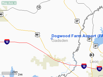
Location
& QuickFacts
|
FAA Information Effective: |
2007-01-18 |
|
Airport
Identifier: |
FA26 |
|
Airport
Status: |
Operational |
|
Longitude/Latitude: |
084-27-07.0000W/30-32-14.0000N
-84.451944/30.537222 (Estimated) |
|
Elevation: |
200 ft / 60.96 m (Estimated) |
|
Land: |
6 acres |
|
From
nearest city: |
5 nautical miles SW of Havana, FL |
|
Location: |
Gadsden County, FL |
|
Magnetic Variation: |
02W (1990) |
Owner
& Manager
|
Ownership: |
Privately owned |
|
Owner: |
Guy De La Valdene |
|
Address: |
606 Robin Lane
Havana, FL 32333 |
|
Phone number: |
850-539-8922 |
|
Manager: |
Bill Poppell |
|
Address: |
606 Robin Lane
Havana, FL 32333 |
|
Phone number: |
850-539-8965 |
Airport
Operations and Facilities
|
Airport Use: |
Private |
|
Wind
indicator: |
Yes |
|
Segmented
Circle: |
No |
|
Control
Tower: |
No |
|
Lighting
Schedule: |
DUSK-DAWN |
|
Sectional
chart: |
Jacksonville |
|
Region: |
ASO - Southern |
|
Boundary
ARTCC: |
ZJX - Jacksonville |
|
Tie-in
FSS: |
GNV - Gainesville |
|
FSS
on Airport: |
No |
|
FSS
Phone: |
850-377-3291 |
|
FSS
Toll Free: |
1-800-WX-BRIEF |
|
Runway Information
Runway 09/27
|
Dimension: |
2500 x 100 ft / 762.0 x 30.5 m |
|
Surface: |
TURF, |
|
Edge
Lights: |
Medium |
|
|
Runway 09 |
Runway 27 |
|
Traffic
Pattern: |
Left |
Left |
|
Displaced
threshold: |
450.00 ft
/27DSPLCD THLDS FOR NIGHT OPNS ONLY: MKD WITH 3 GREEN LGTS
EACH SIDE OF RY. |
150.00 ft |
|
Obstruction: |
30 ft trees, 100.0 ft from runway |
30 ft trees, 100.0 ft from runway |
|
Radio Navigation
Aids
|
ID |
Type |
Name |
Ch |
Freq |
Var |
Dist |
|
TL |
NDB |
Wakul |
|
379.00 |
01W |
13.6 nm |
|
CYR |
NDB |
Caidy |
|
338.00 |
01W |
26.0 nm |
|
LYZ |
NDB |
Willis |
|
359.00 |
01W |
26.5 nm |
|
GTP |
NDB |
Patten |
|
245.00 |
02W |
41.0 nm |
|
CXU |
NDB |
Camilla |
|
369.00 |
02W |
42.2 nm |
|
SMY |
NDB |
Soyya |
|
329.00 |
02W |
44.7 nm |
|
MGR |
VOR/DME |
Moultrie |
025X |
108.80 |
02W |
46.8 nm |
|
SZW |
VORTAC |
Seminole |
122X |
117.50 |
02E |
4.2 nm |
|
GEF |
VORTAC |
Greenville |
027X |
109.00 |
01E |
34.6 nm |
|
MAI |
VORTAC |
Marianna |
087X |
114.00 |
00E |
37.9 nm |
|
TLH |
VOT |
Tallahassee Muni |
|
111.00 |
|
9.6 nm |
Remarks
- OWNER
DESIRES ARPT NOT BE CHARTED.
- PRVDD
VFR/ PRIVATE USE & ALL TFC OPNS ARE CONDUCTED WITHIN 11/2 NM E OF
RY.
Dogwood Farm Airport
Address:
Gadsden County, FL
Tel:
850-539-8922, 850-539-8965
Images
and information placed above are from
http://www.airport-data.com/airport/FA26/
We
thank them for the data!
| General
Info |
| Country |
United
States |
| State |
FLORIDA
|
| FAA ID |
FA26
|
| Latitude |
30-32-14.000N
|
| Longitude |
084-27-07.000W
|
| Elevation |
200 feet
|
| Near City |
HAVANA
|
We don't guarantee the information is fresh and accurate. The data may
be wrong or outdated.
For more up-to-date information please refer to other sources.
|
|


