 |
|
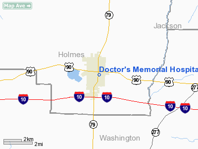
Doctor's Memorial Hospital Heliport |
|
|
Location
& QuickFacts
|
FAA Information Effective: |
2007-01-18 |
|
Airport
Identifier: |
02FD |
|
Airport
Status: |
Operational |
|
Longitude/Latitude: |
085-40-42.7510W/30-47-06.6820N
-85.678542/30.785189 (Estimated) |
|
Elevation: |
170 ft / 51.82 m (Estimated) |
|
Land: |
1 acres |
|
From
nearest city: |
0 nautical miles N of Bonifay, FL |
|
Location: |
Holmes County, FL |
|
Magnetic Variation: |
00W (1985) |
Owner
& Manager
|
Ownership: |
Publicly owned |
|
Owner: |
Holmes County |
|
Address: |
201 North Oklahoma St
Bonifay, FL 32425 |
|
Phone
number: |
904-547-1101 |
|
Manager: |
Tina Brown |
|
Address: |
401 E Byrd Ave
Bonifay, FL 32425 |
|
Phone number: |
904-547-1120 |
Airport
Operations and Facilities
|
Airport Use: |
Private
MEDICAL USE. |
|
Wind
indicator: |
Yes |
|
Segmented
Circle: |
No |
|
Control
Tower: |
No |
|
Lighting
Schedule: |
PHONE REQ
FOR PERIMETER LIGHTS CALL 904-547-1120. |
|
Sectional
chart: |
New Orleans |
|
Region: |
ASO - Southern |
|
Boundary
ARTCC: |
ZJX - Jacksonville |
|
Tie-in
FSS: |
GNV - Gainesville |
|
FSS
on Airport: |
No |
|
FSS
Phone: |
850-377-3291 |
|
FSS
Toll Free: |
1-800-WX-BRIEF |
|
Runway Information
Helipad H1
|
Dimension: |
50 x 50 ft / 15.2 x 15.2 m |
|
Surface: |
ASPH, Good Condition |
|
|
Runway H1 |
Runway |
|
Traffic
Pattern: |
Left |
Left |
|
Radio Navigation
Aids
|
ID |
Type |
Name |
Ch |
Freq |
Var |
Dist |
|
BKK |
NDB |
Tri County |
|
275.00 |
02W |
5.6 nm |
|
SMY |
NDB |
Soyya |
|
329.00 |
02W |
24.0 nm |
|
OZ |
NDB |
Ruckr |
|
212.00 |
00E |
27.4 nm |
|
LOR |
NDB |
Lowe |
|
269.00 |
03W |
34.7 nm |
|
HYE |
NDB |
Hanchey |
|
221.00 |
00E |
35.0 nm |
|
BVG |
NDB |
Boll Weevil |
|
352.00 |
03E |
36.7 nm |
|
DTS |
NDB |
Destin |
|
254.00 |
01W |
47.1 nm |
|
JUY |
NDB |
Judd |
|
264.00 |
02W |
48.2 nm |
|
PAM |
TACAN |
Tyndall |
124X |
|
00W |
43.1 nm |
|
DWG |
TACAN |
Warrington |
002X |
|
00E |
47.3 nm |
|
FYL |
VOR |
Tri County |
|
108.40 |
08W |
5.0 nm |
|
EDN |
VOR |
Enterprise |
|
116.60 |
03W |
32.8 nm |
|
HEY |
VOR |
Hanchey |
|
110.60 |
02E |
35.4 nm |
|
UIA |
VOR |
Andalusia |
|
110.20 |
00E |
48.4 nm |
|
OZR |
VOR/DME |
Cairns |
049X |
111.20 |
02E |
29.2 nm |
|
MAI |
VORTAC |
Marianna |
087X |
114.00 |
00E |
28.6 nm |
|
RRS |
VORTAC |
Wiregrass |
053X |
111.60 |
02E |
32.6 nm |
|
PFN |
VORTAC |
Panama City |
090X |
114.30 |
00W |
34.2 nm |
Remarks
- PRVDD
LANDING FOR PVT USE ONLY; APCH/DEP CONDUCTED IN AN AREA 210-220 DEG
CLKWS; OPNS NA WHEN TAILWIND EXCEEDS 10 KNOTS; WIND INDICATOR MAINTAINED.
Doctor's Memorial Hospital Heliport
Address:
Holmes County, FL
Tel:
904-547-1101,
904-547-1120
Images
and information placed above are from
http://www.airport-data.com/airport/02FD/
We
thank them for the data!
| General
Info |
| Country |
United
States |
| State |
FLORIDA
|
| FAA ID |
02FD
|
| Latitude |
30-47-06.682N
|
| Longitude |
085-40-42.751W
|
| Elevation |
170 feet
|
| Near City |
BONIFAY
|
We don't guarantee the information is fresh and accurate. The data may
be wrong or outdated.
For more up-to-date information please refer to other sources.
|
|


