 |
|
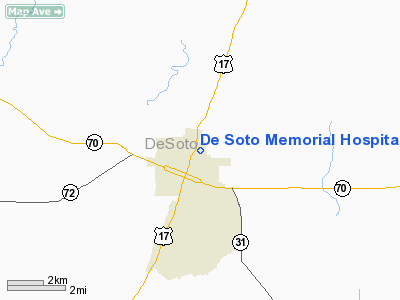
De Soto Memorial Hospital Heliport |
Location
& QuickFacts
|
FAA Information Effective: |
2007-01-18 |
|
Airport
Identifier: |
FD85 |
|
Airport
Status: |
Operational |
|
Longitude/Latitude: |
081-51-02.2980W/27-13-39.1750N
-81.850638/27.227549 (Estimated) |
|
Elevation: |
65 ft / 19.81 m (Estimated) |
|
Land: |
0 acres |
|
From
nearest city: |
1 nautical miles SW of Arcadia, FL |
|
Location: |
De Soto County, FL |
|
Magnetic Variation: |
02W (1980) |
Owner
& Manager
|
Ownership: |
Publicly owned |
|
Owner: |
De Soto Memorial Hospital |
|
Address: |
900 N Robert Avenue
Arcadia, FL 33821 |
|
Phone
number: |
813-494-8402 |
|
Manager: |
Thomas J. Stone |
|
Address: |
P O Box 2180
Arcadia, FL 33821 |
|
Phone number: |
813-494-8402 |
Airport
Operations and Facilities
|
Airport Use: |
Private |
|
Segmented
Circle: |
No |
|
Control
Tower: |
No |
|
Sectional
chart: |
Miami |
|
Region: |
ASO - Southern |
|
Boundary
ARTCC: |
ZMA - Miami |
|
Tie-in
FSS: |
PIE - Saint Petersburg |
|
FSS
Toll Free: |
1-800-WX-BRIEF |
|
Runway Information
Helipad H1
|
Dimension: |
45 x 45 ft / 13.7 x 13.7 m |
|
Surface: |
CONC, |
|
|
Runway H1 |
Runway |
|
Traffic
Pattern: |
Left |
Left |
|
Radio Navigation
Aids
|
ID |
Type |
Name |
Ch |
Freq |
Var |
Dist |
|
CHN |
NDB |
Wauchula |
|
261.00 |
04W |
17.1 nm |
|
VNC |
NDB |
Venice |
|
206.00 |
02W |
32.6 nm |
|
PCM |
NDB |
Plant City |
|
346.00 |
02W |
49.3 nm |
|
PGD |
VOR |
Punta Gorda |
|
110.20 |
03W |
20.1 nm |
|
LBV |
VORTAC |
La Belle |
041X |
110.40 |
01E |
34.4 nm |
|
SRQ |
VORTAC |
Sarasota |
099X |
115.20 |
02W |
38.9 nm |
|
RSW |
VORTAC |
Lee County |
055X |
111.80 |
02W |
42.1 nm |
|
LAL |
VORTAC |
Lakeland |
107X |
116.00 |
01E |
46.4 nm |
Remarks
De Soto Memorial Hospital Heliport
Address:
De Soto County, FL
Tel:
813-494-8402
Images
and information placed above are from
http://www.airport-data.com/airport/FD85/
We
thank them for the data!
| General
Info |
| Country |
United
States |
| State |
FLORIDA
|
| FAA ID |
FD85
|
| Latitude |
27-13-39.175N
|
| Longitude |
081-51-02.298W
|
| Elevation |
65 feet
|
| Near City |
ARCADIA
|
We don't guarantee the information is fresh and accurate. The data may
be wrong or outdated.
For more up-to-date information please refer to other sources.
|
|


