 |
|
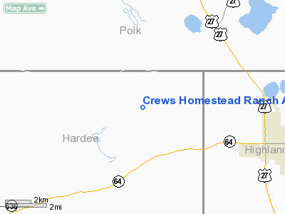
Crews Homestead Ranch Airport |
Location
& QuickFacts
|
FAA Information Effective: |
2007-01-18 |
|
Airport
Identifier: |
FL01 |
|
Airport
Status: |
Operational |
|
Longitude/Latitude: |
081-36-38.2800W/27-37-16.1200N
-81.610633/27.621144 (Estimated) |
|
Elevation: |
90 ft / 27.43 m (Estimated) |
|
Land: |
0 acres |
|
From
nearest city: |
6 nautical miles W of Avon Park, FL |
|
Location: |
Hardee County, FL |
|
Magnetic Variation: |
03W (1990) |
Owner
& Manager
|
Ownership: |
Privately owned |
|
Owner: |
Letta Bonnett Groves Inc |
|
Address: |
Po Box 1117
Avon Park, FL 33825 |
|
Phone
number: |
813-453-3040 |
|
Manager: |
Robert Crews |
|
Address: |
Po Box 1117
Avon Park, FL 33825 |
|
Phone number: |
813-453-3382 |
Airport
Operations and Facilities
|
Airport Use: |
Private |
|
Wind
indicator: |
Yes |
|
Segmented
Circle: |
No |
|
Control
Tower: |
No |
|
Sectional
chart: |
Miami |
|
Region: |
ASO - Southern |
|
Boundary
ARTCC: |
ZMA - Miami |
|
Tie-in
FSS: |
PIE - Saint Petersburg |
|
FSS
on Airport: |
No |
|
FSS
Toll Free: |
1-800-WX-BRIEF |
|
Runway Information
Runway 14/32
|
Dimension: |
3125 x 50 ft / 952.5 x 15.2 m |
|
Surface: |
TURF, |
|
|
Runway 14 |
Runway 32 |
|
Traffic
Pattern: |
Left |
Left |
|
Displaced
threshold: |
855.00 ft |
510.00 ft |
|
Obstruction: |
50 ft trees, 300.0 ft from runway |
30 ft pline, 30.0 ft from runway |
|
Radio Navigation
Aids
|
ID |
Type |
Name |
Ch |
Freq |
Var |
Dist |
|
CHN |
NDB |
Wauchula |
|
261.00 |
04W |
16.0 nm |
|
PCM |
NDB |
Plant City |
|
346.00 |
02W |
37.0 nm |
|
ISM |
NDB |
Kissimmee |
|
329.00 |
05W |
41.2 nm |
|
RHZ |
NDB |
Zephyrhills |
|
253.00 |
03W |
46.6 nm |
|
TPF |
NDB |
Knight |
|
270.00 |
02W |
48.1 nm |
|
PGD |
VOR |
Punta Gorda |
|
110.20 |
03W |
47.0 nm |
|
LAL |
VORTAC |
Lakeland |
107X |
116.00 |
01E |
30.7 nm |
|
LBV |
VORTAC |
La Belle |
041X |
110.40 |
01E |
49.1 nm |
Remarks
Based Aircraft
|
Aircraft
based on field: |
1 |
|
Helicopters: |
1 |
Crews Homestead Ranch Airport
Address:
Hardee County, FL
Tel:
813-453-3040,
813-453-3382
Images
and information placed above are from
http://www.airport-data.com/airport/FL01/
We
thank them for the data!
| General
Info |
| Country |
United
States |
| State |
FLORIDA
|
| FAA ID |
FL01
|
| Latitude |
27-37-16.120N
|
| Longitude |
081-36-38.280W
|
| Elevation |
90 feet
|
| Near City |
AVON PARK
|
We don't guarantee the information is fresh and accurate. The data may
be wrong or outdated.
For more up-to-date information please refer to other sources.
|
|


