|
|
Coordinates: 30°20′11″N 081°30′52″W / 30.33639°N 81.51444°W / 30.33639; -81.51444
| Craig Municipal Airport |
| IATA: CRG – ICAO: KCRG – FAA LID: CRG |
| Summary |
| Airport type |
Public |
| Owner |
Jacksonville Aviation Authority |
| Serves |
Jacksonville, Florida |
| Elevation AMSL |
41 ft / 12 m |
| Website |
jaa.aero/AirSys/Craig.aspx |
| Runways |
| Direction |
Length |
Surface |
| ft |
m |
| 5/23 |
4,004 |
1,220 |
Asphalt |
| 14/32 |
3,998 |
1,219 |
Asphalt |
| Statistics (1999) |
| Aircraft operations |
158,769 |
| Based aircraft |
319 |
| Source: Federal Aviation Administration |
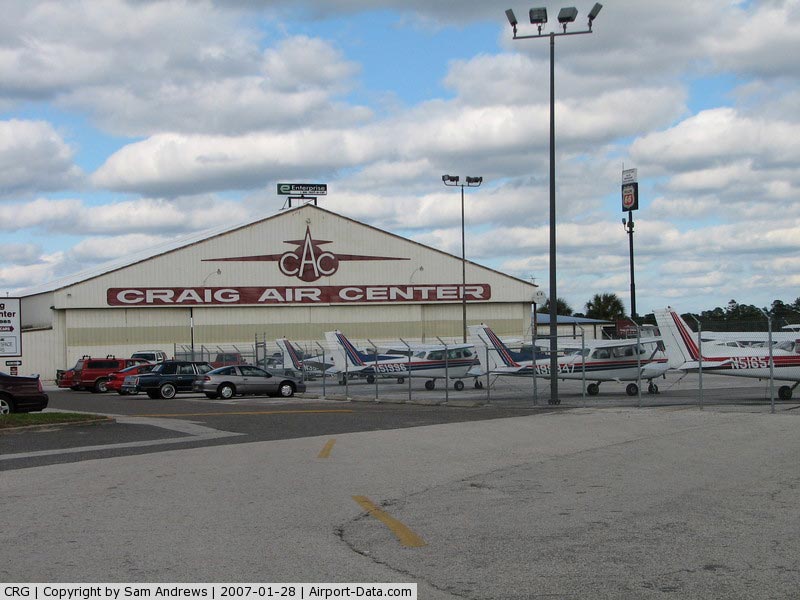
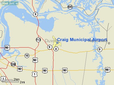
Craig Municipal Airport (IATA: CRG, ICAO: KCRG, FAA LID: CRG) is a public airport located eight miles (13 km) east of the central business district of Jacksonville, in Duval County, Florida, United States. It is owned by the Jacksonville Airport Authority.
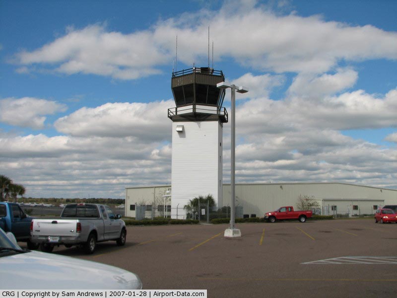
This mid-sized general aviation airport handles personal aircraft and small commuter planes. The entrance is located along St. Johns Bluff Road north of Atlantic Boulevard, although it also borders Atlantic Blvd to the south. The airport has a control tower and handles 400-500 aircraft operations daily. It previously served as a joint civil-military airport hosting an Army Aviation Support Facility and helicopter units of the Florida Army National Guard prior to their relocation to nearby Cecil Field following the latter facility's inactivation as a naval air station in 1999.
The United States Navy's Blue Angels performed their first airshow at Craig Municipal Airport on June 15, 1946.
Facilities and aircraft
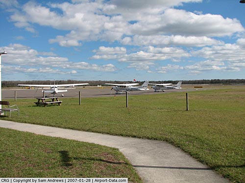
Craig Municipal Airport covers an area of 1,342 acres (543 ha) which contains two asphalt paved runways: 5/23 measuring 4,004 x 120ft and 14/32 measuring 3,998 x 120ft.
For the 12-month period ending October 20, 1999, the airport had 158,769 aircraft operations, an average of 434 per day: 86% general aviation, 9% military and 5% air taxi. There are 319 aircraft based at this airport: 57% single-engine, 27% multi-engine, 7% helicopter, 6% military and 4% jet (12).
The above content comes from Wikipedia and is published under free licenses – click here to read more.
|
 |
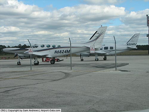
(Click on the photo to enlarge) |
|
 |
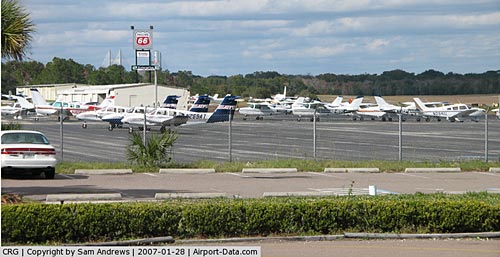
(Click on the photo to enlarge) |
|
 |
(Click on the photo to enlarge) |
|
 |
(Click on the photo to enlarge) |
|
 |
(Click on the photo to enlarge) |
Location
& QuickFacts
|
FAA Information Effective: |
2007-01-18 |
|
Airport
Identifier: |
CRG |
|
Airport
Status: |
Operational |
|
Longitude/Latitude: |
081-30-52.0000W/30-20-10.8000N
-81.514444/30.336333 (Estimated) |
|
Elevation: |
41 ft / 12.50 m (Surveyed) |
|
Land: |
1342 acres |
|
From
nearest city: |
8 nautical miles E of Jacksonville, FL |
|
Location: |
Duval County, FL |
|
Magnetic Variation: |
04W (1995) |
Owner
& Manager
|
Ownership: |
Publicly owned |
|
Owner: |
Jacksonville Airport Auth |
|
Address: |
Po Box 18018
Jacksonville, FL 32229-0018 |
|
Phone
number: |
904-573-1613 |
|
Manager: |
Russell Chandler
AVIATION DRCTR JAX PORT AUTH. |
|
Address: |
855-11 St St John's Bluff Rd N
Jacksonville, FL 32225 |
|
Phone number: |
904-641-7666 |
Airport
Operations and Facilities
|
Airport Use: |
Open to public |
|
Wind
indicator: |
Yes |
|
Segmented
Circle: |
Yes |
|
Control
Tower: |
Yes |
|
Lighting
Schedule: |
DUSK-DAWN
WHEN ATCT CLSD HIRL RY 14/32 & MIRL RY 05/23 PRESET
MED INTST.
ACTVT REIL RY 23 & MALSR RY 32 - CTAF. |
|
Beacon
Color: |
Clear-Green (lighted land airport) |
|
Landing
fee charge: |
No |
|
Sectional
chart: |
Jacksonville |
|
Region: |
ASO - Southern |
|
Boundary
ARTCC: |
ZJX - Jacksonville |
|
Tie-in
FSS: |
GNV - Gainesville |
|
FSS
on Airport: |
No |
|
FSS
Phone: |
850-377-3291 |
|
FSS
Toll Free: |
1-800-WX-BRIEF |
|
NOTAMs
Facility: |
CRG (NOTAM-d service avaliable) |
|
Federal Agreements: |
NGRY3 |
Airport
Communications
|
CTAF: |
132.100 |
|
Unicom: |
122.950 |
Airport
Services
|
Fuel available: |
100LLA |
|
Airframe Repair: |
MAJOR |
|
Power Plant Repair: |
MAJOR |
|
Bottled
Oxygen: |
NONE |
|
Runway Information
Runway 05/23
|
Dimension: |
4004
x 100 ft / 1220.4 x 30.5 m
RY 05/23 HAS 75 FT STWYS BOTH ENDS.
RY
14/32 HAS 75 FT STWYS BOTH ENDS. |
|
Surface: |
ASPH, Good Condition |
|
Weight
Limit: |
Single wheel: 30000 lbs. |
|
Edge
Lights: |
Medium |
|
|
Runway 05 |
Runway 23 |
|
Longitude: |
081-31-08.1680W |
081-30-35.8640W |
|
Latitude: |
30-19-44.0060N |
30-20-12.0330N |
|
Elevation: |
40.00 ft |
40.00 ft |
|
Alignment: |
45 |
127 |
|
Traffic
Pattern: |
Left |
Left |
|
Markings: |
Basic, Good Condition |
Basic, Good Condition |
|
VASI: |
4-light PAPI on left side
PAPI RY 05 UNUSBL BYD 7.5 DEGS RIGHT OF CNTRLN. |
4-light PAPI on left side
PAPI RY 23 UNUSBL BYD 9.0 DEGS RIGHT OF CNTRLN. |
|
Visual
Glide Angle: |
3.00� |
3.00� |
|
Runway
End Identifier: |
|
Yes |
|
Obstruction: |
1000 ft tower, 20000.0 ft from runway, 20:1
slope to clear |
45 ft trees, 1751.0 ft from runway, 34:1 slope
to clear |
|
Runway 14/32
|
Dimension: |
3998
x 100 ft / 1218.6 x 30.5 m
RY 05/23 HAS 75 FT STWYS BOTH ENDS.
RY
14/32 HAS 75 FT STWYS BOTH ENDS. |
|
Surface: |
ASPH, Good Condition |
|
Weight
Limit: |
Single wheel: 30000 lbs. |
|
Edge
Lights: |
High |
|
|
Runway 14 |
Runway 32 |
|
Longitude: |
081-31-08.1970W |
081-30-35.9460W |
|
Latitude: |
30-20-37.5760N |
30-20-09.5860N |
|
Elevation: |
32.00 ft |
40.00 ft |
|
Alignment: |
127 |
127 |
|
ILS
Type: |
|
ILS |
|
Traffic
Pattern: |
Left |
Left |
|
Markings: |
Non-precision instrument, Good Condition |
Precision instrument, Good Condition |
|
VASI: |
4-light PAPI on left side |
4-light PAPI on left side
PAPI RY 32 UNUSBL BYD 8.0 DEGS EITHER SIDE OF CNTRLN. |
|
Visual
Glide Angle: |
3.00� |
3.00� |
|
Approach
lights: |
|
MALSR |
|
Runway
End Identifier: |
Yes |
|
|
Radio Navigation
Aids
|
ID |
Type |
Name |
Ch |
Freq |
Var |
Dist |
|
EYA |
NDB |
Eastport |
|
357.00 |
03W |
7.2 nm |
|
HEG |
NDB |
Herlong |
|
332.00 |
02W |
15.7 nm |
|
JA |
NDB |
Dinns |
|
344.00 |
03W |
16.8 nm |
|
IAK |
NDB |
Palatka |
|
243.00 |
05W |
43.9 nm |
|
JUK |
NDB |
Mc Kinnon |
|
353.00 |
05W |
49.5 nm |
|
NRB |
TACAN |
Mayport |
051X |
|
03W |
5.7 nm |
|
NIP |
TACAN |
Jacksonville |
19X |
|
04W |
10.3 nm |
|
NZC |
TACAN |
Cecil/dcmsnd |
088X |
|
04W |
19.8 nm |
|
VQQ |
VOR |
Cecil |
|
117.90 |
03W |
20.9 nm |
|
SGJ |
VOR/DME |
St Augustine |
031X |
109.40 |
06W |
24.7 nm |
|
CRG |
VORTAC |
Craig |
092X |
114.50 |
03W |
0.3 nm |
|
SSI |
VORTAC |
Brunswick |
035X |
109.80 |
04W |
43.1 nm |
|
JAX |
VOT |
Jacksonville Intl |
|
111.00 |
|
13.1 nm |
Remarks
- BIRDS
PERIODICALLY ON OR NEAR THE ARPT INCREASING IN ACTIVITY DURING INCLEMENT
WEATHER.
- BANNER
TOWING ON WEEKENDS & SPECIAL EVENTS.
- VFR
NOISE ABATEMENT PROCEDURES IN EFFECT. CALL COMPLIANCE SPECIALIST 904-641-3606
OR CTC WWW.JAXPORT.COM/CRAIG.CFM FOR INFO. WX PERMITTING, RY 05 PREFERRED
FOR APCH, RY 32 PREFERRED FOR DEP.
- WILDLIFE
ON & INVOF ARPT.
- TXY
J UNLGTD.
Based Aircraft
|
Aircraft
based on field: |
319 |
|
Single
Engine Airplanes: |
182 |
|
Multi
Engine Airplanes: |
85 |
|
Jet Engine
Airplanes: |
12 |
|
Helicopters: |
22 |
|
Military: |
18 |
Operational Statistics
Time Period: 1998-10-21
- 1999-10-20
|
Aircraft
Operations: |
435/Day |
|
Air Taxi: |
4.8% |
|
General
Aviation Local: |
35.4% |
|
General
Aviation Itinerant: |
50.3% |
|
Military: |
9.5% |
Craig Municipal Airport
Address:
Duval County, FL
Tel:
904-573-1613,
904-641-7666
Images
and information placed above are from
http://www.airport-data.com/airport/CRG/
We
thank them for the data!
| General
Info |
| Country |
United
States |
| State |
FLORIDA
|
| FAA ID |
CRG
|
| Latitude |
30-20-10.800N
|
| Longitude |
081-30-52.000W
|
| Elevation |
41 feet
|
| Near City |
JACKSONVILLE
|
We don't guarantee the information is fresh and accurate. The data may
be wrong or outdated.
For more up-to-date information please refer to other sources.
|
|