 |
|
|
|
|
|
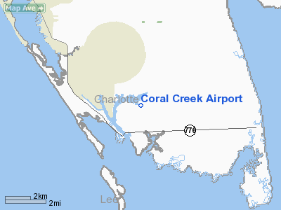
Location
& QuickFacts
|
FAA
Information Effective: |
2007-01-18 |
|
Airport
Identifier: |
FA54 |
|
Airport
Status: |
Operational |
|
Longitude/Latitude: |
082-15-04.3370W/26-51-16.2350N
-82.251205/26.854510 (Estimated) |
|
Elevation: |
4 ft / 1.22 m (Estimated) |
|
Land: |
193 acres |
|
From
nearest city: |
2 nautical miles NE of Placida, FL |
|
Location: |
Charlotte County, FL |
|
Magnetic Variation: |
02W (1985) |
Owner
& Manager
|
Ownership: |
Privately owned |
|
Owner: |
Bk Iv As Llc C/o Eastern Dev |
|
Address: |
120 Presidential Way Suite 300
Woburn, MA 01801 |
|
Phone number: |
781-926-6275 |
|
Manager: |
Marcy Hopp |
|
Address: |
11901 Gasparilla Road
Placida, FL 33946 |
|
Phone number: |
941-740-9876 |
Airport
Operations and Facilities
|
Airport
Use: |
Private |
|
Wind
indicator: |
Yes |
|
Segmented
Circle: |
No |
|
Control
Tower: |
No |
|
Lighting
Schedule: |
RDO-CTL
ACTVT MIRL RY 05/23 AND REIL RYS 05 & 23 - 130.65. |
|
Landing fee charge: |
No |
|
Sectional chart: |
Miami |
|
Region: |
ASO - Southern |
|
Boundary ARTCC: |
ZMA - Miami |
|
Tie-in FSS: |
PIE - Saint Petersburg |
|
FSS on Airport: |
No |
|
FSS Toll Free: |
1-800-WX-BRIEF |
Airport
Communications
Airport
Services
|
Fuel
available: |
A |
|
Bottled
Oxygen: |
NONE |
|
Bulk
Oxygen: |
NONE |
|
Runway Information
Runway 05/23
|
Dimension: |
4200 x 50 ft / 1280.2 x 15.2 m |
|
Surface: |
ASPH, Fair Condition |
|
Weight
Limit: |
Single wheel: 30000 lbs.
Dual wheel: 100000 lbs. |
|
Edge
Lights: |
Medium |
|
|
Runway 05 |
Runway 23 |
|
Traffic
Pattern: |
Left |
Right |
|
Markings: |
Basic, Good Condition |
Basic, Good Condition |
|
Crossing
Height: |
35.00 ft |
35.00 ft |
|
VASI: |
2-light PAPI on left side |
2-light PAPI on left side |
|
Visual
Glide Angle: |
3.00� |
3.00� |
|
Runway
End Identifier: |
Yes |
Yes |
|
Centerline
Lights: |
No |
No |
|
Touchdown
Lights: |
No |
No |
|
Obstruction: |
30 ft trees, 550.0 ft from runway, 60 ft right
of centerline, 20:1 slope to clear |
40 ft trees, 520.0 ft from runway, 150 ft right
of centerline, 20:1 slope to clear |
|
Radio Navigation
Aids
|
ID |
Type |
Name |
Ch |
Freq |
Var |
Dist |
|
VNC |
NDB |
Venice |
|
206.00 |
02W |
15.7 nm |
|
CHN |
NDB |
Wauchula |
|
261.00 |
04W |
44.0 nm |
|
APF |
NDB |
Naples |
|
201.00 |
03W |
49.2 nm |
|
PGD |
VOR |
Punta Gorda |
|
110.20 |
03W |
14.4 nm |
|
CYY |
VOR/DME |
Cypress |
023X |
108.60 |
03W |
49.2 nm |
|
RSW |
VORTAC |
Lee County |
055X |
111.80 |
02W |
32.1 nm |
|
SRQ |
VORTAC |
Sarasota |
099X |
115.20 |
02W |
36.5 nm |
|
LBV |
VORTAC |
La Belle |
041X |
110.40 |
01E |
46.1 nm |
Remarks
Operational Statistics
Time Period: 1985-01-16 - 1986-01-15
|
Aircraft
Operations: |
20/Week |
|
General
Aviation Local: |
50.0% |
|
General
Aviation Itinerant: |
50.0% |
Coral Creek Airport
Address:
Charlotte County, FL
Tel:
781-926-6275, 941-740-9876
Images
and information placed above are from
http://www.airport-data.com/airport/FA54/
We
thank them for the data!
| General
Info |
| Country |
United
States |
| State |
FLORIDA
|
| FAA ID |
FA54
|
| Latitude |
26.854511
26� 51' 16.24" N |
| Longitude |
-82.251206
082� 15' 04.34" W |
| Elevation |
4 feet
1 meters |
| Magnetic
Variation |
004� W
(01/06) |
| Operating
Agency |
PRIVATE
|
We don't guarantee the information is fresh and accurate. The data may
be wrong or outdated.
For more up-to-date information please refer to other sources.
|
|


