 |
|
Location
& QuickFacts
|
FAA Information Effective: |
2007-01-18 |
|
Airport Identifier: |
93FD |
|
Airport Status: |
Operational |
|
Longitude/Latitude: |
087-10-38.8940W/30-45-16.6810N
-87.177471/30.754634 (Estimated) |
|
Elevation: |
205 ft / 62.48 m (Estimated) |
|
Land: |
0 acres |
|
From nearest city: |
10 nautical miles NW of Milton, FL |
|
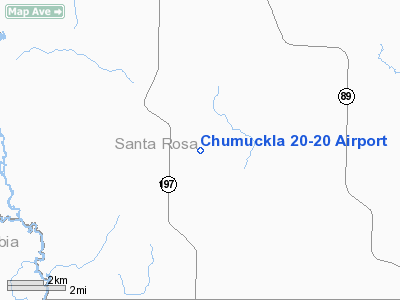
Location: |
Santa Rosa County, FL |
|
Magnetic Variation: |
00E (1990) |
Owner
& Manager
|
Ownership: |
Privately owned |
|
Owner: |
Martin D. Griswold |
|
Address: |
Rt 3 Box 709c
Jay, FL 32565 |
|
Phone number: |
904-997-7661 |
|
Address: |
|
Airport
Operations and Facilities
|
Airport
Use: |
Private |
|
Segmented
Circle: |
No |
|
Control
Tower: |
No |
|
Sectional
chart: |
New Orleans |
|
Region: |
ASO - Southern |
|
Boundary
ARTCC: |
ZJX - Jacksonville |
|
Tie-in
FSS: |
GNV - Gainesville |
|
FSS
Phone: |
850-377-3291 |
|
FSS
Toll Free: |
1-800-WX-BRIEF |
|
Runway Information
Runway 18/36
|
Dimension: |
3000 x 100 ft / 914.4 x 30.5 m |
|
Surface: |
TURF, |
|
|
Runway 18 |
Runway 36 |
|
Traffic
Pattern: |
Left |
Left |
|
Obstruction: |
30 ft trees |
30 ft trees |
|
Radio Navigation
Aids
|
ID |
Type |
Name |
Ch |
Freq |
Var |
Dist |
|
PKZ |
NDB |
Pickens |
|
326.00 |
01E |
19.1 nm |
|
ESU |
NDB |
Summerdale |
|
204.00 |
01E |
32.2 nm |
|
DTS |
NDB |
Destin |
|
254.00 |
01W |
42.0 nm |
|
NSE |
TACAN |
Whiting |
070X |
|
01E |
8.4 nm |
|
NGS |
TACAN |
Santa Rosa |
063X |
|
01E |
15.0 nm |
|
NPA |
TACAN |
Pensacola |
119X |
|
01E |
24.9 nm |
|
HRT |
TACAN |
Hurlburt |
045X |
|
00E |
31.9 nm |
|
DWG |
TACAN |
Warrington |
002X |
|
00E |
37.8 nm |
|
NUN |
VOR |
Saufley |
|
108.80 |
01E |
18.9 nm |
|
CEW |
VORTAC |
Crestview |
106X |
115.90 |
03E |
26.1 nm |
|
MVC |
VORTAC |
Monroeville |
115X |
116.80 |
04E |
43.4 nm |
|
BFM |
VORTAC |
Brookley |
075X |
112.80 |
04E |
46.2 nm |
Remarks
Based Aircraft
|
Aircraft
based on field: |
1 |
|
Single
Engine Airplanes: |
1 |
Chumuckla 20-20 Airport
Address:
Santa Rosa County, FL
Tel:
904-997-7661
Images
and information placed above are from
http://www.airport-data.com/airport/93FD/
We
thank them for the data!
| General
Info |
| Country |
United
States |
| State |
FLORIDA
|
| FAA ID |
93FD
|
| Latitude |
30-45-16.681N
|
| Longitude |
087-10-38.894W
|
| Elevation |
205 feet
|
| Near City |
MILTON
|
We don't guarantee the information is fresh and accurate. The data may
be wrong or outdated.
For more up-to-date information please refer to other sources.
|
|


