 |
|
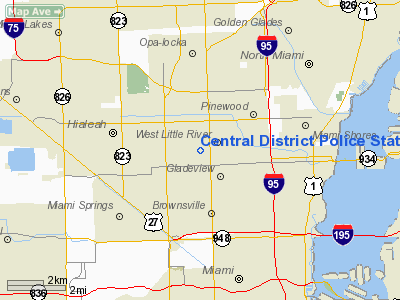
Central District Police Station Heliport |
Location
& QuickFacts
|
FAA
Information Effective: |
2007-01-18 |
|
Airport
Identifier: |
7FD3 |
|
Airport
Status: |
Operational |
|
Longitude/Latitude: |
080-14-49.1770W/25-51-11.3460N
-80.246994/25.853152 (Estimated) |
|
Elevation: |
36 ft / 10.97 m (Estimated) |
|
Land: |
0 acres |
|
From
nearest city: |
0 nautical miles E of Hialeah, FL |
|
Location: |
Dade County, FL |
|
Magnetic Variation: |
03W (1985) |
Owner
& Manager
|
Ownership: |
Publicly owned |
|
Owner: |
Metro-dade Police Dept |
|
Address: |
9105 Nw 25 St
305-471-2100 |
|
Phone number: |
305-688-1901 |
|
Manager: |
Metro-dade Police Dept |
|
Address: |
9105-471-2100
Miami, FL 33172 |
|
Phone number: |
305-471-2100 |
Airport
Operations and Facilities
|
Airport
Use: |
Private |
|
Segmented
Circle: |
No |
|
Control
Tower: |
No |
|
Lighting
Schedule: |
PHONE REQ
FOR PERIMETER LGTS CALL 305-681-4011 |
|
Sectional
chart: |
Miami |
|
Region: |
ASO - Southern |
|
Boundary
ARTCC: |
ZMA - Miami |
|
Tie-in
FSS: |
MIA - Miami |
|
FSS
Phone: |
305-233-2600 |
|
FSS
Toll Free: |
1-800-WX-BRIEF |
|
Runway Information
Helipad H1
|
Dimension: |
60 x 50 ft / 18.3 x 15.2 m |
|
Surface: |
CONC,
ROOFTOP |
|
|
Runway H1 |
Runway |
|
Traffic
Pattern: |
Left |
Left |
|
Radio Navigation
Aids
|
ID |
Type |
Name |
Ch |
Freq |
Var |
Dist |
|
PJN |
NDB |
Plantation |
|
242.00 |
03W |
16.8 nm |
|
FX |
NDB |
Praiz |
|
221.00 |
02W |
20.2 nm |
|
HST |
TACAN |
Homestead |
019X |
|
03W |
23.0 nm |
|
VKZ |
VOR/DME |
Virginia Key |
118X |
117.10 |
04W |
7.9 nm |
|
FLL |
VOR/DME |
Fort Lauderdale |
091X |
114.40 |
00E |
14.3 nm |
|
DHP |
VORTAC |
Dolphin |
086X |
113.90 |
04W |
6.4 nm |
|
MIA |
VOT |
Miami Intl |
|
112.00 |
|
3.9 nm |
Remarks
- PRVD
VFR/PVT USE; USE OF HELIPORT COORDINATED WITH OPA LOCKA GADO; &
INGRESS/EGRESS ROUTES ARE COORDINATED WITH THE MIAMI INTL ATCT.
Central District Police Station Heliport
Address:
Dade County, FL
Tel:
305-688-1901, 305-471-2100
Images
and information placed above are from
http://www.airport-data.com/airport/7FD3/
We
thank them for the data!
| General
Info |
| Country |
United
States |
| State |
FLORIDA
|
| FAA ID |
7FD3
|
| Latitude |
25-51-11.346N
|
| Longitude |
080-14-49.177W
|
| Elevation |
36 feet
|
| Near City |
HIALEAH
|
We don't guarantee the information is fresh and accurate. The data may
be wrong or outdated.
For more up-to-date information please refer to other sources.
|
|


