 |
|
Location
& QuickFacts
|
FAA
Information Effective: |
2006-09-28 |
|
Airport
Identifier: |
84FL |
|
Longitude/Latitude: |
080-17-59.1810W/25-55-31.3380N
-80.299772/25.925372 (Estimated) |
|
Elevation: |
7 ft / 2.13 m (Estimated) |
|
Land: |
0 acres |
|
From
nearest city: |
2 nautical miles N of Hialeah, FL |
|
Location: |
Dade County, FL |
|
Magnetic Variation: |
03W (1985) |
Owner
& Manager
|
Ownership: |
Privately owned |
|
Owner: |
A. J. Capeletti |
|
Address: |
16400 Nw 57th Ave
Miami, FL 33014 |
|
Phone
number: |
305-823-9500 |
|
Manager: |
Joe Capeletti |
|
Address: |
16400 Nw 57th Ave
Miami, FL 33014 |
|
Phone number: |
305-823-9500 |
Airport
Operations and Facilities
|
Airport
Use: |
Private |
|
Wind
indicator: |
Yes |
|
Segmented
Circle: |
Yes |
|
Control
Tower: |
No |
|
Attendance
Schedule: |
UNATNDD |
|
Sectional
chart: |
Miami |
|
Region: |
ASO - Southern |
|
Boundary
ARTCC: |
ZMA - Miami |
|
Tie-in
FSS: |
MIA - Miami |
|
FSS
Phone: |
305-233-2600 |
|
FSS
Toll Free: |
1-800-WX-BRIEF |
|
Runway Information
Helipad H1
|
Dimension: |
100 x 100 ft / 30.5 x 30.5 m |
|
Surface: |
TURF, |
|
|
Runway H1 |
Runway |
|
Traffic
Pattern: |
Left |
Left |
|
Radio Navigation
Aids
|
ID |
Type |
Name |
Ch |
Freq |
Var |
Dist |
|
PJN |
NDB |
Plantation |
|
242.00 |
03W |
13.2 nm |
|
FX |
NDB |
Praiz |
|
221.00 |
02W |
15.6 nm |
|
PB |
NDB |
Rubin |
|
356.00 |
03W |
46.1 nm |
|
HST |
TACAN |
Homestead |
019X |
|
03W |
26.6 nm |
|
FLL |
VOR/DME |
Fort Lauderdale |
091X |
114.40 |
00E |
12.0 nm |
|
VKZ |
VOR/DME |
Virginia Key |
118X |
117.10 |
04W |
13.1 nm |
|
DHP |
VORTAC |
Dolphin |
086X |
113.90 |
04W |
8.0 nm |
|
PBI |
VORTAC |
Palm Beach |
104X |
115.70 |
03W |
46.8 nm |
|
MIA |
VOT |
Miami Intl |
|
112.00 |
|
7.9 nm |
|
PBI |
VOT |
Palm Beach |
|
109.00 |
|
47.0 nm |
Remarks
- VFR
PVT USE; PVDD 2-WAY RADIO COM ARE EXTABD WITH OPA LOCKA ATC PRIOR TO
ENTERING DEPG HELI.
Based Aircraft
|
Aircraft
based on field: |
1 |
|
Helicopters: |
1 |
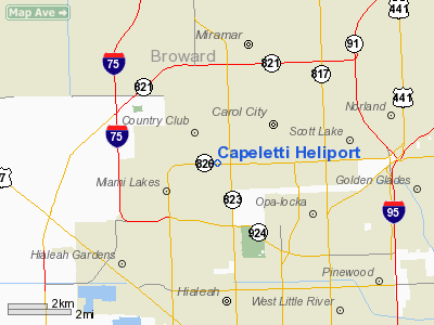
Capeletti Heliport
Address:
Dade County, FL
Tel:
305-823-9500
Images
and information placed above are from
http://www.airport-data.com/airport/84FL/
We
thank them for the data!
| General
Info |
| Country |
United
States |
| State |
FLORIDA
|
| FAA ID |
84FL
|
| Latitude |
25-55-31.338N
|
| Longitude |
080-17-59.181W
|
| Elevation |
7 feet
|
| Near City |
HIALEAH
|
We don't guarantee the information is fresh and accurate. The data may
be wrong or outdated.
For more up-to-date information please refer to other sources.
|
|


