 |
|
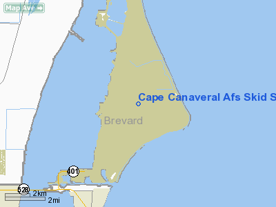
Cape Canaveral Air Force Skid Strip Airport |
| Cape Canaveral AFS Skid Strip |
| IATA: none – ICAO: KXMR – FAA LID: XMR |
| Summary |
| Airport type |
Military |
| Operator |
United States Air Force |
| Serves |
Cape Canaveral Air Force Station |
| Location |
Cape Canaveral |
| Elevation AMSL |
10 ft / 3 m |
| Coordinates |
28°28′04″N 080°34′01″W / 28.46778°N 80.56694°W / 28.46778; -80.56694 |
| Runways |
| Direction |
Length |
Surface |
| ft |
m |
| 13/31 |
10,000 |
3,048 |
Asphalt |
| Source: Federal Aviation Administration |
Cape Canaveral AFS Skid Strip (IATA: XMR, ICAO: KXMR) is a military airport on Cape Canaveral Air Force Station, seven miles (11 km) northeast of Cocoa Beach, in Brevard County, Florida, United States. It has an asphalt paved runway designated 13/31 and measuring 10,000 x 200 ft. (3,048 x 61 m). The facility is owned by the United States Air Force.
Although most U.S. airports use the same three-letter location identifier for the FAA and IATA, Cape Canaveral AFS Skid Strip is assigned XMR by the FAA but has no designation from the IATA.
The Skid Strip was used by NASA's Pregnant Guppy and Super Guppy transport aircraft carrying the S-IVB upper stage for the Saturn IB and Saturn V rockets used in Project Apollo. Today, it is predominantly used by USAF C-130 Hercules, C-17 Globemaster III and C-5 Galaxy aircraft transporting satellite payloads to CCAFS for mating with launch vehicles.
The CCAFS Skid Strip is sometimes confused with the NASA Shuttle Landing Facility, but that runway, specially constructed for the Space Shuttle, is located on Merritt Island at the adjacent John F. Kennedy Space Center.
The above content comes from Wikipedia and is published under free licenses – click here to read more.
Location
& QuickFacts
|
FAA
Information Effective: |
2006-09-28 |
|
Airport
Identifier: |
XMR |
|
Longitude/Latitude: |
080-34-00.6000W/28-28-03.6000N
-80.566833/28.467667 (Estimated) |
|
Elevation: |
10 ft / 3.05 m (Surveyed) |
|
Land: |
0 acres |
|
From
nearest city: |
7 nautical miles NE of Cocoa Beach, FL |
|
Location: |
Brevard County, FL |
|
Magnetic Variation: |
03W (1985) |
Owner
& Manager
|
Ownership: |
Air Force owned |
|
Owner: |
Usaf |
|
Address: |
Patrick Afb
Cocoa Beach, FL 32925 |
|
Phone
number: |
V467-5941 |
|
Manager: |
Chief Of Afld Management |
|
Address: |
Patrick Afb
Cocoa Beach, FL 32925 |
|
Phone number: |
305-853-5941 |
Airport
Operations and Facilities
|
Airport
Use: |
Private
PPR FM ROS, CCAFS, FL V467-5941. |
|
Wind
indicator: |
Yes |
|
Segmented
Circle: |
No |
|
Control
Tower: |
Yes |
|
Landing
fee charge: |
No |
|
Sectional
chart: |
Jacksonville |
|
Region: |
ASO - Southern |
|
Boundary
ARTCC: |
ZMA - Miami |
|
Responsible
ARTCC: |
ZJX - Jacksonville |
|
Tie-in
FSS: |
PIE - Saint Petersburg
FSS-ST.
PETERSBURG PIE-NOTAM PIE. |
|
FSS
on Airport: |
No |
|
FSS
Toll Free: |
1-800-WX-BRIEF |
|
NOTAMs
Facility: |
PIE (NOTAM-d service avaliable) |
|
Certification type/date: |
I AU 2/1977 |
Airport
Services
|
Airframe
Repair: |
NONE |
|
Power
Plant Repair: |
NONE |
|
Bottled
Oxygen: |
NONE |
|
Bulk
Oxygen: |
NONE |
|
Runway Information
Runway 13/31
|
Dimension: |
10000 x 200 ft / 3048.0 x 61.0 m |
|
Surface: |
ASPH, |
|
Surface
Treatment: |
Saw-cut or plastic Grooved |
|
Pavement
Class: |
43/F/A/W/T |
|
Weight
Limit: |
Single wheel: 65000 lbs.
Dual wheel: 200000 lbs.
Dual tandem wheel: 420000 lbs.
Dual dual tandem wheel: 789000 lbs.
ST
175, SBTT 538, TRT 522, TDT 890 |
|
Edge
Lights: |
Medium |
|
|
Runway 13 |
Runway 31 |
|
Longitude: |
080-34-44.1810W |
080-33-16.1790W |
|
Latitude: |
28-28-33.0010N |
28-27-33.0020N |
|
Elevation: |
10.00
ft |
10.00
ft |
|
Traffic
Pattern: |
Left |
Left |
|
Markings: |
Non-precision instrument, Good Condition |
Non-precision instrument, Good Condition |
|
VASI: |
4-light PAPI on left side |
4-light PAPI on left side |
|
Approach
lights: |
|
SALS |
|
Runway
End Identifier: |
No |
No |
|
Centerline
Lights: |
No |
No |
|
Touchdown
Lights: |
No |
No |
|
Radio Navigation
Aids
|
ID |
Type |
Name |
Ch |
Freq |
Var |
Dist |
|
COI |
NDB |
Merritt Island |
|
247.00 |
05W |
10.0 nm |
|
GGL |
NDB |
Geiger Lake |
|
375.00 |
05W |
15.2 nm |
|
SQT |
NDB |
Satellite |
|
257.00 |
03W |
23.2 nm |
|
EVB |
NDB |
New Smyrna Beach |
|
417.00 |
04W |
40.4 nm |
|
SFB |
NDB |
Sanford |
|
408.00 |
05W |
40.5 nm |
|
ISM |
NDB |
Kissimmee |
|
329.00 |
05W |
47.1 nm |
|
VEP |
NDB |
Vero Beach |
|
392.00 |
04W |
48.9 nm |
|
TTS |
TACAN |
Kennedy Space Center |
059Y |
|
00E |
11.7 nm |
|
COF |
TACAN |
Patrick |
097X |
|
04W |
14.0 nm |
|
MLB |
VOR/DME |
Melbourne |
037X |
110.00 |
02W |
22.1 nm |
|
ORL |
VORTAC |
Orlando |
059X |
112.20 |
00E |
40.8 nm |
|
VRB |
VORTAC |
Vero Beach |
120X |
117.30 |
04W |
47.6 nm |
|
VRB |
VOT |
Vero Beach |
|
111.00 |
|
49.6 nm |
Remarks
- SERVICE
LGT: RWY 31 APCH LGT NSTD SALS, 1000'.
- MISC:
LTD PRK. WX OBSERVER AVBL , OTHER THAN AS REQ, 1130-1930Z++ WKD.
NO CLASSIFIED
MATERIALS STOR AVBL.
- TRAN
ALERT: CHIP DETECTION INSP RQRD BY F16'S NOT AVBL.
-
CSTMS/AG/IMG: AVBL 1 HR PN 1300-2200Z++ MON - FRI, OT
2 HR PN. PPR.
- WX
OBSERVATION/FORECAST AVBL 24 HRS VIA PHONE DSN 476-8484, C321-853-8484.
- CAUTION:
LIGHTED 150 FT MSL CRANE OPERATING AT 28-28-20.2080N 80-33-34.9920W.
- JASU:
2(AM32A-60A) 3(A/M32A-86D).
- FUEL:
O/R BY TRUCK FR PATRICK AFB, EXP 4-6 HR DELAY WO PRIOR COORD.
- OPR
HX.
- RSTD:
PPR FR 45 RANS/DS, CCAS, FL, DSN 467-5941. ALL ACFT WILL CTC APP BEFORE
PROCEEDING TO CAPE CANAVERAL. LDG AND TKOF NOT AUTH UNLESS CAPE TWR
IS OPR.
- RSTD:
OFFL BUS OR HI PRIORITY MSN ACFT CTC 1 ROPS/DOUS, CCAS, FL, DSN 467-5941,
C321-853-5941. PPR FOR OPR 1230-2100Z++, MON-FRI RQR 24 HR PN, PPR OT
RQR 5 DAY PN. SKID STRIP OPR HR ARE DETERMINED BY PPR NR FOR SPECIFIED
OPR.
- RSTD:
NO ARR OR DEP WITHIN 1 HR OF CAPE CANAVERAL LAUNCH OPR. LDG AND TKOF
NOT AUZD UNLESS CAPE TWR IS OPR. ALL ACFT WILL CTC APP BEFORE PROCEEDING
TO CAPE CANAVERAL. FLT IS RSTD TO 1000' ABV AND WITHIN A HORIZONTAL
RAD OF 2000' FR ANY SPACE LAUNCH COMPLEX.
- RSTD:
IF OPR NECESSITY RQR FLT CLOSER THAN THESE RSTD, COORD WITH THE CUSTODIAN
OF THE AFFECTED COMPLEX SHALL BE ACCOMPLISHED NO LATER THAN 24 HR PRIOR
TO FLT.
- CAUTION:
MANY OBST IN VCNTY OF RWY. BIRD
HAZ.
Cape Canaveral Air Force Skid Strip Airport
Address:
Brevard County, FL
Tel:
305-853-5941
Images
and information placed above are from
http://www.airport-data.com/airport/XMR/
We
thank them for the data!
| General
Info |
| Country |
United
States |
| State |
FLORIDA
|
| FAA ID |
XMR
|
| Latitude |
28-28-03.001N
|
| Longitude |
080-33-59.180W
|
| Elevation |
10 feet
|
| Near City |
COCOA
BEACH |
We don't guarantee the information is fresh and accurate. The data may
be wrong or outdated.
For more up-to-date information please refer to other sources.
|
|


