 |
|
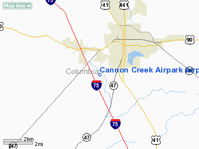
Cannon Creek Airpark Airport |
|
|
Location
& QuickFacts
|
FAA
Information Effective: |
2006-09-28 |
|
Airport
Identifier: |
15FL |
|
Longitude/Latitude: |
082-39-59.0610W/30-09-13.4740N
-82.666406/30.153743 (Estimated) |
|
Elevation: |
125 ft / 38.10 m (Estimated) |
|
Land: |
22 acres |
|
From
nearest city: |
3 nautical miles SW of Lake City, FL |
|
Location: |
Columbia County, FL |
|
Magnetic Variation: |
02W (1985) |
Owner
& Manager
|
Ownership: |
Privately owned |
|
Owner: |
Cannon Creek Airport Inc |
|
Address: |
Route 18 Box 589
Lake City, FL 32055 |
|
Phone
number: |
904-752-1957
ALSO 1-800-766-0406. |
|
Manager: |
Ray Sessions |
|
Address: |
Route 18 Box 589
Lake City, FL 32055 |
|
Phone number: |
904-752-1957
ALSO 904-719-8895. |
Airport
Operations and Facilities
|
Airport Use: |
Private |
|
Wind indicator: |
Yes |
|
Segmented Circle: |
No |
|
Control Tower: |
No |
|
Attendance Schedule: |
IREG
UNATNDD FED HOLS. |
|
Landing fee charge: |
No |
|
Sectional chart: |
Jacksonville |
|
Region: |
ASO - Southern |
|
Boundary ARTCC: |
ZJX - Jacksonville |
|
Tie-in FSS: |
GNV - Gainesville |
|
FSS on Airport: |
No |
|
FSS Phone: |
850-377-3291 |
|
FSS Toll Free: |
1-800-WX-BRIEF |
Airport
Communications
Airport
Services
|
Fuel
available: |
100LL |
|
Airframe
Repair: |
MINOR |
|
Power
Plant Repair: |
MINOR |
|
Runway Information
Runway 09/27
|
Dimension: |
2292 x 50 ft / 698.6 x 15.2 m |
|
Surface: |
TURF, |
|
|
Runway 09 |
Runway 27 |
|
Traffic
Pattern: |
Left |
Left |
|
Displaced
threshold: |
305.00 ft
RY 09/27 DSPLCD THLDS MKD WITH WHITE STONES. |
195.00 ft |
|
Obstruction: |
15 ft road, 95.0 ft from runway |
70 ft trees, 1750.0 ft from runway |
|
Runway 18/36
|
Dimension: |
3513 x 25 ft / 1070.8 x 7.6 m |
|
Surface: |
ASPH, |
|
|
Runway 18 |
Runway 36 |
|
Traffic
Pattern: |
Left |
Left |
|
Displaced
threshold: |
380.00 ft |
400.00 ft |
|
Obstruction: |
15 ft road |
15 ft road, 0.0 ft from runway |
|
Radio Navigation
Aids
|
ID |
Type |
Name |
Ch |
Freq |
Var |
Dist |
|
LCQ |
NDB |
Lake City |
|
204.00 |
03W |
4.9 nm |
|
GN |
NDB |
Wynds |
|
269.00 |
04W |
38.8 nm |
|
HEG |
NDB |
Herlong |
|
332.00 |
02W |
45.1 nm |
|
JA |
NDB |
Dinns |
|
344.00 |
03W |
48.6 nm |
|
FPY |
NDB |
Foley |
|
254.00 |
03W |
48.8 nm |
|
NZC |
TACAN |
Cecil/dcmsnd |
088X |
|
04W |
41.5 nm |
|
VQQ |
VOR |
Cecil |
|
117.90 |
03W |
40.5 nm |
|
OTK |
VOR/DME |
Valdosta |
095X |
114.80 |
02W |
49.3 nm |
|
TAY |
VORTAC |
Taylor |
076X |
112.90 |
03W |
21.9 nm |
|
GNV |
VORTAC |
Gators |
109X |
116.20 |
04W |
34.5 nm |
|
CTY |
VORTAC |
Cross City |
057X |
112.00 |
02W |
38.8 nm |
Remarks
- VFR
OPNS; PVT USE ONLY. TFC PATS ESTBD ON SOUTH SIDE RWY & RWY CNTRLN
EXTNDD; ESTB & MAINTAIN SEGMENTED CIRCLE RGT TFC PATS FOR RWY 09.
Based Aircraft
|
Aircraft
based on field: |
43 |
|
Single
Engine Airplanes: |
37 |
|
Multi
Engine Airplanes: |
2 |
|
Ultralights: |
4 |
Cannon Creek Airpark Airport
Address:
Columbia County, FL
Tel:
904-752-1957
Images
and information placed above are from
http://www.airport-data.com/airport/15FL/
We
thank them for the data!
| General
Info |
| Country |
United
States |
| State |
FLORIDA
|
| FAA ID |
15FL
|
| Latitude |
30-09-13.474N
|
| Longitude |
082-39-59.061W
|
| Elevation |
125 feet
|
| Near City |
LAKE CITY
|
We don't guarantee the information is fresh and accurate. The data may
be wrong or outdated.
For more up-to-date information please refer to other sources.
|
|


