 |
|
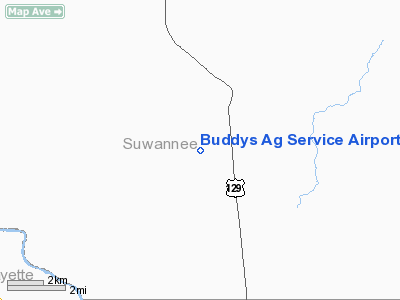
Buddys Ag Service Airport |
Location
& QuickFacts
|
FAA
Information Effective: |
2006-09-28 |
|
Airport
Identifier: |
9FD9 |
|
Longitude/Latitude: |
082-58-04.4660W/30-07-20.8150N
-82.967907/30.122449 (Estimated) |
|
Elevation: |
100 ft / 30.48 m (Estimated) |
|
Land: |
10 acres |
|
From
nearest city: |
3 nautical miles SW of Mc Alpin, FL |
|
Location: |
Suwannee County, FL |
|
Magnetic Variation: |
02W (1990) |
Owner
& Manager
|
Ownership: |
Privately owned |
|
Owner: |
Tommy E. White |
|
Address: |
Rt 1 P.o. Box 370
Mc Alpin, FL 32062 |
|
Phone
number: |
904-362-4847 |
|
Manager: |
Tommy E. White |
|
Address: |
Rt 1 P.o. Box 370
Mc Alpin, FL 32062 |
|
Phone number: |
904-362-4847 |
Airport
Operations and Facilities
|
Airport
Use: |
Private |
|
Segmented
Circle: |
No |
|
Control
Tower: |
No |
|
Attendance
Schedule: |
UNATNDD |
|
Sectional
chart: |
Jacksonville |
|
Region: |
ASO - Southern |
|
Boundary
ARTCC: |
ZJX - Jacksonville |
|
Tie-in
FSS: |
GNV - Gainesville |
|
FSS
on Airport: |
No |
|
FSS
Phone: |
850-377-3291 |
|
FSS
Toll Free: |
1-800-WX-BRIEF |
|
Runway Information
Runway 01/19
|
Dimension: |
2560 x 100 ft / 780.3 x 30.5 m |
|
Surface: |
TURF, |
|
|
Runway 01 |
Runway 19 |
|
Traffic
Pattern: |
Left |
Left |
|
Displaced
threshold: |
950.00 ft |
0.00
ft |
|
Obstruction: |
35 ft pline |
|
|
Radio Navigation
Aids
|
ID |
Type |
Name |
Ch |
Freq |
Var |
Dist |
|
LCQ |
NDB |
Lake City |
|
204.00 |
03W |
20.6 nm |
|
FPY |
NDB |
Foley |
|
254.00 |
03W |
33.1 nm |
|
GN |
NDB |
Wynds |
|
269.00 |
04W |
49.6 nm |
|
OTK |
VOR/DME |
Valdosta |
095X |
114.80 |
02W |
42.7 nm |
|
TAY |
VORTAC |
Taylor |
076X |
112.90 |
03W |
31.5 nm |
|
CTY |
VORTAC |
Cross City |
057X |
112.00 |
02W |
31.7 nm |
|
GNV |
VORTAC |
Gators |
109X |
116.20 |
04W |
44.5 nm |
|
GEF |
VORTAC |
Greenville |
027X |
109.00 |
01E |
49.5 nm |
Remarks
- PRVDD
VFR PRIVATE USE ONLY
Buddys Ag Service Airport
Address:
Suwannee County, FL
Tel: 904-362-4847
Images
and information placed above are from
http://www.airport-data.com/airport/9FD9/
We
thank them for the data!
| General
Info |
| Country |
United
States |
| State |
FLORIDA
|
| FAA ID |
9FD9
|
| Latitude |
30-07-20.815N
|
| Longitude |
082-58-04.466W
|
| Elevation |
100 feet
|
| Near City |
MC ALPIN
|
We don't guarantee the information is fresh and accurate. The data may
be wrong or outdated.
For more up-to-date information please refer to other sources.
|
|


