|
|
|
|
|
|
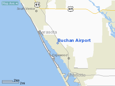
Location
& QuickFacts
|
FAA
Information Effective: |
2006-09-28 |
|
Airport
Identifier: |
X36 |
|
Longitude/Latitude: |
082-22-26.4640W/26-59-24.2900N
-82.374018/26.990081 (Estimated) |
|
Elevation: |
15 ft / 4.57 m (Estimated) |
|
Land: |
100 acres |
|
From
nearest city: |
2 nautical miles NW of Englewood, FL |
|
Location: |
Sarasota County, FL |
|
Magnetic Variation: |
02W (1985) |
Owner
& Manager
|
Ownership: |
Publicly owned |
|
Owner: |
Sarasota County |
|
Address: |
1301 Cattlemen Rd
Sarasota, FL 34232 |
|
Phone
number: |
941-378-6180 |
|
Manager: |
Bill Nichols
DEPUTY DIRECTOR OF TRANSPORTATION, SARASOTA CO. |
|
Address: |
100 Cattlemen Rd
Sarasota, FL 34232 |
|
Phone number: |
941-316-1460 |
Airport
Operations and Facilities
|
Airport
Use: |
Open to public |
|
Wind
indicator: |
Yes |
|
Segmented
Circle: |
Yes |
|
Control
Tower: |
No |
|
Attendance
Schedule: |
UNATNDD |
|
Landing
fee charge: |
No |
|
Sectional
chart: |
Miami |
|
Region: |
ASO - Southern |
|
Boundary
ARTCC: |
ZMA - Miami |
|
Tie-in
FSS: |
PIE - Saint Petersburg |
|
FSS
on Airport: |
No |
|
FSS
Toll Free: |
1-800-WX-BRIEF |
|
NOTAMs
Facility: |
PIE (NOTAM-d service avaliable) |
Airport
Communications
Airport
Services
|
Bottled
Oxygen: |
NONE |
|
Bulk
Oxygen: |
NONE |
|
Runway Information
Runway 12/30
|
Dimension: |
2040 x 120 ft / 621.8 x 36.6 m |
|
Surface: |
TURF, Fair Condition |
|
|
Runway 12 |
Runway 30 |
|
Longitude: |
082-22-37.2690W |
082-22-10.9240W |
|
Latitude: |
26-59-30.2880N |
26-59-15.6790N |
|
Elevation: |
14.00
ft |
15.00
ft |
|
Traffic
Pattern: |
Left |
Left |
|
Obstruction: |
20 ft tree, 414.0 ft from runway, 100 ft left
of centerline, 20:1 slope to clear |
31 ft tree, 640.0 ft from runway, 115 ft left
of centerline, 20:1 slope to clear |
|
Radio Navigation
Aids
|
ID |
Type |
Name |
Ch |
Freq |
Var |
Dist |
|
VNC |
NDB |
Venice |
|
206.00 |
02W |
5.3 nm |
|
CHN |
NDB |
Wauchula |
|
261.00 |
04W |
40.8 nm |
|
PGD |
VOR |
Punta Gorda |
|
110.20 |
03W |
21.0 nm |
|
SRQ |
VORTAC |
Sarasota |
099X |
115.20 |
02W |
26.3 nm |
|
RSW |
VORTAC |
Lee County |
055X |
111.80 |
02W |
42.4 nm |
Remarks
- DRAINAGE
SWALES ALONG SIDE BOTH RWYS.
- RY
12/30 ROUGH & BARE IN SPOTS.
- RY
12/30 30 FT TREES 140 FT BOTH SIDES OF CNTRLN.
- ULTRALIGHT
ACTIVITY ON & INVOF ARPT.
- EXISTED
PRIOR TO 1959.
Based Aircraft
|
Aircraft
based on field: |
5 |
|
Single
Engine Airplanes: |
4 |
|
Ultralights: |
1 |
Operational Statistics
|
Aircraft
Operations: |
52/Week |
|
Air Taxi: |
0.0% |
|
General
Aviation Local: |
70.0% |
|
General
Aviation Itinerant: |
30.0% |
Buchan Airport
Address:
Sarasota County, FL
Tel:
941-378-6180,
941-316-1460
Images
and information placed above are from
http://www.airport-data.com/airport/X36/
We
thank them for the data!
| General
Info |
| Country |
United
States |
| State |
FLORIDA
|
| FAA ID |
X36
|
| Latitude |
26-59-24.290N
|
| Longitude |
082-22-26.464W
|
| Elevation |
15 feet
|
| Near City |
ENGLEWOOD
|
We don't guarantee the information is fresh and accurate. The data may
be wrong or outdated.
For more up-to-date information please refer to other sources.
|
|