 |
|
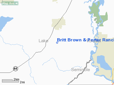
Britt Brown & Porter Ranch Airport |
Location
& QuickFacts
|
FAA
Information Effective: |
2006-09-28 |
|
Airport
Identifier: |
6FD6 |
|
Longitude/Latitude: |
081-25-59.2440W/28-54-17.9590N
-81.433123/28.904989 (Estimated) |
|
Elevation: |
167 ft / 50.90 m (Estimated) |
|
Land: |
0 acres |
|
From
nearest city: |
15 nautical miles W of Eustis, FL |
|
Location: |
Lake County, FL |
|
Magnetic Variation: |
03W (1985) |
Owner
& Manager
|
Ownership: |
Privately owned |
|
Owner: |
Robert Brown |
|
Address: |
1219 Kelso Blvd
Winter Garden, FL 32787 |
|
Phone number: |
305-656-1504 |
|
Address: |
|
Airport Operations and Facilities
|
Airport
Use: |
Private |
|
Segmented
Circle: |
No |
|
Control
Tower: |
No |
|
Attendance
Schedule: |
UNATNDD |
|
Sectional
chart: |
Jacksonville |
|
Region: |
ASO - Southern |
|
Boundary
ARTCC: |
ZJX - Jacksonville |
|
Tie-in
FSS: |
GNV - Gainesville |
|
FSS
Phone: |
850-377-3291 |
|
FSS
Toll Free: |
1-800-WX-BRIEF |
|
Runway Information
Runway 17/35
|
Dimension: |
2500 x 50 ft / 762.0 x 15.2 m |
|
Surface: |
TURF, |
|
|
Runway 17 |
Runway 35 |
|
Traffic
Pattern: |
Left |
Left |
|
Radio Navigation
Aids
|
ID |
Type |
Name |
Ch |
Freq |
Var |
Dist |
|
SFB |
NDB |
Sanford |
|
408.00 |
05W |
12.3 nm |
|
DED |
NDB |
Deland/dcmsnd |
|
201.00 |
05W |
12.9 nm |
|
LEE |
NDB |
Leesburg |
|
335.00 |
04W |
20.4 nm |
|
EVB |
NDB |
New Smyrna Beach |
|
417.00 |
04W |
27.4 nm |
|
ISM |
NDB |
Kissimmee |
|
329.00 |
05W |
37.0 nm |
|
GGL |
NDB |
Geiger Lake |
|
375.00 |
05W |
37.5 nm |
|
IAK |
NDB |
Palatka |
|
243.00 |
05W |
49.1 nm |
|
TTS |
TACAN |
Kennedy Space Center |
059Y |
|
00E |
42.3 nm |
|
ORL |
VORTAC |
Orlando |
059X |
112.20 |
00E |
22.4 nm |
|
OMN |
VORTAC |
Ormond Beach |
073X |
112.60 |
00E |
29.3 nm |
|
OCF |
VORTAC |
Ocala |
084X |
113.70 |
00E |
44.8 nm |
|
DAB |
VOT |
Daytona Beach |
|
111.00 |
|
25.9 nm |
Remarks
Britt Brown & Porter Ranch Airport
Address:
Lake County, FL
Tel:
305-656-1504
Images
and information placed above are from
http://www.airport-data.com/airport/6FD6/
We
thank them for the data!
| General
Info |
| Country |
United
States |
| State |
FLORIDA
|
| FAA ID |
6FD6
|
| Latitude |
28-54-17.959N
|
| Longitude |
081-25-59.244W
|
| Elevation |
167 feet
|
| Near City |
EUSTIS
|
We don't guarantee the information is fresh and accurate. The data may
be wrong or outdated.
For more up-to-date information please refer to other sources.
|
|


