 |
|
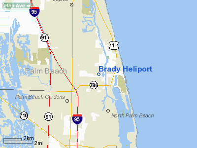
Location
& QuickFacts
|
FAA
Information Effective: |
2006-09-28 |
|
Airport
Identifier: |
2FL4 |
|
Longitude/Latitude: |
080-04-29.0000W/26-51-21.0000N
-80.074722/26.855833 (Estimated) |
|
Elevation: |
4 ft / 1.22 m (Estimated) |
|
Land: |
0 acres |
|
From
nearest city: |
3 nautical miles SW of Juna Beach, FL |
|
Location: |
Palm Beach County, FL |
|
Magnetic Variation: |
05W (1995) |
Owner
& Manager
|
Ownership: |
Privately owned |
|
Owner: |
David Brady |
|
Address: |
2106 Pleasant Drive
North Palm Beach, FL 33408 |
|
Phone
number: |
561-622-5641 |
|
Manager: |
David Brady |
|
Address: |
2106 Pleasant Drive
North Palm Beach, FL 33408 |
|
Phone number: |
561-622-5641 |
Airport
Operations and Facilities
|
Airport
Use: |
Private |
|
Segmented
Circle: |
No |
|
Control
Tower: |
No |
|
Attendance
Schedule: |
ALL/ALL/ALL |
|
Sectional
chart: |
Miami |
|
Region: |
ASO - Southern |
|
Boundary
ARTCC: |
ZMA - Miami |
|
Tie-in
FSS: |
MIA - Miami |
|
FSS
Phone: |
305-233-2600 |
|
FSS
Toll Free: |
1-800-WX-BRIEF |
|
Runway Information
Helipad H1
|
Dimension: |
20
x 20 ft / 6.1 x 6.1 m |
|
Surface: |
TURF, |
|
|
Runway H1 |
Runway |
|
Traffic
Pattern: |
Left |
Left |
|
Radio Navigation
Aids
|
ID |
Type |
Name |
Ch |
Freq |
Var |
Dist |
|
PB |
NDB |
Rubin |
|
356.00 |
03W |
12.4 nm |
|
UTX |
NDB |
United |
|
405.00 |
03W |
14.3 nm |
|
FPR |
NDB |
Fort Pierce |
|
275.00 |
04W |
41.1 nm |
|
FX |
NDB |
Praiz |
|
221.00 |
02W |
42.0 nm |
|
PJN |
NDB |
Plantation |
|
242.00 |
03W |
44.2 nm |
|
FLL |
VOR/DME |
Fort Lauderdale |
091X |
114.40 |
00E |
47.1 nm |
|
PBI |
VORTAC |
Palm Beach |
104X |
115.70 |
03W |
10.6 nm |
|
PHK |
VORTAC |
Pahokee |
101X |
115.40 |
00E |
33.4 nm |
|
PBI |
VOT |
Palm Beach |
|
109.00 |
|
10.3 nm |
Remarks
- 20
FT TREE 150 FT EAST OF HELIPAD.
- SEE
AIRSPACE CASE 98-ORL-127-NRA.
Brady Heliport
Address:
Palm Beach County, FL
Tel:
561-622-5641
Images
and information placed above are from
http://www.airport-data.com/airport/2FL4/
We
thank them for the data!
| General
Info |
| Country |
United
States |
| State |
FLORIDA
|
| FAA ID |
2FL4
|
| Latitude |
26-51-21.000N
|
| Longitude |
080-04-29.000W
|
| Elevation |
4 feet
|
| Near City |
JUNA BEACH
|
We don't guarantee the information is fresh and accurate. The data may
be wrong or outdated.
For more up-to-date information please refer to other sources.
|
|


