 |
|
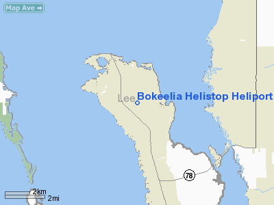
Bokeelia Helistop Heliport |
Location
& QuickFacts
|
FAA
Information Effective: |
2006-09-28 |
|
Airport
Identifier: |
5FD8 |
|
Longitude/Latitude: |
082-08-09.3320W/26-40-14.2600N
-82.135926/26.670628 (Estimated) |
|
Elevation: |
10 ft / 3.05 m (Estimated) |
|
Land: |
0 acres |
|
From
nearest city: |
6 nautical miles E of Cape Coral, FL |
|
Location: |
Lee County, FL |
|
Magnetic Variation: |
02W (1985) |
Owner
& Manager
|
Ownership: |
Publicly owned |
|
Owner: |
Lee Co Mosquito Control Dist |
|
Address: |
Po Box 06005
Fort Myers, FL 33906 |
|
Phone
number: |
813-694-2174 |
|
Manager: |
Lee Co Mosquito Control Dist |
|
Address: |
Po Box 06005
Fort Myers, FL 33906 |
|
Phone number: |
813-694-2174 |
Airport
Operations and Facilities
|
Airport
Use: |
Private |
|
Segmented
Circle: |
No |
|
Control
Tower: |
No |
|
Attendance
Schedule: |
UNATNDD |
|
Sectional
chart: |
Miami |
|
Region: |
ASO - Southern |
|
Boundary
ARTCC: |
ZMA - Miami |
|
Tie-in
FSS: |
MIA - Miami |
|
FSS
Phone: |
305-233-2600 |
|
FSS
Toll Free: |
1-800-WX-BRIEF |
|
Runway Information
Helipad H1
|
Dimension: |
118 x 118 ft / 36.0 x 36.0 m |
|
Surface: |
TURF, |
|
|
Runway H1 |
Runway |
|
Traffic
Pattern: |
Left |
Left |
|
Radio Navigation
Aids
|
ID |
Type |
Name |
Ch |
Freq |
Var |
Dist |
|
VNC |
NDB |
Venice |
|
206.00 |
02W |
28.3 nm |
|
APF |
NDB |
Naples |
|
201.00 |
03W |
36.6 nm |
|
PGD |
VOR |
Punta Gorda |
|
110.20 |
03W |
16.7 nm |
|
CYY |
VOR/DME |
Cypress |
023X |
108.60 |
03W |
36.6 nm |
|
RSW |
VORTAC |
Lee County |
055X |
111.80 |
02W |
21.1 nm |
|
LBV |
VORTAC |
La Belle |
041X |
110.40 |
01E |
41.1 nm |
|
SRQ |
VORTAC |
Sarasota |
099X |
115.20 |
02W |
49.1 nm |
Remarks
- PRVD
VFR/PVT USE; & INGRESS/EGRESS ROUTES LIMITED TO AN EAST/WEST DIRECTION.
Bokeelia Helistop Heliport
Address:
Lee County, FL
Tel:
813-694-2174
Images
and information placed above are from
http://www.airport-data.com/airport/5FD8/
We
thank them for the data!
| General
Info |
| Country |
United
States |
| State |
FLORIDA
|
| FAA ID |
5FD8
|
| Latitude |
26-40-14.260N
|
| Longitude |
082-08-09.332W
|
| Elevation |
10 feet
|
| Near City |
CAPE CORAL
|
We don't guarantee the information is fresh and accurate. The data may
be wrong or outdated.
For more up-to-date information please refer to other sources.
|
|


