 |
|
Location
& QuickFacts
|
FAA
Information Effective: |
2006-09-28 |
|
Airport
Identifier: |
38FA |
|
Longitude/Latitude: |
083-14-59.5150W/30-29-00.7660N
-83.249865/30.483546 (Estimated) |
|
Elevation: |
95 ft / 28.96 m (Estimated) |
|
Land: |
5 acres |
|
From
nearest city: |
3 nautical miles S of Madison, FL |
|
Location: |
Madison County, FL |
|
Magnetic Variation: |
02W (1980) |
Owner
& Manager
|
Ownership: |
Privately owned |
|
Owner: |
Blue Springs Prop Owners Assn |
|
Address: |
Po Box 1776
Gainesville, FL 32602 |
|
Phone number: |
352-334-1976 |
|
Address: |
|
Airport
Operations and Facilities
|
Airport
Use: |
Private |
|
Wind
indicator: |
Yes |
|
Segmented
Circle: |
No |
|
Control
Tower: |
No |
|
Attendance
Schedule: |
UNATNDD |
|
Sectional
chart: |
Jacksonville |
|
Region: |
ASO - Southern |
|
Boundary
ARTCC: |
ZJX - Jacksonville |
|
Tie-in
FSS: |
GNV - Gainesville |
|
FSS
Phone: |
850-377-3291 |
|
FSS
Toll Free: |
1-800-WX-BRIEF |
|
Runway Information
Runway 18/36
|
Dimension: |
2400 x 50 ft / 731.5 x 15.2 m |
|
Surface: |
TURF, |
|
|
Runway 18 |
Runway 36 |
|
Traffic
Pattern: |
Left |
Left |
|
Displaced
threshold: |
400.00 ft |
0.00
ft |
|
Radio Navigation
Aids
|
ID |
Type |
Name |
Ch |
Freq |
Var |
Dist |
|
FPY |
NDB |
Foley |
|
254.00 |
03W |
34.1 nm |
|
LCQ |
NDB |
Lake City |
|
204.00 |
03W |
39.2 nm |
|
GTP |
NDB |
Patten |
|
245.00 |
02W |
41.2 nm |
|
HOE |
NDB |
Homerville |
|
209.00 |
03W |
42.3 nm |
|
OTK |
VOR/DME |
Valdosta |
095X |
114.80 |
02W |
17.9 nm |
|
MGR |
VOR/DME |
Moultrie |
025X |
108.80 |
02W |
46.0 nm |
|
GEF |
VORTAC |
Greenville |
027X |
109.00 |
01E |
27.9 nm |
|
VAD |
VORTAC |
Moody |
080X |
113.30 |
03W |
28.8 nm |
|
TAY |
VORTAC |
Taylor |
076X |
112.90 |
03W |
36.1 nm |
Remarks
- OWNERS
DESIRE ARPT NOT BE CHARTED.
- NO
TKOF ON RY 18 & NO LNDG ON RY 36.
- PRVDD
VFR PVT USE ONLY.
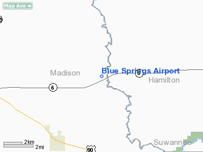
Blue Springs Airport
Address:
Madison County, FL
Tel:
352-334-1976
Images
and information placed above are from
http://www.airport-data.com/airport/38FA/
We
thank them for the data!
| General
Info |
| Country |
United
States |
| State |
FLORIDA
|
| FAA ID |
38FA
|
| Latitude |
30-29-00.766N
|
| Longitude |
083-14-59.515W
|
| Elevation |
95 feet
|
| Near City |
MADISON
|
We don't guarantee the information is fresh and accurate. The data may
be wrong or outdated.
For more up-to-date information please refer to other sources.
|
|


