 |
|
Location
& QuickFacts
|
FAA
Information Effective: |
2006-09-28 |
|
Airport
Identifier: |
6FD5 |
|
Longitude/Latitude: |
081-05-59.2370W/27-46-43.1000N
-81.099788/27.778639 (Estimated) |
|
Elevation: |
65 ft / 19.81 m (Estimated) |
|
Land: |
7 acres |
|
From
nearest city: |
14 nautical miles NW of Yeehaw Junction,
FL |
|
Location: |
Osceola County, FL |
|
Magnetic Variation: |
03W (1990) |
Owner
& Manager
|
Ownership: |
Privately owned |
|
Owner: |
Adams Ranch, Inc |
|
Address: |
Po Box 12909
Ft Pierce, FL 34979-2909 |
|
Phone
number: |
407-461-6321 |
|
Manager: |
Peter Harrison |
|
Address: |
Po Box 12909
Ft Pierce, FL 34979-2909 |
|
Phone number: |
407-461-6321 |
Airport
Operations and Facilities
|
Airport
Use: |
Private |
|
Wind
indicator: |
Yes |
|
Segmented
Circle: |
No |
|
Control
Tower: |
No |
|
Attendance
Schedule: |
UNATNDD |
|
Sectional
chart: |
Miami |
|
Region: |
ASO - Southern |
|
Boundary
ARTCC: |
ZMA - Miami |
|
Tie-in
FSS: |
PIE - Saint Petersburg |
|
FSS
Toll Free: |
1-800-WX-BRIEF |
|
Runway Information
Runway 10/28
|
Dimension: |
3000 x 80 ft / 914.4 x 24.4 m |
|
Surface: |
TURF, Fair Condition |
|
|
Runway 10 |
Runway 28 |
|
Traffic
Pattern: |
Left |
Left |
|
Displaced
threshold: |
100.00 ft |
100.00 ft |
|
Radio Navigation
Aids
|
ID |
Type |
Name |
Ch |
Freq |
Var |
Dist |
|
SQT |
NDB |
Satellite |
|
257.00 |
03W |
28.6 nm |
|
ISM |
NDB |
Kissimmee |
|
329.00 |
05W |
35.5 nm |
|
VEP |
NDB |
Vero Beach |
|
392.00 |
04W |
36.8 nm |
|
COI |
NDB |
Merritt Island |
|
247.00 |
05W |
40.2 nm |
|
FPR |
NDB |
Fort Pierce |
|
275.00 |
04W |
42.5 nm |
|
CHN |
NDB |
Wauchula |
|
261.00 |
04W |
44.7 nm |
|
COF |
TACAN |
Patrick |
097X |
|
04W |
37.8 nm |
|
MLB |
VOR/DME |
Melbourne |
037X |
110.00 |
02W |
31.5 nm |
|
VRB |
VORTAC |
Vero Beach |
120X |
117.30 |
04W |
33.0 nm |
|
ORL |
VORTAC |
Orlando |
059X |
112.20 |
00E |
47.6 nm |
|
VRB |
VOT |
Vero Beach |
|
111.00 |
|
37.1 nm |
Remarks
- PRVD
LNDG AREA LIMITED TO PVT USE; ALL OPNS CONDUCTED IN VFR WX CONDITIONS.
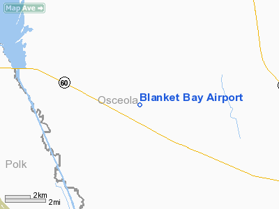
Blanket Bay Airport
Address:
Osceola County, FL
Tel:
407-461-6321
Images
and information placed above are from
http://www.airport-data.com/airport/6FD5/
We
thank them for the data!
| General
Info |
| Country |
United
States |
| State |
FLORIDA
|
| FAA ID |
6FD5
|
| Latitude |
27-46-43.100N
|
| Longitude |
081-05-59.237W
|
| Elevation |
65 feet
|
| Near City |
YEEHAW
JUNCTION |
We don't guarantee the information is fresh and accurate. The data may
be wrong or outdated.
For more up-to-date information please refer to other sources.
|
|


