 |
|
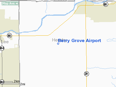
Location
& QuickFacts
|
FAA
Information Effective: |
2006-09-28 |
|
Airport
Identifier: |
7FA8 |
|
Longitude/Latitude: |
081-29-26.2780W/26-41-44.2450N
-81.490633/26.695624 (Estimated) |
|
Elevation: |
28 ft / 8.53 m (Surveyed) |
|
Land: |
0 acres |
|
From
nearest city: |
4 nautical miles SW of La Belle, FL |
|
Location: |
Hendry County, FL |
|
Magnetic Variation: |
02W (1985) |
Owner
& Manager
|
Ownership: |
Privately owned |
|
Owner: |
Berry Groves |
|
Address: |
Po Box 459
Labelle, FL 33935 |
|
Phone
number: |
813-675-6769 |
|
Manager: |
Jim Cloughley |
|
Address: |
Po Box 459
Labelle, FL 33935 |
|
Phone number: |
813-675-6769 |
Airport
Operations and Facilities
|
Airport Use: |
Private |
|
Wind indicator: |
No |
|
Segmented Circle: |
No |
|
Control Tower: |
No |
|
Attendance Schedule: |
UNATNDD |
|
Landing fee charge: |
No |
|
Sectional chart: |
Miami |
|
Region: |
ASO - Southern |
|
Boundary ARTCC: |
ZMA - Miami |
|
Tie-in FSS: |
MIA - Miami |
|
FSS on Airport: |
No |
|
FSS Phone: |
305-233-2600 |
|
FSS Toll Free: |
1-800-WX-BRIEF |
Airport
Services
|
Airframe
Repair: |
NONE |
|
Power
Plant Repair: |
NONE |
|
Runway Information
Runway 18/36
|
Dimension: |
4642 x 85 ft / 1414.9 x 25.9 m |
|
Surface: |
TURF, |
|
|
Runway 18 |
Runway 36 |
|
Traffic
Pattern: |
Left |
Left |
|
Helipad H1
|
Dimension: |
180 x 90 ft / 54.9 x 27.4 m |
|
Surface: |
CONC, |
|
|
Runway H1 |
Runway |
|
Traffic
Pattern: |
Left |
Left |
|
Radio Navigation
Aids
|
ID |
Type |
Name |
Ch |
Freq |
Var |
Dist |
|
APF |
NDB |
Naples |
|
201.00 |
03W |
35.9 nm |
|
PGD |
VOR |
Punta Gorda |
|
110.20 |
03W |
30.0 nm |
|
CYY |
VOR/DME |
Cypress |
023X |
108.60 |
03W |
36.1 nm |
|
LBV |
VORTAC |
La Belle |
041X |
110.40 |
01E |
9.6 nm |
|
RSW |
VORTAC |
Lee County |
055X |
111.80 |
02W |
18.3 nm |
|
PHK |
VORTAC |
Pahokee |
101X |
115.40 |
00E |
43.2 nm |
Remarks
- NO
FORM SUBMITTED PRIOR TO CONSTR,SUBMITTED FOR RECORD PURPOSES.
Berry Grove Airport
Address:
Hendry County, FL
Tel:
813-675-6769
Images
and information placed above are from
http://www.airport-data.com/airport/7FA8/
We
thank them for the data!
| General
Info |
| Country |
United
States |
| State |
FLORIDA
|
| FAA ID |
7FA8
|
| Latitude |
26-41-44.245N
|
| Longitude |
081-29-26.278W
|
| Elevation |
28 feet
|
| Near City |
LA BELLE
|
We don't guarantee the information is fresh and accurate. The data may
be wrong or outdated.
For more up-to-date information please refer to other sources.
|
|


