 |
|
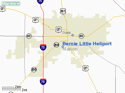
Location
& QuickFacts
|
FAA
Information Effective: |
2006-09-28 |
|
Airport
Identifier: |
FL49 |
|
Longitude/Latitude: |
082-08-58.3300W/29-10-10.9100N
-82.149536/29.169697 (Estimated) |
|
Elevation: |
90 ft / 27.43 m (Estimated) |
|
Land: |
0 acres |
|
From
nearest city: |
1 nautical miles NE of Ocala, FL |
|
Location: |
Marion County, FL |
|
Magnetic Variation: |
04W (2000) |
Owner
& Manager
|
Ownership: |
Privately owned |
|
Owner: |
Bernie Little Distributing |
|
Address: |
1314 Sw 17th Street
Ocala, FL 34474 |
|
Phone
number: |
352-401-0993 |
|
Manager: |
Bernie Little |
|
Address: |
1314 Sw 17th Street
Ocala, FL 34474 |
|
Phone number: |
352-401-0993 |
Airport
Operations and Facilities
|
Airport
Use: |
Private |
|
Wind
indicator: |
Yes |
|
Segmented
Circle: |
No |
|
Control
Tower: |
No |
|
Attendance
Schedule: |
ALL/ALL/DALGT |
|
Sectional
chart: |
Jacksonville |
|
Region: |
ASO - Southern |
|
Boundary
ARTCC: |
ZJX - Jacksonville |
|
Tie-in
FSS: |
GNV - Gainesville |
|
FSS
Phone: |
850-377-3291 |
|
FSS
Toll Free: |
1-800-WX-BRIEF |
|
Runway Information
Helipad H1
|
Dimension: |
40 x 40 ft / 12.2 x 12.2 m |
|
Surface: |
TURF, |
|
|
Runway H1 |
Runway |
|
Traffic
Pattern: |
Left |
Left |
|
Radio Navigation
Aids
|
ID |
Type |
Name |
Ch |
Freq |
Var |
Dist |
|
LEE |
NDB |
Leesburg |
|
335.00 |
04W |
27.8 nm |
|
GN |
NDB |
Wynds |
|
269.00 |
04W |
30.1 nm |
|
IAK |
NDB |
Palatka |
|
243.00 |
05W |
34.0 nm |
|
DED |
NDB |
Deland/dcmsnd |
|
201.00 |
05W |
46.4 nm |
|
OCF |
VORTAC |
Ocala |
084X |
113.70 |
00E |
4.1 nm |
|
GNV |
VORTAC |
Gators |
109X |
116.20 |
04W |
32.1 nm |
Remarks
- PRVDD
VFR OPNS, PVT USE, ALL APCH/DEP FROM 090-091 DEGS & FROM 270-271
DEGS, AREA MKD, WIND INDICATOR MAINTAINED.
Based Aircraft
|
Aircraft
based on field: |
2 |
|
Helicopters: |
2 |
Bernie Little Heliport
Address:
Marion County, FL
Tel:
352-401-0993
Images
and information placed above are from
http://www.airport-data.com/airport/FL49/
We
thank them for the data!
| General
Info |
| Country |
United
States |
| State |
FLORIDA
|
| FAA ID |
FL49
|
| Latitude |
29-10-10.910N
|
| Longitude |
082-08-58.330W
|
| Elevation |
90 feet
|
| Near City |
OCALA
|
We don't guarantee the information is fresh and accurate. The data may
be wrong or outdated.
For more up-to-date information please refer to other sources.
|
|


