 |
|
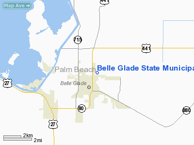
Belle Glade State Municipal Airport |
Coordinates: 26°41′53.9″N 080°39′38.9″W / 26.698306°N 80.660806°W / 26.698306; -80.660806
| Belle Glade State Municipal Airport |
| IATA: none – ICAO: none – FAA LID: X10 |
| Summary |
| Airport type |
Public use |
| Owner |
State of Florida |
| Operator |
Kenny Throup |
| Serves |
Belle Glade, Florida |
| Location |
Palm Beach County, Florida |
| Elevation AMSL |
14 ft / 4 m |
| Runways |
| Direction |
Length |
Surface |
| ft |
m |
| 09/27 |
3,750 |
1,143 |
Asphalt |
| Statistics (1999) |
| Aircraft operations |
1,800 |
| Based aircraft |
13 |
| Source: Federal Aviation Administration |
Belle Glade State Municipal Airport (FAA LID: X10) is a public-use airport located 1 mile (1.6 km) northeast of the central business district of the city of Belle Glade in Palm Beach County, Florida, United States. The airport is publicly owned.
The above content comes from Wikipedia and is published under free licenses – click here to read more.
Location
& QuickFacts
|
FAA
Information Effective: |
2006-09-28 |
|
Airport
Identifier: |
X10 |
|
Longitude/Latitude: |
080-39-44.2070W/26-42-03.2340N
-80.662280/26.700898 (Estimated) |
|
Elevation: |
14 ft / 4.27 m (Estimated) |
|
Land: |
96 acres |
|
From
nearest city: |
1 nautical miles NE of Belle Glade, FL |
|
Location: |
Palm Beach County, FL |
|
Magnetic Variation: |
03W (1985) |
Owner
& Manager
|
Ownership: |
Publicly owned |
|
Owner: |
State Of Florida |
|
Address: |
605 Suwannee St Ms46
Tallahassee, FL 32399-0450 |
|
Phone
number: |
850-414-4500 |
|
Manager: |
Kenny Throup
ARPT LEASED TO CITY OF BELLE GLADE. |
|
Address: |
Municipal Complex
Belle Glade, FL 33430 |
|
Phone number: |
561-996-0010 |
Airport
Operations and Facilities
|
Airport
Use: |
Open to public |
|
Wind
indicator: |
Yes
WIND SOCK TORN OFF |
|
Segmented
Circle: |
No |
|
Control
Tower: |
No |
|
Attendance
Schedule: |
UNATNDD |
|
Landing
fee charge: |
No |
|
Sectional
chart: |
Miami |
|
Region: |
ASO - Southern |
|
Boundary
ARTCC: |
ZMA - Miami |
|
Tie-in
FSS: |
MIA - Miami |
|
FSS
on Airport: |
No |
|
FSS
Phone: |
305-233-2600 |
|
FSS
Toll Free: |
1-800-WX-BRIEF |
|
NOTAMs
Facility: |
MIA (NOTAM-d service avaliable) |
|
Federal Agreements: |
N |
Airport
Communications
Airport
Services
|
Airframe
Repair: |
NONE |
|
Power
Plant Repair: |
NONE |
|
Bottled
Oxygen: |
NONE |
|
Bulk
Oxygen: |
NONE |
|
Runway Information
Runway 09/27
|
Dimension: |
3750 x 50 ft / 1143.0 x 15.2 m |
|
Surface: |
ASPH, Poor Condition
RAVELLING; SMALL ROCKS & GRVL ON RY. |
|
|
Runway 09 |
Runway 27 |
|
Traffic
Pattern: |
Left |
Left |
|
Markings: |
Basic, Poor Condition
/27 MKD WITH REFLECTIVE MARKERS ENTIRE LENGTH; MANY REFLECTORS
MISSING; MARKINGS FADED; NO TWY HOLD LINE MARKINGS ON RY 09. |
Basic, Poor Condition |
|
Displaced
threshold: |
225.00 ft |
75.00 ft |
|
Obstruction: |
26 ft pline, 300.0 ft from runway, 3:1 slope
to clear
APCH RATIO 20:1 TO DSPLCD THR. |
54 ft trees, 1155.0 ft from runway, 17:1 slope
to clear
APCH RATIO 22:1 TO DSPLCD THLD. |
|
Radio Navigation
Aids
|
ID |
Type |
Name |
Ch |
Freq |
Var |
Dist |
|
UTX |
NDB |
United |
|
405.00 |
03W |
21.6 nm |
|
PB |
NDB |
Rubin |
|
356.00 |
03W |
24.3 nm |
|
FX |
NDB |
Praiz |
|
221.00 |
02W |
36.6 nm |
|
PJN |
NDB |
Plantation |
|
242.00 |
03W |
41.7 nm |
|
FPR |
NDB |
Fort Pierce |
|
275.00 |
04W |
49.7 nm |
|
FLL |
VOR/DME |
Fort Lauderdale |
091X |
114.40 |
00E |
46.6 nm |
|
PHK |
VORTAC |
Pahokee |
101X |
115.40 |
00E |
5.2 nm |
|
PBI |
VORTAC |
Palm Beach |
104X |
115.70 |
03W |
30.9 nm |
|
LBV |
VORTAC |
La Belle |
041X |
110.40 |
01E |
39.9 nm |
|
PBI |
VOT |
Palm Beach |
|
109.00 |
|
30.0 nm |
Remarks
- RY
09 NIGHT LNDGS NOT ADVISED DUE TO UNLGTD POWER LINES IN APCH.
Based Aircraft
|
Aircraft
based on field: |
11 |
|
Single
Engine Airplanes: |
11 |
Operational Statistics
|
Aircraft
Operations: |
35/Week |
|
General
Aviation Local: |
66.7% |
|
General
Aviation Itinerant: |
33.3% |
Belle Glade State Municipal Airport
Address:
Palm Beach County, FL
Tel:
850-414-4500,
561-996-0010
Images
and information placed above are from
http://www.airport-data.com/airport/X10/
We
thank them for the data!
| General
Info |
| Country |
United
States |
| State |
FLORIDA
|
| FAA ID |
X10
|
| Latitude |
26-42-03.234N
|
| Longitude |
080-39-44.207W
|
| Elevation |
14 feet
|
| Near City |
BELLE
GLADE |
We don't guarantee the information is fresh and accurate. The data may
be wrong or outdated.
For more up-to-date information please refer to other sources.
|
|


