 |
|
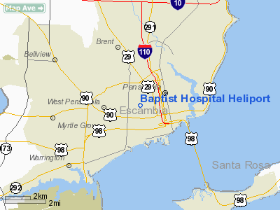
Baptist Hospital Heliport |
|
|
Location
& QuickFacts
|
FAA
Information Effective: |
2006-09-28 |
|
Airport
Identifier: |
FL85 |
|
Longitude/Latitude: |
087-13-51.8950W/30-25-45.7110N
-87.231082/30.429364 (Estimated) |
|
Elevation: |
115 ft / 35.05 m (Estimated) |
|
Land: |
0 acres |
|
From
nearest city: |
0 nautical miles N of Pensacola, FL |
|
Location: |
Escambia County, FL |
|
Magnetic Variation: |
01E (1985) |
Owner
& Manager
|
Ownership: |
Privately owned |
|
Owner: |
Baptist Hospital |
|
Address: |
1000 W Moreno St
Pensacola, FL 32501 |
|
Phone
number: |
850-434-4555 |
|
Manager: |
Bob Murphy |
|
Address: |
1000 W Moreno St
Pensacola, FL 32501 |
|
Phone number: |
850-434-4555 |
Airport
Operations and Facilities
|
Airport Use: |
Private |
|
Wind indicator: |
Yes |
|
Segmented Circle: |
No |
|
Control Tower: |
No |
|
Attendance Schedule: |
ALL/ALL/ALL |
|
Lighting Schedule: |
24 HRS |
|
Beacon Color: |
Clear-Green-Yellow (heliport) |
|
Landing fee charge: |
No |
|
Sectional chart: |
New Orleans |
|
Region: |
ASO - Southern |
|
Boundary ARTCC: |
ZJX - Jacksonville |
|
Tie-in FSS: |
GNV - Gainesville |
|
FSS on Airport: |
No |
|
FSS Phone: |
850-377-3291 |
|
FSS Toll Free: |
1-800-WX-BRIEF |
Airport
Services
|
Airframe
Repair: |
NONE |
|
Power
Plant Repair: |
NONE |
|
Runway Information
Helipad H1
|
Dimension: |
52 x 52 ft / 15.8 x 15.8 m |
|
Surface: |
CONC, |
|
|
Runway H1 |
Runway |
|
Traffic
Pattern: |
Right |
Left |
|
Radio Navigation
Aids
|
ID |
Type |
Name |
Ch |
Freq |
Var |
Dist |
|
PKZ |
NDB |
Pickens |
|
326.00 |
01E |
2.8 nm |
|
ESU |
NDB |
Summerdale |
|
204.00 |
01E |
26.0 nm |
|
DTS |
NDB |
Destin |
|
254.00 |
01W |
39.3 nm |
|
NPA |
TACAN |
Pensacola |
119X |
|
01E |
6.2 nm |
|
NGS |
TACAN |
Santa Rosa |
063X |
|
01E |
18.9 nm |
|
NSE |
TACAN |
Whiting |
070X |
|
01E |
20.9 nm |
|
HRT |
TACAN |
Hurlburt |
045X |
|
00E |
28.0 nm |
|
DWG |
TACAN |
Warrington |
002X |
|
00E |
36.9 nm |
|
NUN |
VOR |
Saufley |
|
108.80 |
01E |
6.0 nm |
|
CEW |
VORTAC |
Crestview |
106X |
115.90 |
03E |
37.2 nm |
|
BFM |
VORTAC |
Brookley |
075X |
112.80 |
04E |
44.1 nm |
Remarks
- PVT/VFR
OPERATION ONLY. HELIPORT AVBL FOR MEDICALLY RELATED OPERATIONS.
Based Aircraft
|
Aircraft
based on field: |
1 |
|
Helicopters: |
1 |
Baptist Hospital Heliport
Address:
Escambia County, FL
Tel:
850-434-4555
Images
and information placed above are from
http://www.airport-data.com/airport/FL85/
We
thank them for the data!
| General
Info |
| Country |
United
States |
| State |
FLORIDA
|
| FAA ID |
FL85
|
| Latitude |
30-25-45.711N
|
| Longitude |
087-13-51.895W
|
| Elevation |
115 feet
|
| Near City |
PENSACOLA
|
We don't guarantee the information is fresh and accurate. The data may
be wrong or outdated.
For more up-to-date information please refer to other sources.
|
|


