 |
|
Location
& QuickFacts
|
FAA
Information Effective: |
2006-09-28 |
|
Airport
Identifier: |
18FL |
|
Longitude/Latitude: |
082-28-31.3410W/27-43-47.1050N
-82.475373/27.729751 (Estimated) |
|
Elevation: |
6 ft / 1.83 m (Estimated) |
|
Land: |
0 acres |
|
From
nearest city: |
3 nautical miles WN of Ruskin, FL |
|
Location: |
Hillsborough County, FL |
|
Magnetic Variation: |
02W (1985) |
Owner
& Manager
|
Ownership: |
Privately owned |
|
Owner: |
Destiny Corp/venture Airways |
|
Address: |
P.o. Box 3984
Orlando, FL 32802-4984 |
|
Phone
number: |
407-896-2176 |
|
Manager: |
Sandy P. Rosell |
|
Address: |
359 N. Crystal Lake Dr
Orlando, FL 32803 |
|
Phone number: |
407-896-2176 |
Airport
Operations and Facilities
|
Airport
Use: |
Private |
|
Wind
indicator: |
Yes |
|
Segmented
Circle: |
No |
|
Control
Tower: |
No |
|
Attendance
Schedule: |
ALL/ALL/ALL |
|
Landing
fee charge: |
No |
|
Sectional
chart: |
Miami |
|
Region: |
ASO - Southern |
|
Boundary
ARTCC: |
ZMA - Miami |
|
Tie-in
FSS: |
PIE - Saint Petersburg |
|
FSS
on Airport: |
No |
|
FSS
Toll Free: |
1-800-WX-BRIEF |
|
Runway Information
Helipad H1
|
Dimension: |
75 x 75 ft / 22.9 x 22.9 m |
|
Surface: |
ASPH, |
|
|
Runway H1 |
Runway |
|
Traffic
Pattern: |
Left |
Left |
|
Radio Navigation
Aids
|
ID |
Type |
Name |
Ch |
Freq |
Var |
Dist |
|
AM |
NDB |
Picny |
|
388.00 |
02W |
8.7 nm |
|
TPF |
NDB |
Knight |
|
270.00 |
02W |
10.8 nm |
|
PCM |
NDB |
Plant City |
|
346.00 |
02W |
23.6 nm |
|
CHN |
NDB |
Wauchula |
|
261.00 |
04W |
34.2 nm |
|
RHZ |
NDB |
Zephyrhills |
|
253.00 |
03W |
34.3 nm |
|
VNC |
NDB |
Venice |
|
206.00 |
02W |
40.2 nm |
|
MCF |
TACAN |
Macdill |
047X |
|
04W |
8.2 nm |
|
PIE |
VORTAC |
St Petersburg |
111X |
116.40 |
01E |
15.4 nm |
|
SRQ |
VORTAC |
Sarasota |
099X |
115.20 |
02W |
20.4 nm |
|
LAL |
VORTAC |
Lakeland |
107X |
116.00 |
01E |
29.0 nm |
|
TPA |
VOT |
Tampa Intl |
|
111.00 |
|
15.0 nm |
Remarks
- VFR;
PVT USE. COORDINATE USE OF HELI WITH ST PETERSBURG FSDO.
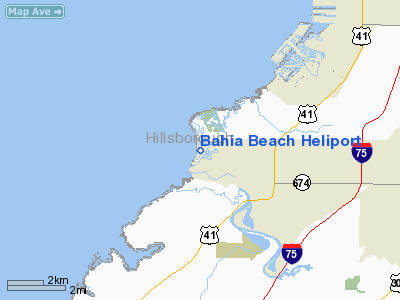
Bahia Beach Heliport
Address:
Hillsborough County, FL
Tel:
407-896-2176
Images
and information placed above are from
http://www.airport-data.com/airport/18FL/
We
thank them for the data!
| General
Info |
| Country |
United
States |
| State |
FLORIDA
|
| FAA ID |
18FL
|
| Latitude |
27-43-47.105N
|
| Longitude |
082-28-31.341W
|
| Elevation |
6 feet
|
| Near City |
RUSKIN
|
We don't guarantee the information is fresh and accurate. The data may
be wrong or outdated.
For more up-to-date information please refer to other sources.
|
|


