 |
|
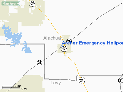
Archer Emergency Heliport |
Location
& QuickFacts
|
FAA
Information Effective: |
2006-09-28 |
|
Airport
Identifier: |
FA57 |
|
Longitude/Latitude: |
082-31-28.0000W/29-32-03.0000N
-82.524444/29.534167 (Estimated) |
|
Elevation: |
82 ft / 24.99 m (Estimated) |
|
Land: |
0 acres |
|
From
nearest city: |
0 nautical miles W of Archer, FL |
|
Location: |
Alachua County, FL |
|
Magnetic Variation: |
04W (2000) |
Owner
& Manager
|
Ownership: |
Privately owned |
|
Owner: |
City Of Archer |
|
Address: |
Po Box 39
Archer, FL 32618 |
|
Phone number: |
352-495-2880 |
|
Manager: |
Bruce Pagel |
|
Address: |
Po Box 39
Archer, FL 32618 |
|
Phone number: |
352-495-2880 |
Airport
Operations and Facilities
|
Airport
Use: |
Private |
|
Segmented
Circle: |
No |
|
Control
Tower: |
No |
|
Attendance
Schedule: |
UNATNDD |
|
Lighting
Schedule: |
PHONE REQ
FOR PERIMETER LGTS CALL 352-495-2880. |
|
Sectional
chart: |
Jacksonville |
|
Region: |
ASO - Southern |
|
Boundary
ARTCC: |
ZJX - Jacksonville |
|
Responsible
ARTCC: |
ZJX - Jacksonville |
|
Tie-in
FSS: |
GNV - Gainesville |
|
FSS
Phone: |
850-377-3291 |
|
FSS
Toll Free: |
1-800-WX-BRIEF |
|
Runway Information
Helipad H1
|
Dimension: |
40 x 40 ft / 12.2 x 12.2 m |
|
Surface: |
ASPH, |
|
|
Runway H1 |
Runway |
|
Traffic
Pattern: |
Left |
Left |
|
Radio Navigation
Aids
|
ID |
Type |
Name |
Ch |
Freq |
Var |
Dist |
|
GN |
NDB |
Wynds |
|
269.00 |
04W |
20.1 nm |
|
IAK |
NDB |
Palatka |
|
243.00 |
05W |
37.9 nm |
|
LCQ |
NDB |
Lake City |
|
204.00 |
03W |
39.2 nm |
|
GNV |
VORTAC |
Gators |
109X |
116.20 |
04W |
16.2 nm |
|
OCF |
VORTAC |
Ocala |
084X |
113.70 |
00E |
26.5 nm |
|
CTY |
VORTAC |
Cross City |
057X |
112.00 |
02W |
27.7 nm |
Remarks
- PROVIDED
VFR OPNS; PRIVATE USE; APCH/DEP FROM 350 TO 010 AND FROM 170 TO 190;
AREA IS MARKED; AND WIND INDICATOR IS MAINTAINED.
Archer Emergency Heliport
Address:
Alachua County, FL
Tel:
352-495-2880
Images
and information placed above are from
http://www.airport-data.com/airport/FA57/
We
thank them for the data!
| General
Info |
| Country |
United
States |
| State |
FLORIDA
|
| FAA ID |
FA57
|
| Latitude |
29-32-03.000N
|
| Longitude |
082-31-28.000W
|
| Elevation |
82 feet
|
| Near City |
ARCHER
|
We don't guarantee the information is fresh and accurate. The data may
be wrong or outdated.
For more up-to-date information please refer to other sources.
|
|


