 |
|
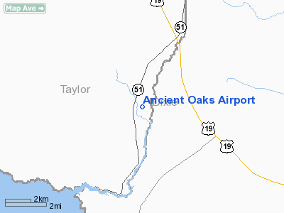
Location
& QuickFacts
|
FAA
Information Effective: |
2006-09-28 |
|
Airport
Identifier: |
39FD |
|
Longitude/Latitude: |
083-21-12.4950W/29-43-45.8100N
-83.353471/29.729392 (Estimated) |
|
Elevation: |
26 ft / 7.92 m (Estimated) |
|
Land: |
0 acres |
|
From
nearest city: |
3 nautical miles NE of Steinhatchee, FL |
|
Location: |
Taylor County, FL |
|
Magnetic Variation: |
02W (1985) |
Owner
& Manager
|
Ownership: |
Privately
owned |
|
Owner: |
Ancient Oaks Property Owners Assn |
|
Address: |
Po Box 279
Steinhatchee, FL 32359 |
|
Phone
number: |
904-498-5666 |
|
Manager: |
C. Chancey, Sec. |
|
Address: |
P.o. Box 279
Steinhatchee, FL 32359 |
|
Phone number: |
352-498-7142 |
Airport Operations and Facilities
|
Airport
Use: |
Private |
|
Segmented Circle: |
No |
|
Control
Tower: |
No |
|
Attendance Schedule: |
UNATNDD |
|
Sectional chart: |
Jacksonville |
|
Region: |
ASO - Southern |
|
Boundary
ARTCC: |
ZJX - Jacksonville |
|
Tie-in
FSS: |
GNV - Gainesville |
|
FSS
Phone: |
850-377-3291 |
|
FSS
Toll Free: |
1-800-WX-BRIEF |
|
Runway Information
Runway 18/36
|
Dimension: |
3100
x 50 ft / 944.9 x 15.2 m |
|
Surface: |
TURF, |
|
|
Runway 18 |
Runway 36 |
|
Traffic
Pattern: |
Left |
Left |
|
Radio Navigation
Aids
|
ID |
Type |
Name |
Ch |
Freq |
Var |
Dist |
|
FPY |
NDB |
Foley |
|
254.00 |
03W |
20.1 nm |
|
LCQ |
NDB |
Lake City |
|
204.00 |
03W |
48.8 nm |
|
CTY |
VORTAC |
Cross City |
057X |
112.00 |
02W |
17.7 nm |
Remarks
- WILDLIFE
ON RY.
- TREE
OBST NORTH & SOUTH APCHS.
- PRVD
VFR/PVT USE; & CAUTION IS USED SINCE HIGH SPEED MILITARY ACFT WILL
BE TRAVERSING S TO N ALONG MILITARY TRNG ROUTES AT ALTITUDES OF 1500'
& BELOW APPROX 3NM W OF ARPT.
Based Aircraft
|
Aircraft
based on field: |
3 |
|
Single
Engine Airplanes: |
2 |
|
Helicopters: |
1 |
Ancient Oaks Airport
Address:
Taylor County, FL
Tel:
904-498-5666,
352-498-7142
Images
and information placed above are from
http://www.airport-data.com/airport/39FD/
We
thank them for the data!
| General
Info |
| Country |
United
States |
| State |
FLORIDA
|
| FAA ID |
39FD |
| Latitude |
29-43-45.810N
|
| Longitude |
083-21-12.495W
|
| Elevation |
26 feet
|
| Near City |
STEINHATCHEE
|
We don't guarantee the information is fresh and accurate. The data may
be wrong or outdated.
For more up-to-date information please refer to other sources.
|
|


