|
|
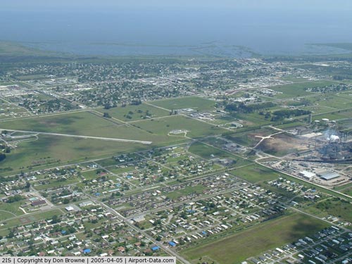
| Airglades Airport |
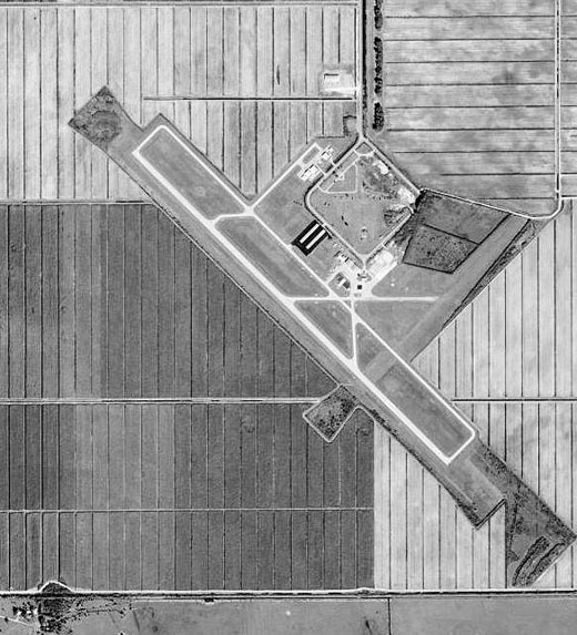 |
| 1999 USGS photo |
| IATA: none – ICAO: none – FAA LID: 2IS |
| Summary |
| Airport type |
Public use |
| Owner |
Hendry County |
| Serves |
Clewiston, Florida |
| Elevation AMSL |
20 ft / 6 m |
| Coordinates |
26°44′06″N 081°03′04″W / 26.735°N 81.05111°W / 26.735; -81.05111 |
| Runways |
| Direction |
Length |
Surface |
| ft |
m |
| 13/31 |
5,950 |
1,814 |
Asphalt |
| Statistics (2002) |
| Aircraft operations |
11,532 |
| Based aircraft |
21 |
| Source: Federal Aviation Administration |
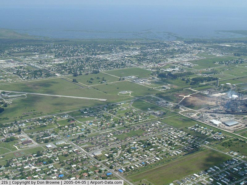
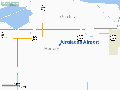
Airglades Airport (FAA LID: 2IS) is a county-owned public-use airport in Hendry County, Florida, United States. It is located 5 miles (8.0 km) west of the central business district of Clewiston, Florida. History
Established as Riddle Field on 12 November 1942 by the United States Army Air Force. Assigned to USAAF Southeast Training Center (later Southeast Flying Training Command). Conducted contract basic flying training by Riddle-McKay Aero College. Fairchild PT-19s were the primary trainer used. Also had several PT-17 Stearmans and a few P-40 Warhawks assigned.
Inactivated 31 December 1945 with the drawdown of AAFTC's pilot training program and was declared surplus in 1946. Responsibility for it was given to the War Assets Administration and was eventually acquired by Hendry County.
The above content comes from Wikipedia and is published under free licenses – click here to read more.
|
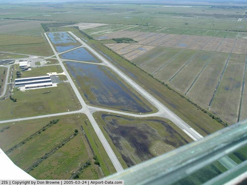 |
(Click on the photo to enlarge) |
|
 |
(Click on the photo to enlarge) |
Location
& QuickFacts
|
FAA
Information Effective: |
2006-09-28 |
|
Airport
Identifier: |
2IS |
|
Longitude/Latitude: |
081-02-59.2410W/26-44-31.2350N
-81.049789/26.742010 (Estimated) |
|
Elevation: |
20 ft / 6.10 m (Estimated) |
|
Land: |
2560 acres |
|
From
nearest city: |
5 nautical miles W of Clewiston, FL |
|
Location: |
Hendry County, FL |
|
Magnetic Variation: |
03W (1985) |
Owner
& Manager
|
Ownership: |
Publicly owned |
|
Owner: |
Hendry County |
|
Address: |
Court House
Labelle, FL 33935 |
|
Phone number: |
863-675-5217 |
|
Manager: |
Caleb Esmiol |
|
Address: |
Po Box 787
Clewiston, FL 33440 |
|
Phone number: |
863-983-6151 |
Airport
Operations and Facilities
|
Airport
Use: |
Open to public |
|
Wind
indicator: |
Yes |
|
Segmented
Circle: |
Yes |
|
Control
Tower: |
No |
|
Attendance
Schedule: |
ALL/ALL/ALL |
|
Lighting
Schedule: |
DUSK-DAWN
ACTVT MIRL RY 13/31 - CTAF. PAPI RYS 13 & 31 OPER CONT. |
|
Beacon
Color: |
Clear-Green (lighted land airport) |
|
Landing
fee charge: |
No |
|
Sectional
chart: |
Miami |
|
Region: |
ASO - Southern |
|
Boundary
ARTCC: |
ZMA - Miami |
|
Tie-in
FSS: |
MIA - Miami |
|
FSS
on Airport: |
No |
|
FSS
Phone: |
305-233-2600 |
|
FSS
Toll Free: |
1-800-WX-BRIEF |
|
NOTAMs
Facility: |
MIA (NOTAM-d service avaliable) |
|
Federal Agreements: |
NGPY |
Airport
Communications
|
CTAF: |
123.050 |
|
Unicom: |
123.050 |
Airport
Services
|
Fuel
available: |
100LLA |
|
Airframe
Repair: |
MINOR |
|
Power
Plant Repair: |
MINOR |
|
Bottled
Oxygen: |
NONE |
|
Bulk
Oxygen: |
NONE |
|
Runway Information
Runway 13/31
|
Dimension: |
5950 x 75 ft / 1813.6 x 22.9 m |
|
Surface: |
ASPH, Good Condition |
|
Weight
Limit: |
Single wheel: 12500 lbs. |
|
Edge
Lights: |
Medium |
|
|
Runway 13 |
Runway 31 |
|
Traffic
Pattern: |
Right |
Left |
|
Markings: |
Non-precision instrument, Fair Condition
RY 13/31 MARKINGS FADED. |
Non-precision instrument, Fair Condition |
|
Crossing
Height: |
35.00 ft |
35.00 ft |
|
VASI: |
2-light PAPI on left side |
2-light PAPI on left side |
|
Visual
Glide Angle: |
3.00� |
3.00� |
|
Radio Navigation
Aids
|
ID |
Type |
Name |
Ch |
Freq |
Var |
Dist |
|
UTX |
NDB |
United |
|
405.00 |
03W |
39.6 nm |
|
PB |
NDB |
Rubin |
|
356.00 |
03W |
45.2 nm |
|
LBV |
VORTAC |
La Belle |
041X |
110.40 |
01E |
19.1 nm |
|
PHK |
VORTAC |
Pahokee |
101X |
115.40 |
00E |
19.4 nm |
|
RSW |
VORTAC |
Lee County |
055X |
111.80 |
02W |
41.0 nm |
Remarks
Based Aircraft
|
Aircraft
based on field: |
29 |
|
Single
Engine Airplanes: |
20 |
|
Jet Engine
Airplanes: |
2 |
|
Helicopters: |
2 |
|
Ultralights: |
5 |
Operational Statistics
|
Aircraft
Operations: |
222/Week |
|
General
Aviation Local: |
59.9% |
|
General
Aviation Itinerant: |
39.9% |
|
Military: |
0.2% |
Airglades Airport
Address:
Hendry County, FL
Tel:
863-675-5217, 863-983-6151
Images
and information placed above are from
http://www.airport-data.com/airport/2IS/
We
thank them for the data!
| General
Info |
| Country |
United
States |
| State |
FLORIDA
|
| FAA ID |
2IS
|
| Latitude |
26-44-31.235N
|
| Longitude |
081-02-59.241W
|
| Elevation |
20 feet
|
| Near City |
CLEWISTON
|
We don't guarantee the information is fresh and accurate. The data may
be wrong or outdated.
For more up-to-date information please refer to other sources.
|
|