 |
|
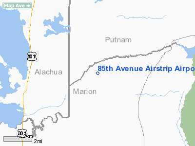
85th Avenue Airstrip Airport |
Location
& QuickFacts
|
FAA
Information Effective: |
2006-09-28 |
|
Airport
Identifier: |
FD02 |
|
Longitude/Latitude: |
082-01-19.3260W/29-29-05.8950N
-82.022035/29.484971 (Estimated) |
|
Elevation: |
80 ft / 24.38 m (Estimated) |
|
Land: |
0 acres |
|
From
nearest city: |
0 nautical miles N of Orange Springs, FL |
|
Location: |
Marion County, FL |
|
Magnetic Variation: |
03W (1985) |
Owner
& Manager
|
Ownership: |
Privately owned |
|
Owner: |
Edward A. Hunold |
|
Address: |
Po Box 130
Menominee, MI 49858 |
|
Address: |
|
Airport
Operations and Facilities
|
Airport
Use: |
Private |
|
Wind
indicator: |
Yes |
|
Segmented
Circle: |
No |
|
Control
Tower: |
No |
|
Attendance
Schedule: |
UNATNDD |
|
Landing
fee charge: |
No |
|
Sectional
chart: |
Jacksonville |
|
Region: |
ASO - Southern |
|
Boundary
ARTCC: |
ZJX - Jacksonville |
|
Tie-in
FSS: |
GNV - Gainesville |
|
FSS
on Airport: |
No |
|
FSS
Phone: |
850-377-3291 |
|
FSS
Toll Free: |
1-800-WX-BRIEF |
|
Runway Information
Runway 16/34
|
Dimension: |
3000 x 130 ft / 914.4 x 39.6 m |
|
Surface: |
TURF, |
|
|
Runway 16 |
Runway 34 |
|
Traffic
Pattern: |
Left |
Left |
|
Radio Navigation
Aids
|
ID |
Type |
Name |
Ch |
Freq |
Var |
Dist |
|
GN |
NDB |
Wynds |
|
269.00 |
04W |
13.6 nm |
|
IAK |
NDB |
Palatka |
|
243.00 |
05W |
14.9 nm |
|
LEE |
NDB |
Leesburg |
|
335.00 |
04W |
41.6 nm |
|
DED |
NDB |
Deland/dcmsnd |
|
201.00 |
05W |
46.5 nm |
|
HEG |
NDB |
Herlong |
|
332.00 |
02W |
48.9 nm |
|
NZC |
TACAN |
Cecil/dcmsnd |
088X |
|
04W |
44.9 nm |
|
NIP |
TACAN |
Jacksonville |
19X |
|
04W |
48.6 nm |
|
VQQ |
VOR |
Cecil |
|
117.90 |
03W |
44.3 nm |
|
SGJ |
VOR/DME |
St Augustine |
031X |
109.40 |
06W |
45.6 nm |
|
GNV |
VORTAC |
Gators |
109X |
116.20 |
04W |
18.1 nm |
|
OCF |
VORTAC |
Ocala |
084X |
113.70 |
00E |
21.4 nm |
|
OMN |
VORTAC |
Ormond Beach |
073X |
112.60 |
00E |
48.9 nm |
Remarks
85th Avenue Airstrip Airport
Address:
Marion County, FL
Tel:
Images
and information placed above are from
http://www.airport-data.com/airport/FD02/
We
thank them for the data!
| General
Info |
| Country |
United
States |
| State |
FLORIDA
|
| FAA ID |
FD02
|
| Latitude |
29-29-05.895N
|
| Longitude |
082-01-19.326W
|
| Elevation |
80 feet
|
| Near City |
ORANGE
SPRINGS |
We don't guarantee the information is fresh and accurate. The data may
be wrong or outdated.
For more up-to-date information please refer to other sources.
|
|


