|
 |
|
||||
|
Coordinates: 38°51′08″N 077°02′16″W / 38.85222°N 77.03778°W
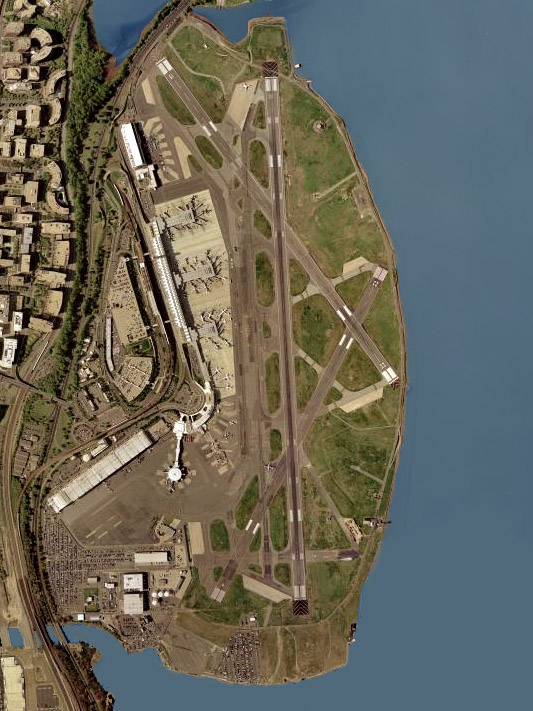
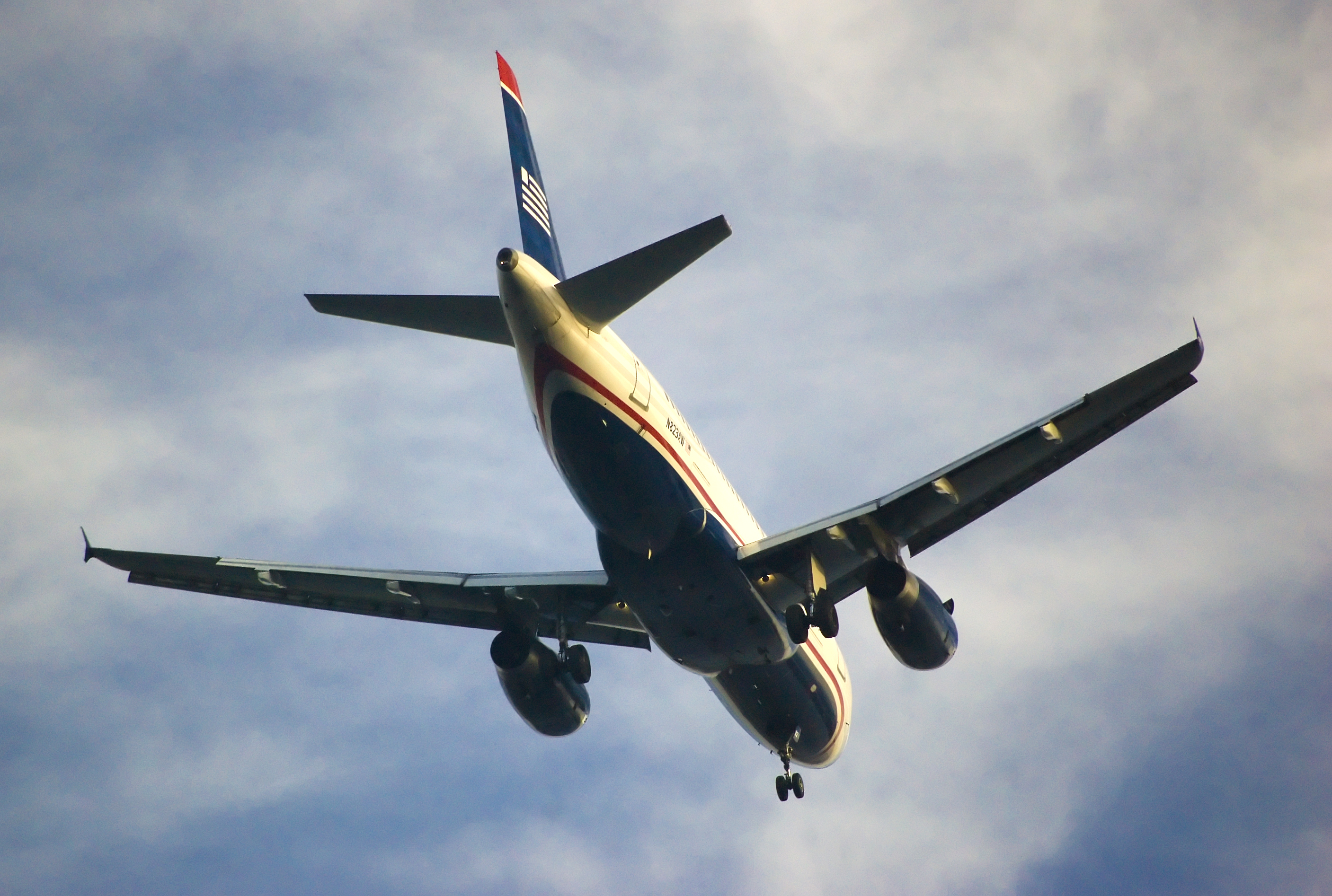
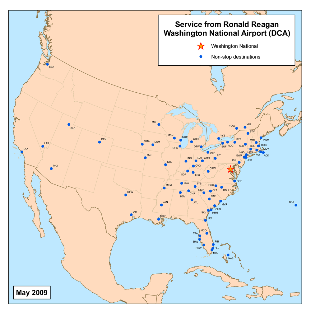
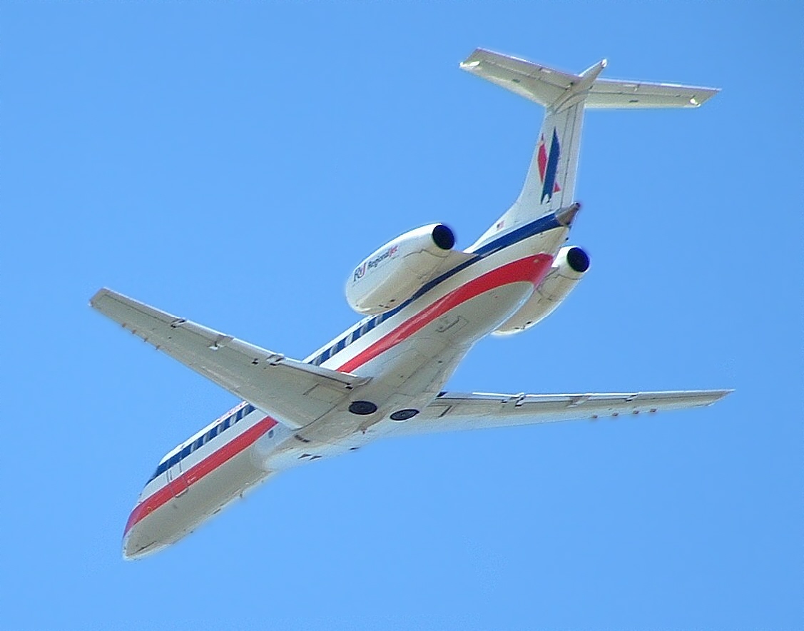
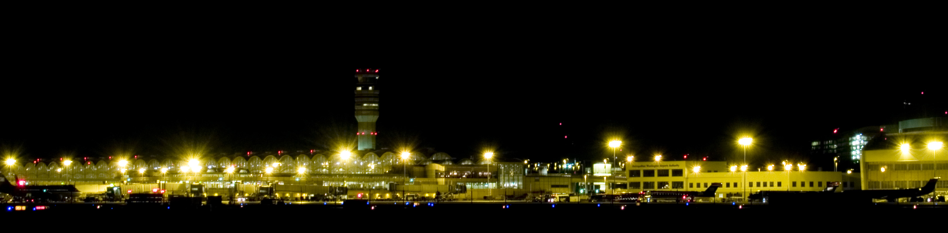
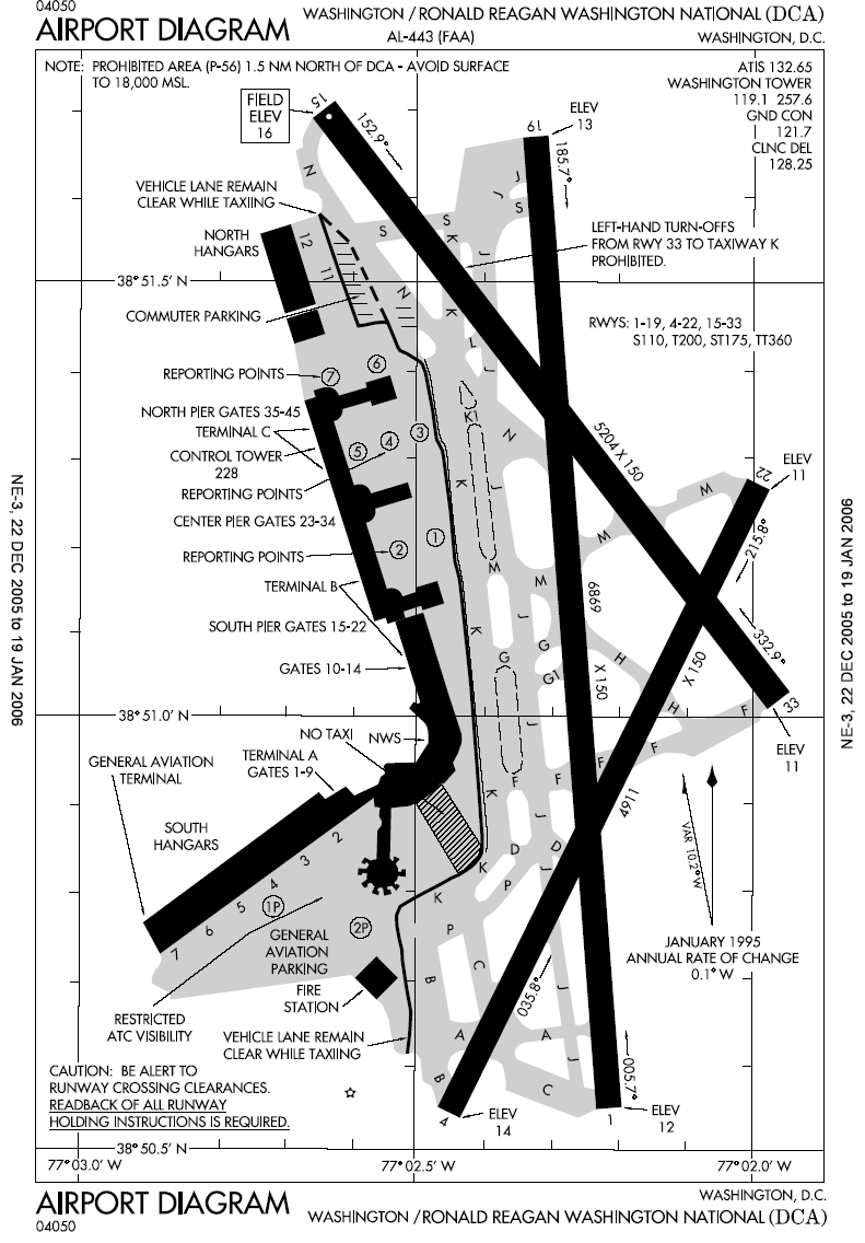
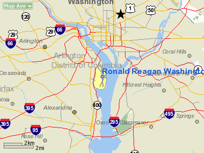
Ronald Reagan Washington National Airport (IATA: DCA, ICAO: KDCA, FAA LID: DCA) is a public airport located three miles (5 km) south of the central business district of Washington, D.C., in Arlington County, Virginia, United States. It is the nearest commercial airport to Washington, D.C. Originally named Washington National Airport, the facility was renamed to honor former President Ronald Reagan in 1998. The airport is commonly known as "National", "Washington National", "Reagan", and "Reagan National". "DCA" is used as the main airport code. The airport is a focus city for US Airways, the airport's largest carrier. The US Airways Shuttle offers near-hourly air shuttle service to LaGuardia Airport in New York City and Logan International Airport in Boston, Massachusetts. Delta Air Lines' Delta Shuttle also offers near-hourly air shuttle service to LaGuardia. With a few exceptions, flights are restricted to destinations within 1,250 miles (2,012 km), in an effort to control aviation noise and to drive air traffic to the larger but more distant Washington Dulles International Airport. In 2006, the airport served approximately 18.5 million passengers. Because the airport only provides U.S. immigration and customs facilities for corporate jet traffic, the only international flights allowed to land at DCA are those from airports with U.S. Customs and Border Protection preclearance, which include Nassau, Bahamas; Bermuda (seasonal); and most major airports in eastern Canada. HistoryWashington National Airport was built by the federal government in 1940–41 by John McShain on mudflats alongside the Potomac River at Gravelly Point, immediately west of Washington, D.C, and roughly four miles from the United States Capitol. Prior usesIn 1746 Captain John Alexander built a mansion, Abingdon, on the site. A descendent, Philip Alexander, donated most of the land on which the City of Alexandria was built, and it was so named in his honor. Abingdon Mansion was purchased in 1778 by John Parke Custis and was the birthplace of Eleanor "Nelly" Parke Custis, step-granddaughter of President George Washington. Abingdon was destroyed by fire in 1930. In 1998, the Metropolitan Washington Airports Authority preserved the site and housed artifacts found there in the Exhibit Hall, located in Terminal A. Founding and constructionAirport facilities in Washington, D.C. were seriously inadequate throughout the early 20th century. Hoover Field, located near the present site of the Pentagon, was the first major terminal to be developed in the Capital area, opening its doors in 1926. The facility's single runway was intersected by a local street; guards had to stop automobile traffic during takeoffs and landings. The following year, Washington Airport, another privately operated field, began service next door. In 1930, the economics of the Great Depression caused the two terminals to merge to form Washington-Hoover Airport. Bordered on the east by US-1, with its accompanying high-tension electrical wires, and obstructed by a high smokestack on one approach and a dump nearby, the field was less than adequate. Although the need for a better airport was acknowledged in 37 studies conducted between 1926 and 1938, there was a statutory prohibition against federal development of airports. When Congress lifted the prohibition in 1938, President Franklin Roosevelt made a recess appropriation of $15 million to build National Airport by reallocating funds from other purposes. Although Congress later challenged the legality of this move, construction of the new airport continued. Washington National Airport opened its doors on June 16, 1941. Though located on the Virginia side of the Potomac, much of the site had originally been underwater, in District of Columbia territory. A 1945 law established the airport as legally within Virginia but under the jurisdiction of Congress. ExpansionRapid growth in air traffic led to the construction of runway extensions in 1950 and 1955. The runway layout — limited due to the location and orientation of the airport — has otherwise changed little, except for the 1956 closure of a fourth, east-west runway now used for taxiing and aircraft parking. The terminal building was supplemented by the completion of the North Terminal in 1958; the two were connected in 1961. Despite the expansions, several efforts have been made to restrict the growth of the airport. The advent of jet aircraft as well as traffic growth led Congress to pass the Washington Airport Act of 1950, which resulted in the opening of Dulles Airport in 1962. Concerns about aviation noise led to the imposition of noise restrictions even before jet service began in 1966. To reduce congestion and drive traffic to alternative airports, the Federal Aviation Administration imposed landing slot and perimeter restrictions on National and four other high-density airports in 1969. Service to the airport's dedicated Metro station began in 1977. The station was sited based on the planned location of terminals B and C, separate from the main terminal, and is now connected to terminals B and C via pedestrian bridges. Major crash: Air Florida Flight 90On the afternoon of January 13, 1982, following a period of exceptionally cold weather and a morning of blizzard conditions, Air Florida Flight 90 crashed after waiting forty-nine minutes on a taxiway and taking off with ice and snow on the wings. The Boeing 737 aircraft failed to gain altitude. Less than a mile from the end of the runway, the airplane struck the 14th Street Bridge complex, shearing the tops off vehicles stuck in traffic before plunging through the 1-inch-thick (25 mm) ice covering the Potomac River. Rescue responses were greatly hampered by the weather and traffic. Due to heroic action on the part of motorists, a United States Park Service police helicopter crew, and one of the plane's passengers who later perished, five occupants of the downed plane survived. The other 74 people who had been aboard died, as well as four occupants of vehicles on the bridge. President Reagan cited motorist Lenny Skutnik in his State of the Union Address later that year. RenamingThe federal government relinquished control of Dulles and National Airports in 1987, when President Ronald Reagan signed a bill creating the independent Metropolitan Washington Airports Authority. However, Congress has continued to intervene in the management of the airports. On February 6, 1998, President Bill Clinton signed legislation changing the airport's name from Washington National Airport to Ronald Reagan Washington National Airport, to honor the former president on his 87th birthday. The legislation, passed by Congress in 1998, was drafted against the wishes of MWAA officials and political leaders in Northern Virginia and Washington, D.C. Opponents of the renaming argued that a large federal office building had already been named for Reagan, that the airport was already named for a United States President (George Washington). The bill expressly stated that it did not require the expenditure of any funds to accomplish the name change. Construction of current terminal buildings
In 1984, Secretary of Transportation Elizabeth Dole appointed a commission to study transferring National and Dulles Airports from the Federal Aviation Administration (FAA) to a local entity, which could use airport revenues to finance improvements. The commission recommended that one multi-state agency administer both Dulles and National, over the alternative of having Virginia control Dulles and the District of Columbia control National. In 1986, Congress transferred control of the airport from the FAA to the new Metropolitan Washington Airports Authority (MWAA), with MWAA's decisions subject to a Congressional review panel. The constitutionality of the review panel was then challenged in the court, which held up all construction projects while the litigation was pending. The Supreme Court has twice declared the oversight panel unconstitutional. With the addition of more flights and limited space in the aging main terminal, the airport began an extensive renovation and expansion in the 1990s. Hangar 11 on the northern end of the airport was converted into an interim terminal for US Airways and Delta Air Lines in 1989, freeing up several gates in the main terminal until the new $450 million terminal complex became operational. On July 27, 1997, the new terminal complex, consisting of terminals B and C and two parking garages, opened. Argentine architect César Pelli designed the new terminals of the airport. The interim terminal closed immediately after the opening and was converted back into a hangar. One pier of the main terminal (now Terminal A), which mainly housed American Airlines and Pan Am, was demolished; the other pier remains operational today as gates 1–9. Before 1999, Runway 1/19 and 4/22 were originally designated 18/36 and 3/21. Tightened security and safety concerns
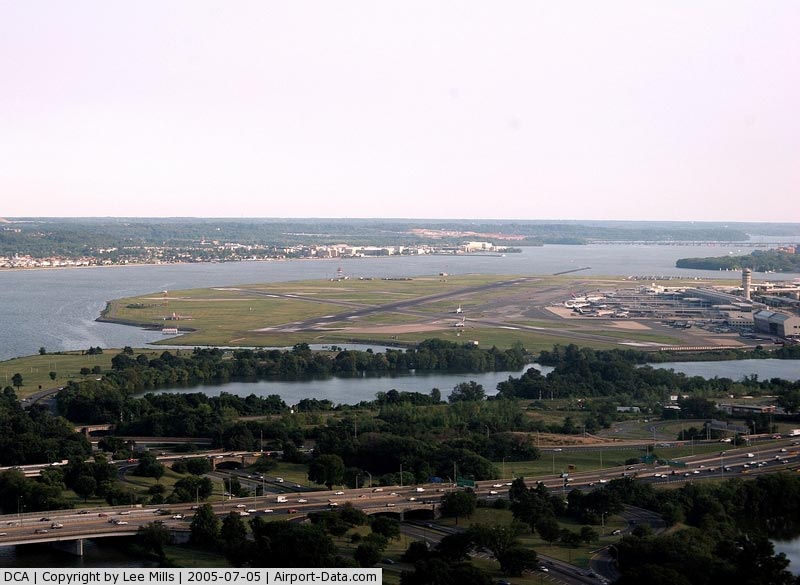
Because of Reagan National Airport's proximity to federal buildings such as the White House, the Capitol, and the Pentagon, as well as to major monuments such as the Washington Monument, enhanced security measures have been in place since the airport began operations. Prior to the September 11 attacks, the most notable security measure was the southbound approach into the airport. Most of central Washington D.C. is prohibited airspace up to 18,000 feet. Due to this restriction, pilots approaching from the north follow the path of the Potomac River and make a steep turn shortly before landing on the southbound runway. This approach is known as the River Visual. Similarly, flights taking off to the north are required to climb quickly and take a steep left turn, to avoid contact with the Washington Monument or flight over the White House. After the attacks, the airport was closed for several weeks, and security was tightened extensively when it reopened. Increased security measures included:
On October 18, 2005, Ronald Reagan Washington National Airport was reopened to general aviation on a limited basis (48 operations per day) and under serious restrictions: passenger and crew manifests must be submitted to the Transportation Security Administration 24 hours in advance, and all planes must pass through one of 27 "gateway airports" where reinspections of aircraft, passengers, and baggage take place. An armed security officer must be on board before departing a gateway airport.
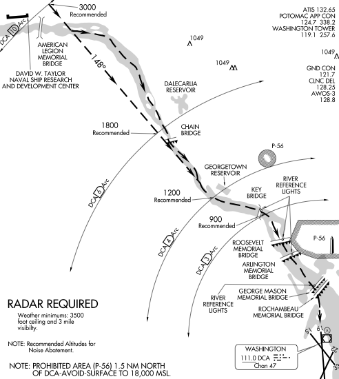
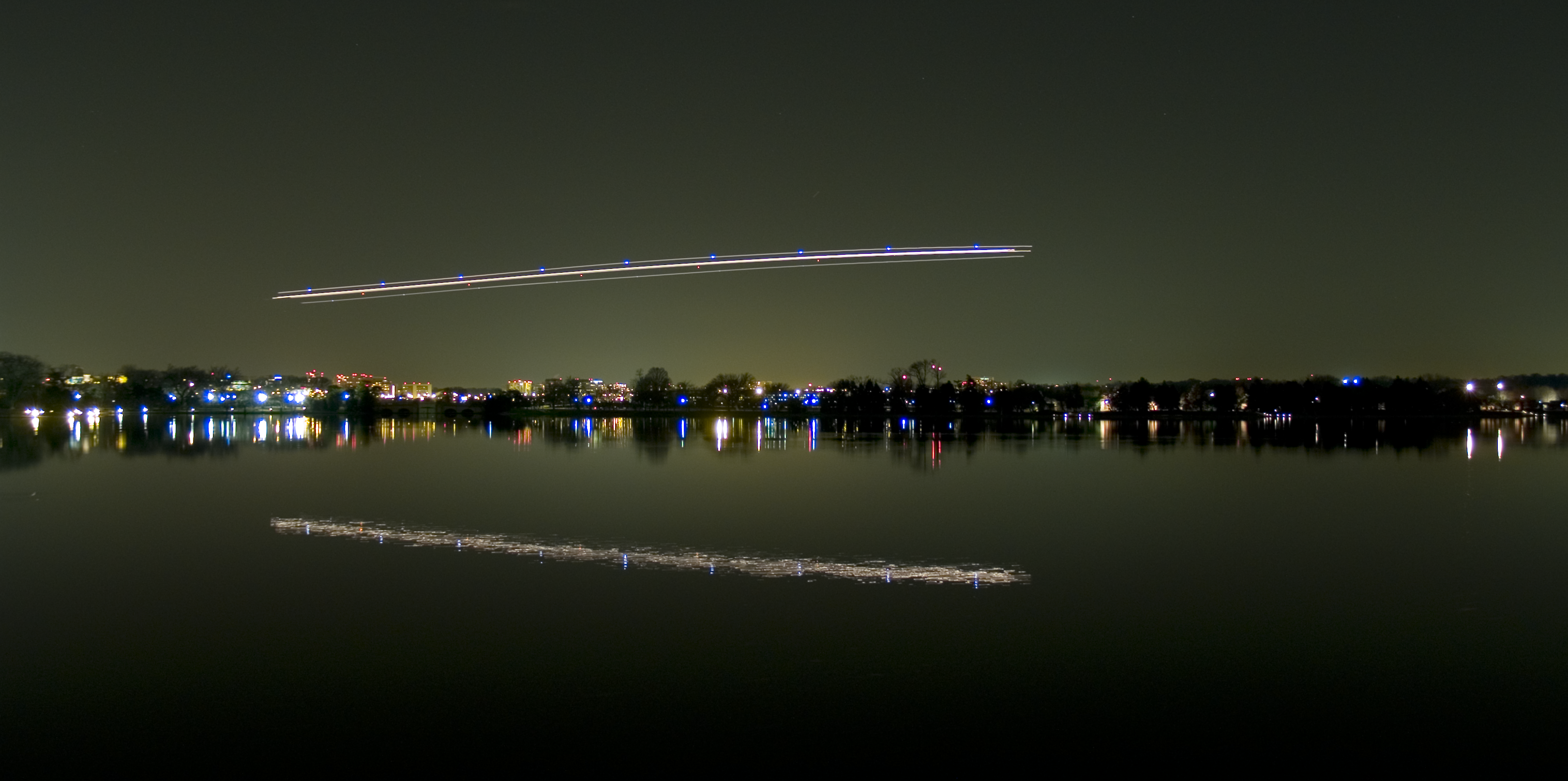
The River Visual approach
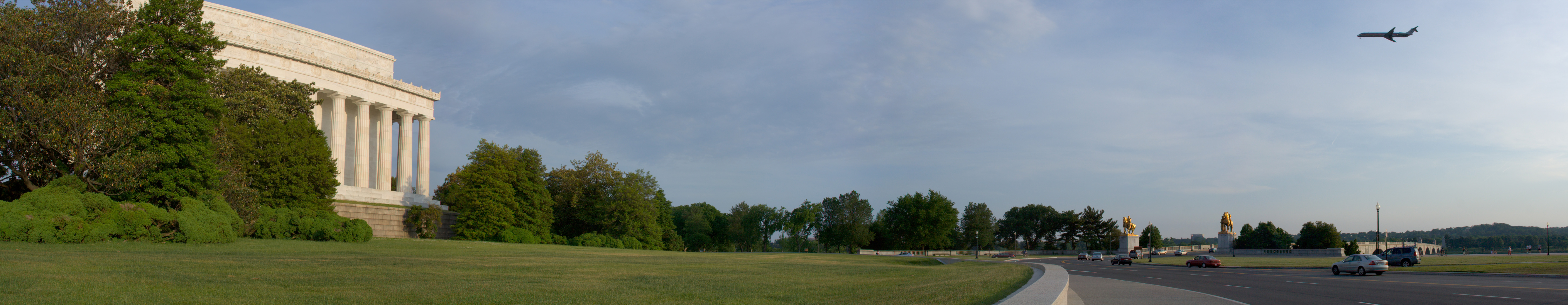
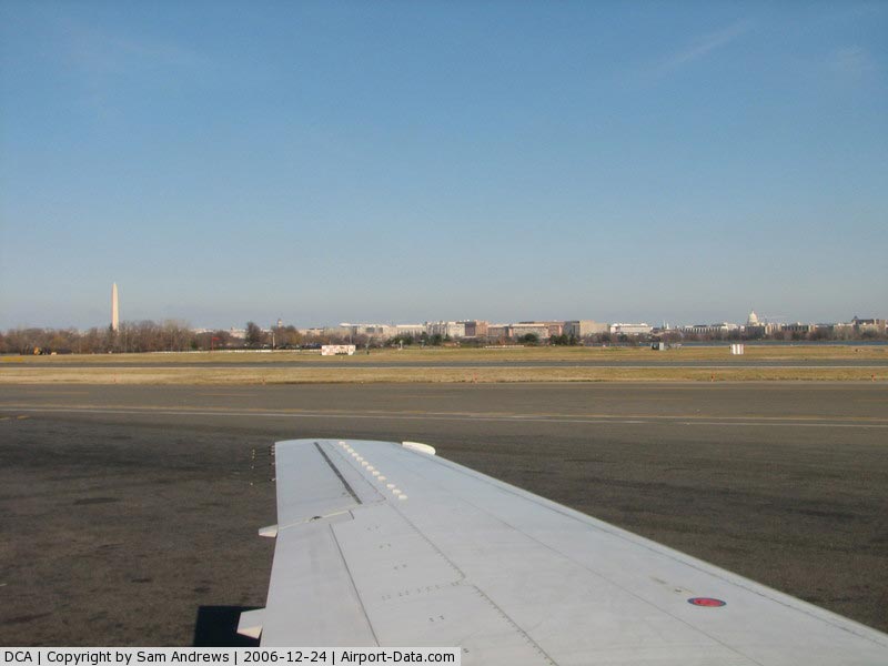
The River Visual approach was instituted due to safety and noise abatement concerns. The approach (which is for runway 19), which follows the course of the Potomac River, is only possible with a ceiling of at least 3,500 feet and visibility of 3 miles or more. There are lights on the Key Bridge, Theodore Roosevelt Bridge, Arlington Memorial Bridge, and the George Mason Memorial Bridge to aid pilots following the river. Aircraft using the approach can be observed from various parks on the river's west bank. Passengers seated on the left side of an airplane that is landing can easily see the Capitol, the Washington Monument, the Jefferson Memorial, the World War II Memorial, Georgetown University, the National Mall, and the White House. Passengers seated on the right side can see CIA headquarters, Arlington National Cemetery, the Pentagon, and the United States Air Force Memorial. When visibility and ceiling are below the minimums for the River Visual and southerly winds restrict northbound runway operations, aircraft fly an offset localizer or GPS approach to Runway 19, again involving a final turn moments before touchdown, or they fly a VOR or GPS approach to either of the shorter Runways 15 and 22, which are marginally usable by air carrier jets. Perimeter restrictionsNational Airport is subject to a federally mandated perimeter limitation and may not accommodate nonstop flights to or from cities beyond a 1,250 statute mile radius, with limited exceptions. The U.S. Department of Transportation has issued "beyond-perimeter slot exemptions" which allow specified carriers to operate 12 daily round-trip flights to cities outside the perimeter. These exemptions are allocated as follows:
In 1999, Senator John McCain of Arizona introduced legislation to remove the 1250-mile perimeter restriction, infuriating some local residents concerned about noise and traffic from increased service by larger, long-haul aircraft. McCain argued that the move would improve competition, while critics charged he was supporting the interests of Phoenix, Arizona-based America West Airlines (AWA). In the end the restriction was not lifted, but the FAA was permitted to add additional exemptions, which went not to AWA but to competitor Alaska Airlines. America West (now US Airways) would later gain additional exemptions for non-stop service to Phoenix in 2004. Originally the airport had no perimeter rule; in the 1950s airlines scheduled nonstop flights to California on piston-engine airliners. Scheduled jet airliners were not allowed at all until April 1966; the perimeter rule arrived with them, and apparently applied only to them. The initial perimeter was 650 miles, except that airports under 1000 miles that had scheduled nonstops in 1965 were allowed to retain them. This meant Minneapolis-St Paul was allowed nonstop jet flights but Kansas City, New Orleans and Fort Lauderdale were not. Around 1981 the perimeter became a flat 1000 miles, and it expanded to 1250 miles (enough to encompass Houston) around 1986. Terminals
US Airways is the largest carrier at the airport, accounting for roughly 24% of the airport's passenger traffic as of July 2009. American Airlines, the second-largest, accounts for roughly 13% of traffic.
Terminal A opened in 1941 and was expanded in 1955 to accommodate more passengers and airlines. This terminal is currently undergoing renovation to restore its original architecture, and is expected to be completed in a couple of years.
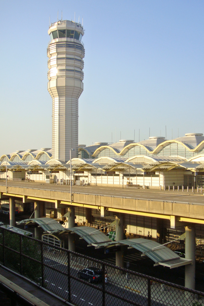
Terminals B and C opened in 1997, replacing a collection of airline-specific terminals built during the 1960s. The new terminals were designed by architect Cesar Pelli and house 35 gates. There is no Gate 13, possibly due to superstition. Airlines and destinations
Cargo
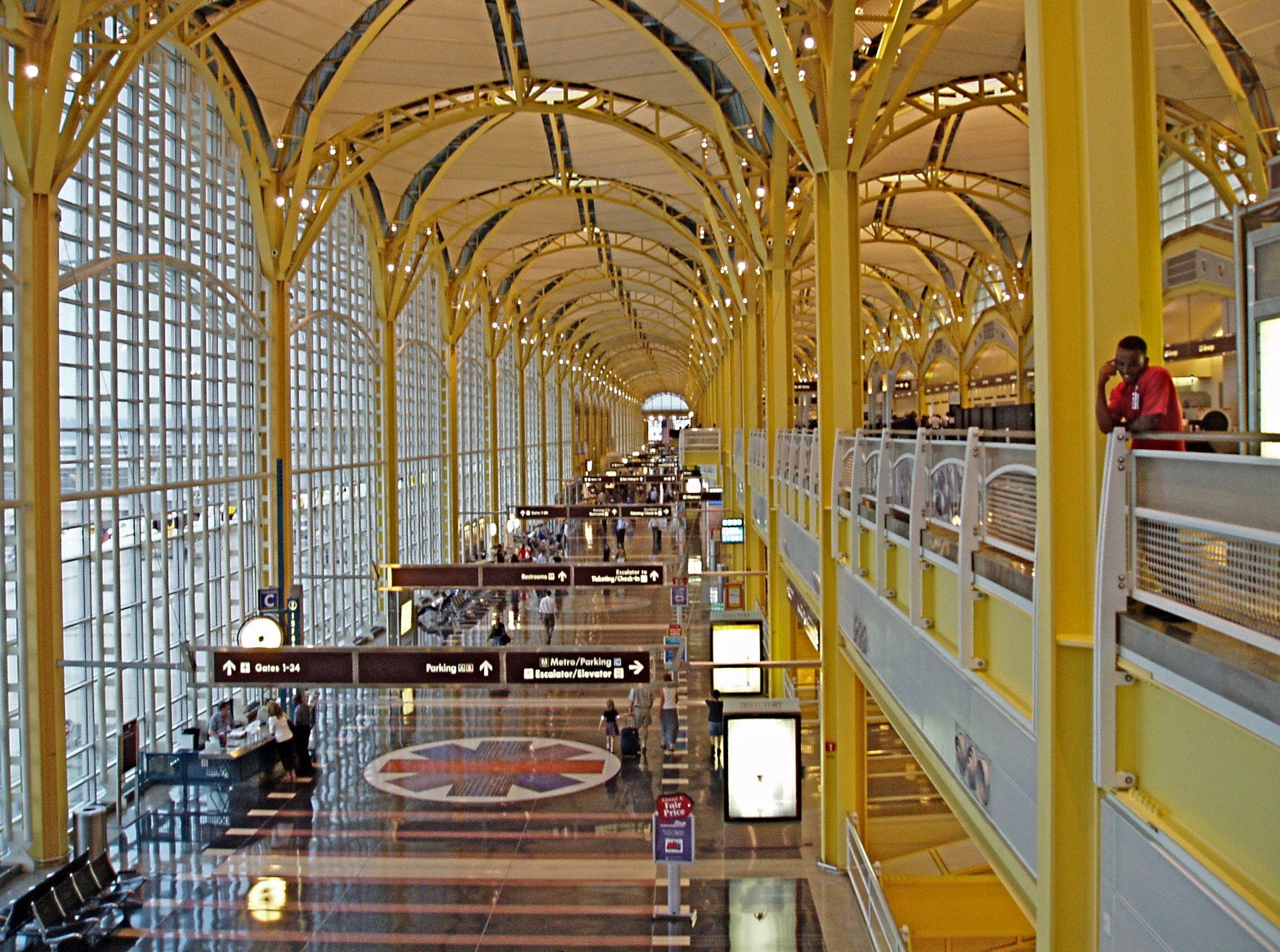
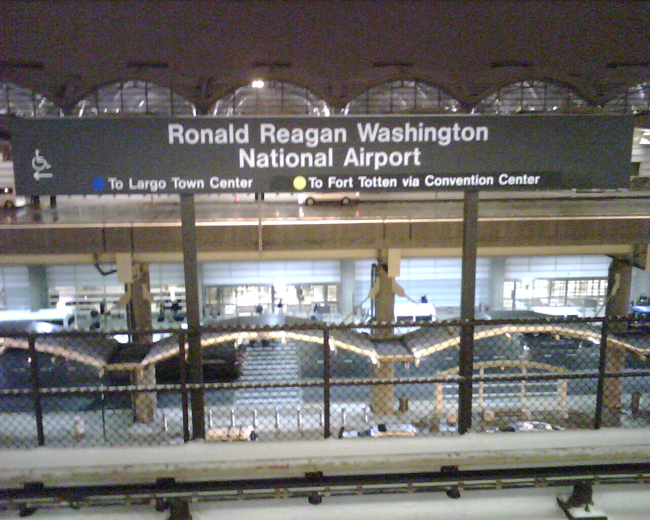
Ground transportation
In popular cultureDirk Pitt, hero of Clive Cussler's long running NUMA novel series, lives in a remodeled and refurbished hangar on the grounds of the airport. The above content comes from Wikipedia and is published under free licenses – click here to read more.
Runway InformationRunway 01/19
Runway 04/22
Runway 15/33
Runway 19X
Radio Navigation Aids
Remarks
Major Carriers Serving This Airport
Most Popular Destinations
Most Popular Aircraft
Operational Statistics
Ronald Reagan Washington National Airport Address: Arlington County, VA Tel: 703-417-8600, 703-417-8050 Images
and information placed above are from We thank them for the data!
We don't guarantee the information is fresh and accurate. The data may
be wrong or outdated.
|
|||||||||||||||||||||||||||||||||||||||||||||||||||||||||||||||||||||||||||||||||||||||||||||||||||||||||||||||||||||||||||||||||||||||||||||||||||||||||||||||||||||||||||||||||||||||||||||||||||||||||||||||||||||||||||||||||||||||||||||||||||||||||||||||||||||||||||||||||||||||||||||||||||||||||||||||||||||||||||||||||||||||||||||||||||||||||||||||||||||||||||||||||||||||||||||||||||||||||||||||||||||||||||||||||||||||||||||||||||||||||||||||||||||||||||||||||||||||||||||||||||||||||||||||||||||||||||||||||||||||||||||||||||||||||||||||||||||||||||||||||||||||||||||||||||||||||||||||||||||||||||||||||||||||||||||||||||||||||||||||||||||||||||||||||||||||||||||||||||||||||||||||||||||||||||||||||||||||||||||||||||||||||||||||||||||||||||||||||||||||||||

 |
|
Copyright 2004-2026 © by Airports-Worldwide.com, Vyshenskoho st. 36, Lviv 79010, Ukraine Legal Disclaimer |