 |
|
|
|
|
|
Location
& QuickFacts
|
FAA
Information Effective: |
2006-09-28 |
|
Airport
Identifier: |
DE27 |
|
Longitude/Latitude: |
075-10-29.6700W/38-27-45.4080N
-75.174908/38.462613 (Estimated) |
|
Elevation: |
26 ft / 7.92 m (Estimated) |
|
Land: |
30 acres |
|
From
nearest city: |
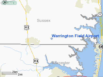
3 nautical miles E of Selbyville, DE |
|
Location: |
Sussex County, DE |
|
Magnetic Variation: |
11W (1985) |
Owner
& Manager
|
Ownership: |
Privately owned |
|
Owner: |
Manaen Warrington |
|
Address: |
Rr 1, Box 38
Selbyville, DE 19975 |
|
Phone number: |
302-436-5562 |
|
Manager: |
Manaen Warrington |
|
Address: |
Rr 1, Box 38
Selbyville, DE 19975 |
|
Phone number: |
302-436-5562 |
Airport
Operations and Facilities
|
Airport Use: |
Private |
|
Wind indicator: |
Yes |
|
Segmented Circle: |
No |
|
Control Tower: |
No |
|
Attendance Schedule: |
ALL/ALL/DAWN-DUSK |
|
Landing fee charge: |
Yes
PARKING FEE. |
|
Sectional chart: |
Washington |
|
Region: |
AEA - Eastern |
|
Boundary ARTCC: |
ZDC - Washington |
|
Tie-in FSS: |
MIV - Millville |
|
FSS on Airport: |
No |
|
FSS Phone: |
856-825-8090 |
|
FSS Toll Free: |
1-800-WX-BRIEF |
Airport
Services
|
Airframe
Repair: |
NONE |
|
Power
Plant Repair: |
NONE |
|
Bottled
Oxygen: |
NONE |
|
Bulk
Oxygen: |
NONE |
|
Runway Information
Runway 14/32
|
Dimension: |
2099 x 80 ft / 639.8 x 24.4 m |
|
Surface: |
TURF, |
|
|
Runway 14 |
Runway 32 |
|
Traffic
Pattern: |
Left |
Left |
|
Obstruction: |
, 200.0 ft from runway, 50:1 slope to clear |
60 ft trees, 60.0 ft from runway, 1:1 slope
to clear |
|
Runway 17/35
|
Dimension: |
2180 x 94 ft / 664.5 x 28.7 m |
|
Surface: |
TURF, |
|
|
Runway 17 |
Runway 35 |
|
Traffic
Pattern: |
Left |
Left |
|
Obstruction: |
, 150.0 ft from runway, 50:1 slope to clear |
60 ft trees, 60.0 ft from runway, 1:1 slope
to clear |
|
Radio Navigation
Aids
|
ID |
Type |
Name |
Ch |
Freq |
Var |
Dist |
|
OX |
NDB |
Landy |
|
407.00 |
12W |
6.1 nm |
|
CGE |
NDB |
Cambridge |
|
355.00 |
10W |
40.6 nm |
|
ESN |
NDB |
Easton |
|
212.00 |
10W |
46.8 nm |
|
DOV |
TACAN |
Dover |
037X |
|
09W |
42.5 nm |
|
ATR |
VOR/DME |
Waterloo |
073X |
112.60 |
09W |
20.9 nm |
|
SBY |
VORTAC |
Salisbury |
049X |
111.20 |
12W |
17.3 nm |
|
SWL |
VORTAC |
Snow Hill |
071X |
112.40 |
08W |
28.0 nm |
|
SIE |
VORTAC |
Sea Isle |
095X |
114.80 |
09W |
41.9 nm |
|
ENO |
VORTAC |
Smyrna |
051X |
111.40 |
09W |
48.9 nm |
Remarks
- NO
ULTRALIGHTS ANYTIME.
- EXISTED
PRIOR TO 1959.
Based Aircraft
|
Aircraft
based on field: |
9 |
|
Single
Engine Airplanes: |
9 |
Warrington Field Airport
Address:
Sussex County, DE
Tel:
302-436-5562
Images
and information placed above are from
http://www.airport-data.com/airport/DE27/
We
thank them for the data!
| General
Info |
| Country |
United
States |
| State |
DELAWARE
|
| FAA ID |
DE27
|
| Latitude |
38-27-45.408N
|
| Longitude |
075-10-29.670W
|
| Elevation |
26 feet
|
| Near City |
SELBYVILLE
|
We don't guarantee the information is fresh and accurate. The data may
be wrong or outdated.
For more up-to-date information please refer to other sources.
|
|


