 |
|
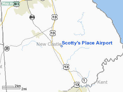
Location
& QuickFacts
|
FAA
Information Effective: |
2006-09-28 |
|
Airport
Identifier: |
DE29 |
|
Longitude/Latitude: |
075-38-38.7400W/39-22-30.4000N
-75.644094/39.375111 (Estimated) |
|
Elevation: |
40 ft / 12.19 m () |
|
Land: |
24 acres |
|
From
nearest city: |
5 nautical miles S of Smyrna, DE |
|
Location: |
Kent County, DE |
|
Magnetic Variation: |
12W (2000) |
Owner
& Manager
|
Ownership: |
Privately owned |
|
Owner: |
Scott W. Powell |
|
Address: |
325 Gumbush Rd.
Townsend, DE 19734 |
|
Phone number: |
302-653-8722 |
|
Manager: |
Scott W. Powell |
|
Address: |
325 Gumbush Rd.
Townsend, DE 19734 |
|
Phone number: |
302-653-8722 |
Airport
Operations and Facilities
|
Airport
Use: |
Private |
|
Wind
indicator: |
Yes |
|
Segmented
Circle: |
No |
|
Control
Tower: |
No |
|
Attendance
Schedule: |
UNATNDD |
|
Sectional
chart: |
Washington |
|
Region: |
AEA - Eastern |
|
Boundary
ARTCC: |
ZDC - Washington |
|
Tie-in
FSS: |
MIV - Millville |
|
FSS
Phone: |
856-825-8090 |
|
FSS
Toll Free: |
1-800-WX-BRIEF |
|
Runway Information
Runway 14/32
|
Dimension: |
2600 x 80 ft / 792.5 x 24.4 m |
|
Surface: |
TURF, |
|
|
Runway 14 |
Runway 32 |
|
Traffic
Pattern: |
Left |
Left |
|
Obstruction: |
|
90 ft trees, 225.0 ft from runway |
|
Radio Navigation
Aids
|
ID |
Type |
Name |
Ch |
Freq |
Var |
Dist |
|
APG |
NDB |
Aberdeen |
|
349.00 |
11W |
23.5 nm |
|
RNB |
NDB |
Rainbow |
|
363.00 |
11W |
23.8 nm |
|
MTN |
NDB |
Martin |
|
342.00 |
11W |
34.5 nm |
|
ESN |
NDB |
Easton |
|
212.00 |
10W |
39.6 nm |
|
IUB |
NDB |
Institute |
|
404.00 |
08W |
45.9 nm |
|
ING |
NDB |
Ambler |
|
275.00 |
11W |
48.1 nm |
|
DOV |
TACAN |
Dover |
037X |
|
09W |
16.8 nm |
|
MTN |
TACAN |
Martin |
068X |
|
11W |
35.8 nm |
|
PPM |
VOR/DME |
Phillips |
021X |
108.40 |
09W |
25.1 nm |
|
ATR |
VOR/DME |
Waterloo |
073X |
112.60 |
09W |
39.5 nm |
|
ENO |
VORTAC |
Smyrna |
051X |
111.40 |
09W |
10.5 nm |
|
DQO |
VORTAC |
Dupont |
087X |
114.00 |
10W |
18.3 nm |
|
OOD |
VORTAC |
Woodstown |
075X |
112.80 |
10W |
22.3 nm |
|
MXE |
VORTAC |
Modena |
079X |
113.20 |
09W |
32.7 nm |
|
VCN |
VORTAC |
Cedar Lake |
099X |
115.20 |
10W |
32.9 nm |
|
SIE |
VORTAC |
Sea Isle |
095X |
114.80 |
09W |
42.7 nm |
|
BAL |
VORTAC |
Baltimore |
098X |
115.10 |
11W |
48.9 nm |
|
ACY |
VORTAC |
Atlantic City |
023X |
108.60 |
10W |
49.8 nm |
|
PHL |
VOT |
Philadelphia Intl |
|
109.80 |
|
35.0 nm |
Remarks
- PRVDD
VFR ONLY, CLEAR 20:1 APCH/DEP, TREES AT RY 14 END REMOVED, PRIMARY AREA
CLEAR OF SHRUBS/BUSHES/TREES.
Based Aircraft
|
Aircraft
based on field: |
2 |
|
Single
Engine Airplanes: |
2 |
Scotty's Place Airport
Address:
Kent County, DE
Tel:
302-653-8722
Images
and information placed above are from
http://www.airport-data.com/airport/DE29/
We
thank them for the data!
| General
Info |
| Country |
United
States |
| State |
DELAWARE
|
| FAA ID |
DE29
|
| Latitude |
39-22-30.400N
|
| Longitude |
075-38-38.740W
|
| Elevation |
40 feet
|
| Near City |
SMYRNA
|
We don't guarantee the information is fresh and accurate. The data may
be wrong or outdated.
For more up-to-date information please refer to other sources.
|
|


