 |
|
Location
& QuickFacts
|
FAA
Information Effective: |
2006-09-28 |
|
Airport
Identifier: |
DE49 |
|
Longitude/Latitude: |
075-21-18.6970W/38-38-15.4080N
-75.355194/38.637613 (Estimated) |
|
Elevation: |
42 ft / 12.80 m (Surveyed) |
|
Land: |
0 acres |
|
From
nearest city: |
3 nautical miles S of Georgetown, DE |
|
Location: |
Sussex County, DE |
|
Magnetic Variation: |
11W (1985) |
Owner
& Manager
|
Ownership: |
Privately owned |
|
Owner: |
Melvin L. Joseph Const. Co. |
|
Address: |
Rd 7, Box 218
Georgetown, DE 19947 |
|
Phone number: |
302-856-7396 |
|
Manager: |
Richard Swain |
|
Address: |
Rd 7, Box 218
Georgetown, DE 19947 |
|
Phone number: |
302-856-7396 |
Airport
Operations and Facilities
|
Airport
Use: |
Private |
|
Wind
indicator: |
Yes |
|
Segmented
Circle: |
No |
|
Control
Tower: |
No |
|
Attendance
Schedule: |
UNATNDD |
|
Lighting
Schedule: |
RDO-CTL
ACTVT LIRL RY 15/33 - 123.5. |
|
Landing
fee charge: |
No |
|
Sectional
chart: |
Washington |
|
Region: |
AEA - Eastern |
|
Boundary
ARTCC: |
ZDC - Washington |
|
Tie-in
FSS: |
MIV - Millville |
|
FSS
on Airport: |
No |
|
FSS
Phone: |
856-825-8090 |
|
FSS
Toll Free: |
1-800-WX-BRIEF |
|
Runway Information
Runway 15/33
|
Dimension: |
4564 x 60 ft / 1391.1 x 18.3 m |
|
Surface: |
ASPH, |
|
Edge
Lights: |
Low |
|
|
Runway 15 |
Runway 33 |
|
Traffic
Pattern: |
Right |
Left |
|
Markings: |
Basic, |
, |
|
Displaced
threshold: |
0.00
ft |
600.00 ft |
|
Obstruction: |
60 ft trees, 900.0 ft from runway |
, 8.0 ft from runway |
|
Radio Navigation
Aids
|
ID |
Type |
Name |
Ch |
Freq |
Var |
Dist |
|
OX |
NDB |
Landy |
|
407.00 |
12W |
18.1 nm |
|
CGE |
NDB |
Cambridge |
|
355.00 |
10W |
32.4 nm |
|
ESN |
NDB |
Easton |
|
212.00 |
10W |
35.0 nm |
|
RNB |
NDB |
Rainbow |
|
363.00 |
11W |
48.0 nm |
|
DOV |
TACAN |
Dover |
037X |
|
09W |
30.2 nm |
|
ATR |
VOR/DME |
Waterloo |
073X |
112.60 |
09W |
12.4 nm |
|
SBY |
VORTAC |
Salisbury |
049X |
111.20 |
12W |
19.0 nm |
|
SWL |
VORTAC |
Snow Hill |
071X |
112.40 |
08W |
35.3 nm |
|
ENO |
VORTAC |
Smyrna |
051X |
111.40 |
09W |
36.5 nm |
|
SIE |
VORTAC |
Sea Isle |
095X |
114.80 |
09W |
37.8 nm |
Remarks
- 50'
ANTENNA 1000' NE.
- VFR
USE ONLY.
Based Aircraft
|
Aircraft
based on field: |
2 |
|
Single
Engine Airplanes: |
1 |
|
Jet Engine
Airplanes: |
1 |
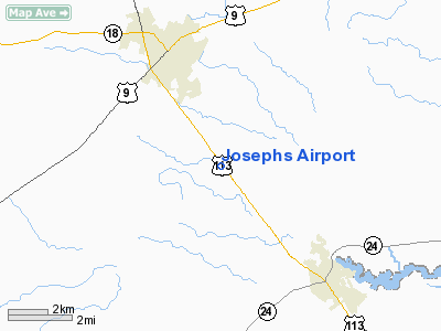
Josephs Airport
Address:
Sussex County, DE
Tel:
302-856-7396
Images
and information placed above are from
http://www.airport-data.com/airport/DE49/
We
thank them for the data!
| General
Info |
| Country |
United
States |
| State |
DELAWARE
|
| FAA ID |
DE49
|
| Latitude |
38-38-15.408N
|
| Longitude |
075-21-18.697W
|
| Elevation |
42 feet
|
| Near City |
GEORGETOWN
|
We don't guarantee the information is fresh and accurate. The data may
be wrong or outdated.
For more up-to-date information please refer to other sources.
|
|


