 |
|
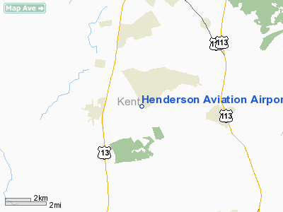
Henderson Aviation Airport |
|
|
Location
& QuickFacts
|
FAA
Information Effective: |
2006-09-28 |
|
Airport
Identifier: |
0N6 |
|
Longitude/Latitude: |
075-32-00.7250W/39-00-45.4060N
-75.533535/39.012613 (Estimated) |
|
Elevation: |
50 ft / 15.24 m (Estimated) |
|
Land: |
86 acres |
|
From
nearest city: |
2 nautical miles NE of Felton, DE |
|
Location: |
Kent County, DE |
|
Magnetic Variation: |
11W (1985) |
Owner
& Manager
|
Ownership: |
Privately owned |
|
Owner: |
Emad Albanna |
|
Address: |
3550 Deep Ldg. Rd.
Huntingtown, MD 20639 |
|
Phone
number: |
410-535-2045 |
|
Manager: |
Emad Albanna |
|
Address: |
3550 Deep Ldg. Rd.
Hunting Town, MD 20639 |
|
Phone number: |
410-535-2045 |
Airport
Operations and Facilities
|
Airport
Use: |
Open to public |
|
Wind
indicator: |
Yes |
|
Segmented
Circle: |
No |
|
Control
Tower: |
No |
|
Attendance
Schedule: |
ALL/MON-FRI/0800-1700 |
|
Landing
fee charge: |
No |
|
Sectional
chart: |
Washington |
|
Region: |
AEA - Eastern |
|
Boundary
ARTCC: |
ZDC - Washington |
|
Tie-in
FSS: |
MIV - Millville |
|
FSS
on Airport: |
No |
|
FSS
Phone: |
856-825-8090 |
|
FSS
Toll Free: |
1-800-WX-BRIEF |
|
NOTAMs
Facility: |
MIV (NOTAM-d service avaliable) |
Airport
Communications
|
CTAF: |
123.000 |
|
Unicom: |
123.000 |
Airport
Services
|
Airframe
Repair: |
MAJOR |
|
Power
Plant Repair: |
MAJOR |
|
Bottled
Oxygen: |
NONE |
|
Bulk
Oxygen: |
NONE |
|
Runway Information
Runway 15/33
|
Dimension: |
2048 x 40 ft / 624.2 x 12.2 m |
|
Surface: |
TURF, Good Condition |
|
|
Runway 15 |
Runway 33 |
|
Traffic
Pattern: |
Left |
Left |
|
Obstruction: |
18 ft bldg, 602.0 ft from runway, 25 ft left
of centerline, 33:1 slope to clear |
40 ft trees, 30.0 ft from runway |
|
Radio Navigation
Aids
|
ID |
Type |
Name |
Ch |
Freq |
Var |
Dist |
|
ESN |
NDB |
Easton |
|
212.00 |
10W |
28.0 nm |
|
RNB |
NDB |
Rainbow |
|
363.00 |
11W |
30.6 nm |
|
CGE |
NDB |
Cambridge |
|
355.00 |
10W |
36.9 nm |
|
APG |
NDB |
Aberdeen |
|
349.00 |
11W |
41.2 nm |
|
OX |
NDB |
Landy |
|
407.00 |
12W |
42.1 nm |
|
MTN |
NDB |
Martin |
|
342.00 |
11W |
43.1 nm |
|
DOV |
TACAN |
Dover |
037X |
|
09W |
7.8 nm |
|
MTN |
TACAN |
Martin |
068X |
|
11W |
45.2 nm |
|
ATR |
VOR/DME |
Waterloo |
073X |
112.60 |
09W |
19.4 nm |
|
PPM |
VOR/DME |
Phillips |
021X |
108.40 |
09W |
40.3 nm |
|
ENO |
VORTAC |
Smyrna |
051X |
111.40 |
09W |
13.2 nm |
|
SIE |
VORTAC |
Sea Isle |
095X |
114.80 |
09W |
34.6 nm |
|
OOD |
VORTAC |
Woodstown |
075X |
112.80 |
10W |
39.0 nm |
|
SBY |
VORTAC |
Salisbury |
049X |
111.20 |
12W |
40.1 nm |
|
DQO |
VORTAC |
Dupont |
087X |
114.00 |
10W |
40.1 nm |
|
VCN |
VORTAC |
Cedar Lake |
099X |
115.20 |
10W |
41.1 nm |
Based Aircraft
|
Aircraft
based on field: |
4 |
|
Single
Engine Airplanes: |
4 |
Operational Statistics
|
Aircraft
Operations: |
35/Week |
|
General
Aviation Local: |
83.3% |
|
General
Aviation Itinerant: |
16.7% |
Henderson Aviation Airport
Address:
Kent County, DE
Tel:
410-535-2045
Images
and information placed above are from
http://www.airport-data.com/airport/0N6/
We
thank them for the data!
| General
Info |
| Country |
United
States |
| State |
DELAWARE
|
| FAA ID |
0N6
|
| Latitude |
39-00-45.406N
|
| Longitude |
075-32-00.725W
|
| Elevation |
50 feet
|
| Near City |
FELTON
|
We don't guarantee the information is fresh and accurate. The data may
be wrong or outdated.
For more up-to-date information please refer to other sources.
|
|


