 |
|
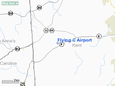
Location
& QuickFacts
|
FAA
Information Effective: |
2006-09-28 |
|
Airport
Identifier: |
DE07 |
|
Longitude/Latitude: |
075-41-28.7470W/39-08-39.4040N
-75.691319/39.144279 (Estimated) |
|
Elevation: |
70 ft / 21.34 m (Estimated) |
|
Land: |
0 acres |
|
From
nearest city: |
2 nautical miles SE of Hartly, DE |
|
Location: |
Kent County, DE |
|
Magnetic Variation: |
11W (1985) |
Owner
& Manager
|
Ownership: |
Privately owned |
|
Owner: |
Charles R. Sears, Sr. |
|
Address: |
Rd 1, Box 270g
Hartly, DE 19953 |
|
Phone number: |
302-492-3752 |
|
Address: |
|
Airport
Operations and Facilities
|
Airport Use: |
Private |
|
Wind indicator: |
Yes |
|
Segmented Circle: |
No |
|
Control Tower: |
No |
|
Attendance Schedule: |
ALL/ALL/DALGT |
|
Landing fee charge: |
No |
|
Sectional chart: |
Washington |
|
Region: |
AEA - Eastern |
|
Boundary ARTCC: |
ZDC - Washington |
|
Tie-in FSS: |
MIV - Millville |
|
FSS on Airport: |
No |
|
FSS Phone: |
856-825-8090 |
|
FSS Toll Free: |
1-800-WX-BRIEF |
Airport
Services
|
Airframe
Repair: |
NONE |
|
Power
Plant Repair: |
NONE |
|
Runway Information
Runway NW/SE
|
Dimension: |
2300 x 150 ft / 701.0 x 45.7 m |
|
Surface: |
TURF, |
|
|
Runway NW |
Runway SE |
|
Traffic
Pattern: |
Left |
Left |
|
Obstruction: |
50 ft pline, 350.0 ft from runway |
|
|
Radio Navigation
Aids
|
ID |
Type |
Name |
Ch |
Freq |
Var |
Dist |
|
ESN |
NDB |
Easton |
|
212.00 |
10W |
27.0 nm |
|
APG |
NDB |
Aberdeen |
|
349.00 |
11W |
30.4 nm |
|
RNB |
NDB |
Rainbow |
|
363.00 |
11W |
30.7 nm |
|
MTN |
NDB |
Martin |
|
342.00 |
11W |
33.4 nm |
|
CGE |
NDB |
Cambridge |
|
355.00 |
10W |
39.8 nm |
|
IUB |
NDB |
Institute |
|
404.00 |
08W |
44.3 nm |
|
BUH |
NDB |
Anne Arundel |
|
260.00 |
10W |
50.0 nm |
|
DOV |
TACAN |
Dover |
037X |
|
09W |
10.5 nm |
|
MTN |
TACAN |
Martin |
068X |
|
11W |
35.3 nm |
|
PPM |
VOR/DME |
Phillips |
021X |
108.40 |
09W |
29.6 nm |
|
ATR |
VOR/DME |
Waterloo |
073X |
112.60 |
09W |
30.1 nm |
|
ENO |
VORTAC |
Smyrna |
051X |
111.40 |
09W |
9.7 nm |
|
DQO |
VORTAC |
Dupont |
087X |
114.00 |
10W |
32.3 nm |
|
OOD |
VORTAC |
Woodstown |
075X |
112.80 |
10W |
34.6 nm |
|
VCN |
VORTAC |
Cedar Lake |
099X |
115.20 |
10W |
41.1 nm |
|
SIE |
VORTAC |
Sea Isle |
095X |
114.80 |
09W |
41.7 nm |
|
BAL |
VORTAC |
Baltimore |
098X |
115.10 |
11W |
45.2 nm |
|
MXE |
VORTAC |
Modena |
079X |
113.20 |
09W |
46.5 nm |
|
SBY |
VORTAC |
Salisbury |
049X |
111.20 |
12W |
48.8 nm |
|
PHL |
VOT |
Philadelphia Intl |
|
109.80 |
|
48.3 nm |
Based Aircraft
|
Aircraft
based on field: |
8 |
|
Single
Engine Airplanes: |
5 |
|
Multi
Engine Airplanes: |
1 |
|
Helicopters: |
1 |
|
Ultralights: |
1 |
Flying C Airport
Address:
Kent County, DE
Tel:
302-492-3752
Images
and information placed above are from
http://www.airport-data.com/airport/DE07/
We
thank them for the data!
| General
Info |
| Country |
United
States |
| State |
DELAWARE
|
| FAA ID |
DE07
|
| Latitude |
39-08-39.404N
|
| Longitude |
075-41-28.747W
|
| Elevation |
70 feet
|
| Near City |
HARTLY
|
We don't guarantee the information is fresh and accurate. The data may
be wrong or outdated.
For more up-to-date information please refer to other sources.
|
|


