 |
|
Location
& QuickFacts
|
FAA
Information Effective: |
2006-09-28 |
|
Airport
Identifier: |
DE22 |
|
Longitude/Latitude: |
075-34-58.7340W/39-13-00.4030N
-75.582982/39.216779 (Estimated) |
|
Elevation: |
55 ft / 16.76 m (Estimated) |
|
Land: |
0 acres |
|
From
nearest city: |
1 nautical miles E of Cheswold, DE |
|
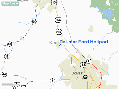
Location: |
Kent County, DE |
|
Magnetic Variation: |
11W (1985) |
Owner
& Manager
|
Ownership: |
Privately owned |
|
Owner: |
Del-mar Ford Tractor Inc |
|
Address: |
500 Mill Road
Bensalem, PA 19020 |
|
Phone
number: |
215-638-4222 |
|
Manager: |
James G. Mc Manus |
|
Address: |
P.o. Box 4511
Greenville, DE 19807-9998 |
|
Phone number: |
215-638-4222 |
Airport
Operations and Facilities
|
Airport
Use: |
Private |
|
Wind
indicator: |
Yes |
|
Segmented
Circle: |
No |
|
Control
Tower: |
No |
|
Attendance
Schedule: |
ALL/ALL/0800-1700 |
|
Landing
fee charge: |
No |
|
Sectional
chart: |
Washington |
|
Region: |
AEA - Eastern |
|
Boundary
ARTCC: |
ZDC - Washington |
|
Tie-in
FSS: |
MIV - Millville |
|
FSS
on Airport: |
No |
|
FSS
Phone: |
856-825-8090 |
|
FSS
Toll Free: |
1-800-WX-BRIEF |
|
Runway Information
Helipad H1
|
Dimension: |
100 x 100 ft / 30.5 x 30.5 m |
|
Surface: |
TURF, |
|
|
Runway H1 |
Runway |
|
Traffic
Pattern: |
Left |
Left |
|
Radio Navigation
Aids
|
ID |
Type |
Name |
Ch |
Freq |
Var |
Dist |
|
RNB |
NDB |
Rainbow |
|
363.00 |
11W |
24.1 nm |
|
APG |
NDB |
Aberdeen |
|
349.00 |
11W |
30.9 nm |
|
ESN |
NDB |
Easton |
|
212.00 |
10W |
33.6 nm |
|
MTN |
NDB |
Martin |
|
342.00 |
11W |
37.4 nm |
|
CGE |
NDB |
Cambridge |
|
355.00 |
10W |
45.9 nm |
|
IUB |
NDB |
Institute |
|
404.00 |
08W |
48.7 nm |
|
DOV |
TACAN |
Dover |
037X |
|
09W |
7.4 nm |
|
MTN |
TACAN |
Martin |
068X |
|
11W |
39.2 nm |
|
ATR |
VOR/DME |
Waterloo |
073X |
112.60 |
09W |
30.0 nm |
|
PPM |
VOR/DME |
Phillips |
021X |
108.40 |
09W |
31.2 nm |
|
ENO |
VORTAC |
Smyrna |
051X |
111.40 |
09W |
3.2 nm |
|
DQO |
VORTAC |
Dupont |
087X |
114.00 |
10W |
27.8 nm |
|
OOD |
VORTAC |
Woodstown |
075X |
112.80 |
10W |
28.4 nm |
|
VCN |
VORTAC |
Cedar Lake |
099X |
115.20 |
10W |
34.5 nm |
|
SIE |
VORTAC |
Sea Isle |
095X |
114.80 |
09W |
37.2 nm |
|
MXE |
VORTAC |
Modena |
079X |
113.20 |
09W |
42.3 nm |
|
ACY |
VORTAC |
Atlantic City |
023X |
108.60 |
10W |
49.0 nm |
|
PHL |
VOT |
Philadelphia Intl |
|
109.80 |
|
42.3 nm |
Based Aircraft
|
Aircraft
based on field: |
1 |
|
Helicopters: |
1 |
Del-mar Ford Heliport
Address:
Kent County, DE
Tel:
215-638-4222
Images
and information placed above are from
http://www.airport-data.com/airport/DE22/
We
thank them for the data!
| General
Info |
| Country |
United
States |
| State |
DELAWARE
|
| FAA ID |
DE22
|
| Latitude |
39-13-00.403N
|
| Longitude |
075-34-58.734W
|
| Elevation |
55 feet
|
| Near City |
CHESWOLD
|
We don't guarantee the information is fresh and accurate. The data may
be wrong or outdated.
For more up-to-date information please refer to other sources.
|
|


