 |
|
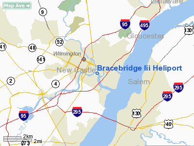
Location
& QuickFacts
|
FAA
Information Effective: |
2006-09-28 |
|
Airport
Identifier: |
DE30 |
|
Longitude/Latitude: |
075-32-07.0000W/39-44-08.0000N
-75.535278/39.735556 (Estimated) |
|
Elevation: |
125 ft / 38.10 m () |
|
Land: |
0 acres |
|
From
nearest city: |
0 nautical miles N of Wilmington, DE |
|
Location: |
New Castle County, DE |
|
Magnetic Variation: |
12W (2000) |
Owner
& Manager
|
Ownership: |
Privately owned |
|
Owner: |
Mbna Corp |
|
Address: |
142 Old Churchmans Rd
New Castle, DE 19720 |
|
Phone
number: |
302-325-7705 |
|
Manager: |
John Nadolny |
|
Address: |
142 Old Churchmans Rd
Newcastle, DE 19720 |
|
Phone number: |
302-325-7705 |
Airport
Operations and Facilities
|
Airport
Use: |
Private |
|
Wind
indicator: |
Yes |
|
Segmented
Circle: |
No |
|
Control
Tower: |
No |
|
Attendance
Schedule: |
UNATNDD |
|
Lighting
Schedule: |
PHONE REQ
FOR PERIMETER LGTS CALL 301-325-7705. |
|
Sectional
chart: |
Washington |
|
Region: |
AEA - Eastern |
|
Boundary
ARTCC: |
ZDC - Washington |
|
Tie-in
FSS: |
MIV - Millville |
|
FSS
Phone: |
856-825-8090 |
|
FSS
Toll Free: |
1-800-WX-BRIEF |
|
Runway Information
Helipad H1
|
Dimension: |
83 x 75 ft / 25.3 x 22.9 m |
|
Surface: |
CONC,
ROOFTOP. |
|
|
Runway H1 |
Runway |
|
Traffic
Pattern: |
Left |
Left |
|
Radio Navigation
Aids
|
ID |
Type |
Name |
Ch |
Freq |
Var |
Dist |
|
ING |
NDB |
Ambler |
|
275.00 |
11W |
26.1 nm |
|
RNB |
NDB |
Rainbow |
|
363.00 |
11W |
26.6 nm |
|
APG |
NDB |
Aberdeen |
|
349.00 |
11W |
29.1 nm |
|
NXX |
NDB |
Willow Grove |
|
388.00 |
12W |
32.7 nm |
|
DYL |
NDB |
Doylestown |
|
237.00 |
10W |
40.8 nm |
|
UKT |
NDB |
Quakertown |
|
208.00 |
12W |
42.9 nm |
|
MTN |
NDB |
Martin |
|
342.00 |
11W |
47.1 nm |
|
NXX |
TACAN |
Willow Grove |
061X |
|
10W |
32.9 nm |
|
DOV |
TACAN |
Dover |
037X |
|
09W |
36.4 nm |
|
MTN |
TACAN |
Martin |
068X |
|
11W |
47.3 nm |
|
PNE |
VOR |
North Philadelphia |
|
112.00 |
10W |
32.0 nm |
|
PPM |
VOR/DME |
Phillips |
021X |
108.40 |
09W |
33.6 nm |
|
CKZ |
VOR/DME |
Pennridge |
025Y |
108.85 |
12W |
41.0 nm |
|
ARD |
VOR/DME |
Yardley |
019X |
108.20 |
10W |
42.5 nm |
|
DQO |
VORTAC |
Dupont |
087X |
114.00 |
10W |
4.8 nm |
|
OOD |
VORTAC |
Woodstown |
075X |
112.80 |
10W |
12.3 nm |
|
MXE |
VORTAC |
Modena |
079X |
113.20 |
09W |
12.6 nm |
|
VCN |
VORTAC |
Cedar Lake |
099X |
115.20 |
10W |
28.9 nm |
|
PTW |
VORTAC |
Pottstown |
112X |
116.50 |
09W |
29.3 nm |
|
ENO |
VORTAC |
Smyrna |
051X |
111.40 |
09W |
30.3 nm |
|
LRP |
VORTAC |
Lancaster |
120X |
117.30 |
09W |
41.8 nm |
|
GXU |
VORTAC |
Mc Guire |
043X |
110.60 |
11W |
46.3 nm |
|
ACY |
VORTAC |
Atlantic City |
023X |
108.60 |
10W |
47.5 nm |
|
PHL |
VOT |
Philadelphia Intl |
|
109.80 |
|
15.7 nm |
Remarks
- PRVDD
OVERFLIGHT OF SCHOOLS & PUBLIC ASSEMBLY BE AVOIDED, MINIMIZE NOISE
OVER RESIDENCES NEAR FACILITY, APPROPRIATE INGRESS/EGRESS MKGS ON H1,
LGHTD WINDSOCK INSTALLED, VEHICLE TRAFFIC AROUND H1 CONTROLLED, MAINTAIN
AN ACCURATE INGRESS/EGRESS ROUTE & CLEAR 8:1 SLOPE, FIRE EXTINGUISHER
SPRAY HOOKUP.
Bracebridge Iii Heliport
Address:
New Castle County, DE
Tel:
302-325-7705
Images
and information placed above are from
http://www.airport-data.com/airport/DE30/
We
thank them for the data!
| General
Info |
| Country |
United
States |
| State |
DELAWARE
|
| FAA ID |
DE30
|
| Latitude |
39-44-08.000N
|
| Longitude |
075-32-07.000W
|
| Elevation |
125 feet
|
| Near City |
WILMINGTON
|
We don't guarantee the information is fresh and accurate. The data may
be wrong or outdated.
For more up-to-date information please refer to other sources.
|
|


