 |
|
|
|
|
|
Location
& QuickFacts
|
FAA
Information Effective: |
2006-09-28 |
|
Airport
Identifier: |
C44 |
|
Longitude/Latitude: |
072-03-15.7000W/41-57-20.5000N
-72.054361/41.955694 (Estimated) |
|
Elevation: |
770 ft / 234.70 m (Estimated) |
|
Land: |
40 acres |
|
From
nearest city: |
6 nautical miles NW of Putnam, CT |
|
Location: |
Windham County, CT |
|
Magnetic Variation: |
15W (1985) |
Owner
& Manager
|
Ownership: |
Privately owned |
|
Owner: |
Roland J. Toutant |
|
Address: |
Bungay Road
West Woodstock, CT 06281 |
|
Phone
number: |
860-974-2099 |
|
Manager: |
Roland J. Toutant |
|
Address: |
Bungay Road
West Woodstock, CT 06281 |
|
Phone number: |
860-974-2099 |
Airport
Operations and Facilities
|
Airport
Use: |
Open to public |
|
Wind
indicator: |
Yes |
|
Segmented
Circle: |
No |
|
Control
Tower: |
No |
|
Attendance
Schedule: |
ALL/ALL/IREG |
|
Lighting
Schedule: |
PHONE REQ
FOR LGTS CALL 860-974-2099. |
|
Landing
fee charge: |
No |
|
Sectional
chart: |
New York |
|
Region: |
ANE - New England |
|
Boundary
ARTCC: |
ZBW - Boston |
|
Tie-in
FSS: |
BDR - Bridgeport |
|
FSS
on Airport: |
No |
|
FSS
Phone: |
866-293-5149 |
|
FSS
Toll Free: |
1-800-WX-BRIEF |
|
NOTAMs
Facility: |
BDR (NOTAM-d service avaliable) |
Airport
Communications
Airport
Services
|
Airframe
Repair: |
NONE |
|
Power
Plant Repair: |
NONE |
|
Runway Information
Runway 17/35
|
Dimension: |
1756 x 60 ft / 535.2 x 18.3 m |
|
Surface: |
ASPH, Good Condition |
|
Edge
Lights: |
Non-standard lighting system
NSTD LIGHTING NOT L-800 SERIES. |
|
|
Runway 17 |
Runway 35 |
|
Longitude: |
072-03-21.4026W |
072-03-09.8977W |
|
Latitude: |
41-57-28.0758N |
41-57-13.0039N |
|
Elevation: |
772.00 ft |
756.00 ft |
|
Traffic
Pattern: |
Left |
Left |
|
Obstruction: |
28 ft trees, 327.0 ft from runway, 158 ft right
of centerline, 4:1 slope to clear
+6 FT BRUSH 50 FT FM THLD 20 FT R; +10 FT BRUSH 50 FT FM THLD
40 FT L. |
29 ft trees, 231.0 ft from runway, 148L/ ft
right of centerline, 1:1 slope to clear
+6 FT BUSH 20 FT FM THLD 15 FT L; +15 FT BRUSH 5 FT FM THLD
28 FT R. |
|
Radio Navigation
Aids
|
ID |
Type |
Name |
Ch |
Freq |
Var |
Dist |
|
ORW |
FAN MARKER |
Canton |
|
|
15W |
42.0 nm |
|
SFZ |
NDB |
Central |
|
241.00 |
15W |
25.4 nm |
|
HF |
NDB |
Lomis |
|
244.00 |
15W |
32.0 nm |
|
FIT |
NDB |
Fitchburg |
|
365.00 |
15W |
38.1 nm |
|
ORE |
NDB |
Orange |
|
205.00 |
15W |
38.3 nm |
|
IHM |
NDB |
Mansfield |
|
220.00 |
16W |
38.4 nm |
|
MMK |
NDB |
Meriden |
|
238.00 |
14W |
43.8 nm |
|
TAN |
NDB |
Taunton |
|
227.00 |
16W |
46.6 nm |
|
SKR |
NDB |
Shaker Hill |
|
251.00 |
16W |
49.2 nm |
|
PUT |
VOR/DME |
Putnam |
121X |
117.40 |
14W |
9.4 nm |
|
ORW |
VOR/DME |
Norwich |
037X |
110.00 |
14W |
24.1 nm |
|
HFD |
VOR/DME |
Hartford |
096X |
114.90 |
13W |
29.1 nm |
|
GON |
VOR/DME |
Groton |
45Y |
110.85 |
14W |
37.6 nm |
|
CTR |
VOR/DME |
Chester |
098X |
115.10 |
13W |
44.7 nm |
|
MAD |
VOR/DME |
Madison |
041X |
110.40 |
13W |
48.1 nm |
|
CEF |
VORTAC |
Westover |
87X |
114.00 |
14W |
25.6 nm |
|
BDL |
VORTAC |
Bradley |
027X |
109.00 |
14W |
28.4 nm |
|
PVD |
VORTAC |
Providence |
103X |
115.60 |
14W |
31.2 nm |
|
BAF |
VORTAC |
Barnes |
077X |
113.00 |
14W |
32.0 nm |
|
GDM |
VORTAC |
Gardner |
043X |
110.60 |
14W |
35.5 nm |
|
ORH |
VOT |
Worcester |
|
108.20 |
|
20.5 nm |
|
BDL |
VOT |
Bradley Intl |
|
111.40 |
|
28.1 nm |
|
HFD |
VOT |
Hartford |
|
108.20 |
|
29.8 nm |
|
PVD |
VOT |
Providence |
|
108.20 |
|
31.4 nm |
|
GON |
VOT |
Groton |
|
110.25 |
|
37.9 nm |
|
BED |
VOT |
Laurence G Hanscom Fld |
|
110.00 |
|
46.0 nm |
Remarks
Based Aircraft
|
Aircraft
based on field: |
3 |
|
Single
Engine Airplanes: |
1 |
|
Helicopters: |
1 |
|
Ultralights: |
1 |
Operational Statistics
|
Aircraft
Operations: |
11/Month |
|
General
Aviation Local: |
61.5% |
|
General
Aviation Itinerant: |
38.5% |
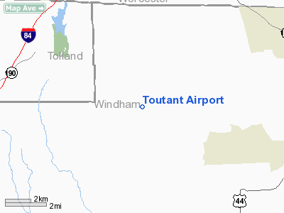
Toutant Airport
Address:
Windham County, CT
Tel:
860-974-2099
Images
and information placed above are from
http://www.airport-data.com/airport/C44/
We
thank them for the data!
| General
Info |
| Country |
United
States |
| State |
CONNECTICUT
|
| FAA ID |
C44
|
| Latitude |
41-57-20.500N
|
| Longitude |
072-03-15.700W
|
| Elevation |
770 feet
|
| Near City |
PUTNAM
|
We don't guarantee the information is fresh and accurate. The data may
be wrong or outdated.
For more up-to-date information please refer to other sources.
|
|


