 |
|
Location
& QuickFacts
|
FAA
Information Effective: |
2006-09-28 |
|
Airport
Identifier: |
02CT |
|
Longitude/Latitude: |
072-26-40.0400W/41-55-10.6900N
-72.444456/41.919636 (Estimated) |
|
Elevation: |
540 ft / 164.59 m (Estimated) |
|
Land: |
0 acres |
|
From
nearest city: |
2 nautical miles NE of Ellington, CT |
|
Location: |
Tolland County, CT |
|
Magnetic Variation: |
15W (2000) |
Owner
& Manager
|
Ownership: |
Privately owned |
|
Owner: |
Dianna Stanger |
|
Address: |
1005 Shoreline Lane
Port La Vaca, TX 77979-5318 |
|
Phone
number: |
361-893-5115 |
|
Manager: |
Paul Keller |
|
Address: |
330 Governors Hwy
South Windsor, CT 06074 |
|
Phone number: |
860-289-8661 |
Airport
Operations and Facilities
|
Airport
Use: |
Private |
|
Segmented
Circle: |
No |
|
Control
Tower: |
No |
|
Attendance
Schedule: |
UNATNDD |
|
Sectional
chart: |
New York |
|
Region: |
ANE - New England |
|
Boundary
ARTCC: |
ZBW - Boston |
|
Tie-in
FSS: |
BDR - Bridgeport |
|
FSS
Phone: |
866-293-5149 |
|
FSS
Toll Free: |
1-800-WX-BRIEF |
|
Runway Information
Helipad H1
|
Dimension: |
50 x 50 ft / 15.2 x 15.2 m |
|
Surface: |
ASPH, |
| |
Runway H1 |
Runway |
|
Traffic
Pattern: |
Left |
Left |
|
Radio Navigation
Aids
|
ID |
Type |
Name |
Ch |
Freq |
Var |
Dist |
|
GBR |
FAN MARKER |
Sheffield |
|
|
13W |
42.9 nm |
|
PSF |
FAN MARKER |
Abyss |
|
|
13W |
47.0 nm |
|
HF |
NDB |
Lomis |
|
244.00 |
15W |
18.9 nm |
|
MMK |
NDB |
Meriden |
|
238.00 |
14W |
30.0 nm |
|
TBY |
NDB |
Waterbury |
|
257.00 |
14W |
39.2 nm |
|
ORE |
NDB |
Orange |
|
205.00 |
15W |
39.6 nm |
|
SFZ |
NDB |
Central |
|
241.00 |
15W |
42.8 nm |
|
GBR |
NDB |
Great Barrington |
|
395.00 |
14W |
45.7 nm |
|
DXT |
NDB |
Dalton |
|
370.00 |
15W |
46.3 nm |
|
FIT |
NDB |
Fitchburg |
|
365.00 |
15W |
48.7 nm |
|
HFD |
VOR/DME |
Hartford |
096X |
114.90 |
13W |
17.4 nm |
|
PUT |
VOR/DME |
Putnam |
121X |
117.40 |
14W |
26.9 nm |
|
ORW |
VOR/DME |
Norwich |
037X |
110.00 |
14W |
29.6 nm |
|
CTR |
VOR/DME |
Chester |
098X |
115.10 |
13W |
31.7 nm |
|
MAD |
VOR/DME |
Madison |
041X |
110.40 |
13W |
38.1 nm |
|
GON |
VOR/DME |
Groton |
45Y |
110.85 |
14W |
39.6 nm |
|
HVN |
VOR/DME |
New Haven |
035X |
109.80 |
13W |
44.2 nm |
|
BDL |
VORTAC |
Bradley |
027X |
109.00 |
14W |
11.0 nm |
|
CEF |
VORTAC |
Westover |
87X |
114.00 |
14W |
17.1 nm |
|
BAF |
VORTAC |
Barnes |
077X |
113.00 |
14W |
19.0 nm |
|
GDM |
VORTAC |
Gardner |
043X |
110.60 |
14W |
41.4 nm |
|
PVD |
VORTAC |
Providence |
103X |
115.60 |
14W |
46.9 nm |
|
BDL |
VOT |
Bradley Intl |
|
111.40 |
|
10.7 nm |
|
HFD |
VOT |
Hartford |
|
108.20 |
|
14.5 nm |
|
ORH |
VOT |
Worcester |
|
108.20 |
|
33.1 nm |
|
GON |
VOT |
Groton |
|
110.25 |
|
39.9 nm |
|
PVD |
VOT |
Providence |
|
108.20 |
|
47.1 nm |
Remarks
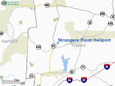
Strangers
Point Heliport
Address:
Tolland County, CT
Tel:
361-893-5115,
860-289-8661
Images
and information placed above are from
http://www.airport-data.com/airport/02CT/
We
thank them for the data!
| General
Info |
| Country |
United
States |
| State |
CONNECTICUT
|
| FAA ID |
02CT
|
| Latitude |
41-55-10.690N
|
| Longitude |
072-26-40.040W
|
| Elevation |
540 feet
|
| Near City |
ELLINGTON
|
We don't guarantee the information is fresh and accurate. The data may
be wrong or outdated.
For more up-to-date information please refer to other sources.
|
|


