 |
|
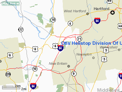
Otis Helistop Division Of Utc Heliport |
|
|
Location
& QuickFacts
|
FAA
Information Effective: |
2006-09-28 |
|
Airport
Identifier: |
CT71 |
|
Longitude/Latitude: |
072-48-08.3520W/41-42-30.3580N
-72.802320/41.708433 (Estimated) |
|
Elevation: |
362 ft / 110.34 m (Estimated) |
|
Land: |
0 acres |
|
From
nearest city: |
4 nautical miles W of Farmington, CT |
|
Location: |
Hartford County, CT |
|
Magnetic Variation: |
14W (1985) |
Owner
& Manager
|
Ownership: |
Privately owned |
|
Owner: |
Otis Elevator Div Of Utc |
|
Address: |
1 Farm Springs Rd
Farmington, CT 06032 |
|
Phone
number: |
203-675-5029 |
|
Manager: |
Keith Hutchins |
|
Address: |
1 Farm Springs Rd
Farmington, CT 06032 |
|
Phone number: |
203-678-2059 |
Airport
Operations and Facilities
|
Airport
Use: |
Private |
|
Wind
indicator: |
Yes |
|
Segmented
Circle: |
No |
|
Control
Tower: |
No |
|
Attendance
Schedule: |
ON CALL |
|
Lighting
Schedule: |
PHONE REQ
FOR PERIMETER LIGHTS CALL 203-676-6000. |
|
Landing fee charge: |
No |
|
Sectional chart: |
New York |
|
Region: |
ANE - New England |
|
Boundary ARTCC: |
ZBW - Boston |
|
Tie-in FSS: |
BDR - Bridgeport |
|
FSS on Airport: |
No |
|
FSS Phone: |
866-293-5149 |
|
FSS Toll Free: |
1-800-WX-BRIEF |
Airport
Services
|
Airframe
Repair: |
NONE |
|
Power
Plant Repair: |
NONE |
|
Bottled
Oxygen: |
NONE |
|
Bulk
Oxygen: |
NONE |
|
Runway Information
Helipad H1
|
Dimension: |
80 x 80 ft / 24.4 x 24.4 m |
|
Surface: |
ASPH, |
|
Edge
Lights: |
Low |
|
|
Runway H1 |
Runway |
|
Traffic
Pattern: |
Left |
Left |
|
Runway
End Identifier: |
No |
|
|
Centerline
Lights: |
No |
|
|
Touchdown
Lights: |
No |
|
|
Radio Navigation
Aids
|
ID |
Type |
Name |
Ch |
Freq |
Var |
Dist |
|
GBR |
FAN MARKER |
Sheffield |
|
|
13W |
35.6 nm |
|
PSF |
FAN MARKER |
Abyss |
|
|
13W |
48.5 nm |
|
HF |
NDB |
Lomis |
|
244.00 |
15W |
9.1 nm |
|
MMK |
NDB |
Meriden |
|
238.00 |
14W |
12.0 nm |
|
TBY |
NDB |
Waterbury |
|
257.00 |
14W |
18.7 nm |
|
GBR |
NDB |
Great Barrington |
|
395.00 |
14W |
39.2 nm |
|
OP |
NDB |
Old Field Point Light |
|
316.00 |
13W |
46.2 nm |
|
DXT |
NDB |
Dalton |
|
370.00 |
15W |
48.7 nm |
|
HFD |
VOR/DME |
Hartford |
096X |
114.90 |
13W |
12.1 nm |
|
MAD |
VOR/DME |
Madison |
041X |
110.40 |
13W |
24.2 nm |
|
HVN |
VOR/DME |
New Haven |
035X |
109.80 |
13W |
27.1 nm |
|
CTR |
VOR/DME |
Chester |
098X |
115.10 |
13W |
35.6 nm |
|
BDR |
VOR/DME |
Bridgeport |
25X |
108.80 |
12W |
36.0 nm |
|
PWL |
VOR/DME |
Pawling |
090X |
114.30 |
12W |
36.0 nm |
|
ORW |
VOR/DME |
Norwich |
037X |
110.00 |
14W |
37.2 nm |
|
GON |
VOR/DME |
Groton |
45Y |
110.85 |
14W |
40.7 nm |
|
CMK |
VOR/DME |
Carmel |
113X |
116.60 |
12W |
43.5 nm |
|
PUT |
VOR/DME |
Putnam |
121X |
117.40 |
14W |
45.4 nm |
|
IGN |
VOR/DME |
Kingston |
123X |
117.60 |
12W |
45.9 nm |
|
CCC |
VOR/DME |
Calverton |
119X |
117.20 |
13W |
46.8 nm |
|
BDL |
VORTAC |
Bradley |
027X |
109.00 |
14W |
14.9 nm |
|
BAF |
VORTAC |
Barnes |
077X |
113.00 |
14W |
27.5 nm |
|
CEF |
VORTAC |
Westover |
87X |
114.00 |
14W |
31.9 nm |
|
HFD |
VOT |
Hartford |
|
108.20 |
|
7.0 nm |
|
BDL |
VOT |
Bradley Intl |
|
111.40 |
|
14.8 nm |
|
BDR |
VOT |
Bridgeport |
|
109.25 |
|
36.0 nm |
|
GON |
VOT |
Groton |
|
110.25 |
|
40.9 nm |
Remarks
Otis Helistop Division Of Utc Heliport
Address:
Hartford County, CT
Tel:
203-675-5029
Images
and information placed above are from
http://www.airport-data.com/airport/CT71/
We
thank them for the data!
| General
Info |
| Country |
United
States |
| State |
CONNECTICUT
|
| FAA ID |
CT71
|
| Latitude |
41-42-30.358N
|
| Longitude |
072-48-08.352W
|
| Elevation |
362 feet
|
| Near City |
FARMINGTON
|
We don't guarantee the information is fresh and accurate. The data may
be wrong or outdated.
For more up-to-date information please refer to other sources.
|
|


