 |
|
| Griswold Airport |
| IATA: none – ICAO: none – FAA LID: N04 |
| Summary |
| Airport type |
Public |
| Owner |
Griswold Airport, Inc. |
| Location |
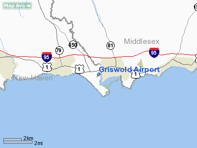
Madison, Connecticut |
| Elevation AMSL |
15 ft / 5 m |
| Coordinates |
41°16′16″N 072°32′59″W / 41.27111°N 72.54972°W / 41.27111; -72.54972 |
| Runways |
| Direction |
Length |
Surface |
| ft |
m |
| 6/24 |
1,863 |
568 |
Asphalt |
| Statistics (2005) |
| Aircraft operations |
3,000 |
| Source: Federal Aviation Administration |
Griswold Airport (FAA LID: N04) was a public airport located three miles (5 km) east of the central business district of Madison, a town in New Haven County, Connecticut, United States. It was privately owned by Griswold Airport, Inc.
The airport has been closed since the beginning of 2007. According to the Hartford Courant, the owner sold the property to make way for a proposed 127-unit development for people 55 and older. History
Griswold Airport opened in 1931, located between Route 1 and the Hammonasset River, and adjacent to Hammonasset State Park. In 1985, the Griswold family offered to sell the airport to the town of Madison. In November 2000, Leyland Development Corporation obtained an option to purchase the land, and submitted plans for a 260-unit housing development, which was approved by the towns' Planning and Zoning Commission (PZC). A lawsuit against the town to stop the development failed, but local opposition was so strong that Leyland withdrew its original proposal. In the fall of 2003, the developer (renamed LeylandAlliance), submitted a revised proposal to build 131 units. In May 2004, the new proposal was approved by the PZC. LeylandAlliance completed the purchase in February 2007.
Facilities and aircraft
Griswold Airport covered an area of 42 acres which contained one asphalt paved runway (6/24) measuring 1,863 x 50 ft (568 x 15 m). For the 12-month period ending December 31, 2005, the airport had 3,000 aircraft operations, 100% of which were general aviation.
The above content comes from Wikipedia and is published under free licenses – click here to read more.
Location
& QuickFacts
|
FAA
Information Effective: |
2006-09-28 |
|
Airport
Identifier: |
N04 |
|
Longitude/Latitude: |
072-32-59.0270W/41-16-16.2560N
-72.549730/41.271182 (Estimated) |
|
Elevation: |
15 ft / 4.57 m (Surveyed) |
|
Land: |
40 acres |
|
From
nearest city: |
3 nautical miles E of Madison, CT |
|
Location: |
New Haven County, CT |
|
Magnetic Variation: |
14W (1985) |
Owner
& Manager
|
Ownership: |
Privately owned |
|
Owner: |
Griswold Arpt Inc |
|
Address: |
1362 Boston Post Road
Madison, CT 06443 |
|
Phone number: |
860-669-3025 |
|
Manager: |
Loren Baker |
|
Address: |
25 Andre Drive
Westbrook, CT 06498 |
|
Phone number: |
860-664-3730 |
Airport
Operations and Facilities
|
Airport
Use: |
Open to public |
|
Wind
indicator: |
Yes |
|
Segmented
Circle: |
No |
|
Control
Tower: |
No |
|
Attendance
Schedule: |
IREG |
|
Landing
fee charge: |
Yes |
|
Sectional
chart: |
New York |
|
Region: |
ANE - New England |
|
Traffic
Pattern Alt: |
1000 ft |
|
Boundary
ARTCC: |
ZBW - Boston |
|
Responsible
ARTCC: |
ZNY - New York |
|
Tie-in
FSS: |
BDR - Bridgeport |
|
FSS
on Airport: |
No |
|
FSS
Phone: |
866-293-5149 |
|
FSS
Toll Free: |
1-800-WX-BRIEF |
|
NOTAMs
Facility: |
BDR (NOTAM-d service avaliable) |
|
Federal Agreements: |
N |
Airport
Communications
|
CTAF: |
122.800 |
|
Unicom: |
122.800 |
Airport
Services
|
Bottled
Oxygen: |
NONE |
|
Bulk
Oxygen: |
NONE |
|
Runway Information
Runway 06/24
|
Dimension: |
1863 x 50 ft / 567.8 x 15.2 m |
|
Surface: |
ASPH, Fair Condition |
|
Weight
Limit: |
Single wheel: 8000 lbs. |
|
|
Runway 06 |
Runway 24 |
|
Longitude: |
072-33-07.6110W |
072-32-50.3800W |
|
Latitude: |
41-16-09.7300N |
41-16-22.7640N |
|
Elevation: |
4.00
ft |
6.00
ft |
|
Alignment: |
45 |
127 |
|
Traffic
Pattern: |
Left |
Left |
|
Markings: |
Basic, Fair Condition |
Basic, Fair Condition |
|
Centerline
Lights: |
|
No |
|
Obstruction: |
49 ft trees, 680.0 ft from runway, 150 ft right
of centerline, 9:1 slope to clear |
67 ft trees, 656.0 ft from runway, 150 ft right
of centerline, 6:1 slope to clear
+8 FT WEEDS 40 FT FROM THLD ON CNTRLN. |
|
Radio Navigation
Aids
|
ID |
Type |
Name |
Ch |
Freq |
Var |
Dist |
|
MMK |
NDB |
Meriden |
|
238.00 |
14W |
19.1 nm |
|
HF |
NDB |
Lomis |
|
244.00 |
15W |
22.2 nm |
|
TBY |
NDB |
Waterbury |
|
257.00 |
14W |
31.0 nm |
|
OP |
NDB |
Old Field Point Light |
|
316.00 |
13W |
31.2 nm |
|
FOK |
TACAN |
Suffolk Co |
047X |
|
13W |
26.3 nm |
|
MAD |
VOR/DME |
Madison |
041X |
110.40 |
13W |
6.9 nm |
|
HVN |
VOR/DME |
New Haven |
035X |
109.80 |
13W |
15.2 nm |
|
HFD |
VOR/DME |
Hartford |
096X |
114.90 |
13W |
22.2 nm |
|
GON |
VOR/DME |
Groton |
45Y |
110.85 |
14W |
22.8 nm |
|
CCC |
VOR/DME |
Calverton |
119X |
117.20 |
13W |
23.4 nm |
|
BDR |
VOR/DME |
Bridgeport |
25X |
108.80 |
12W |
26.8 nm |
|
ORW |
VOR/DME |
Norwich |
037X |
110.00 |
14W |
30.2 nm |
|
SEY |
VOR/DME |
Sandy Point |
125X |
117.80 |
15W |
44.5 nm |
|
DPK |
VOR/DME |
Deer Park |
124X |
117.70 |
12W |
44.7 nm |
|
CMK |
VOR/DME |
Carmel |
113X |
116.60 |
12W |
46.6 nm |
|
HTO |
VORTAC |
Hampton |
083X |
113.60 |
13W |
23.7 nm |
|
BDL |
VORTAC |
Bradley |
027X |
109.00 |
14W |
40.7 nm |
|
GON |
VOT |
Groton |
|
110.25 |
|
22.8 nm |
|
BDR |
VOT |
Bridgeport |
|
109.25 |
|
26.9 nm |
|
HFD |
VOT |
Hartford |
|
108.20 |
|
28.2 nm |
|
ISP |
VOT |
Long Island Mac Arthur |
|
109.40 |
|
38.1 nm |
|
BDL |
VOT |
Bradley Intl |
|
111.40 |
|
40.6 nm |
Remarks
- ALL
TAKEOFFS; LNDGS; & TAXI OPNS RESTRICTED TO ASPH SFCS ONLY.
-
< WINTER
DURG CONDS PVMNT ICY AND WINDS>
- ARPT
CLSD TO TRANSIENT ACFT EXCEPT BY PRIOR PERMISSION.
- ULTRALIGHT
ACTIVITY ON AND INVOF ARPT.
- SW
100 FT OF RY 06/24 SUBJECT TO PONDING AT HIGH TIDE.
- MODEL
AIRPLANES FLYING INVOF ARPT.
- EXISTED
PRIOR TO 1959.
Based Aircraft
|
Aircraft
based on field: |
12 |
|
Single
Engine Airplanes: |
5 |
|
Ultralights: |
7 |
Operational Statistics
|
Aircraft
Operations: |
58/Week |
|
General
Aviation Local: |
83.3% |
|
General
Aviation Itinerant: |
16.7% |
Griswold Airport
Address:
New Haven County, CT
Tel:
860-669-3025, 860-664-3730
Images
and information placed above are from
http://www.airport-data.com/airport/N04/
We
thank them for the data!
| General
Info |
| Country |
United
States |
| State |
CONNECTICUT
|
| FAA ID |
N04
|
| Latitude |
41-16-16.256N
|
| Longitude |
072-32-59.027W
|
| Elevation |
15 feet
|
| Near City |
MADISON
|
We don't guarantee the information is fresh and accurate. The data may
be wrong or outdated.
For more up-to-date information please refer to other sources.
|
|


