 |
|
Location
& QuickFacts
|
FAA
Information Effective: |
2006-09-28 |
|
Airport
Identifier: |
CT32 |
|
Longitude/Latitude: |
071-50-04.2550W/41-32-07.3560N
-71.834515/41.535377 (Estimated) |
|
Elevation: |
440 ft / 134.11 m (Estimated) |
|
Land: |
0 acres |
|
From
nearest city: |
3 nautical miles SE of Voluntown, CT |
|
Location: |
New London County, CT |
|
Magnetic Variation: |
15W (1985) |
Owner
& Manager
|
Ownership: |
Privately owned |
|
Owner: |
Benjamin Gallup |
|
Address: |
Box 18-d1
Voluntown, CT 06384 |
|
Manager: |
Benjamin Gallup |
|
Address: |
Box 18-d1
Voluntown, CT 06384 |
Airport
Operations and Facilities
|
Airport Use: |
Private |
|
Wind indicator: |
Yes |
|
Segmented Circle: |
No |
|
Control Tower: |
No |
|
Attendance Schedule: |
UNATNDD |
|
Landing fee charge: |
No |
|
Sectional chart: |
New York |
|
Region: |
ANE - New England |
|
Boundary ARTCC: |
ZBW - Boston |
|
Tie-in FSS: |
BDR - Bridgeport |
|
FSS on Airport: |
No |
|
FSS Phone: |
866-293-5149 |
|
FSS Toll Free: |
1-800-WX-BRIEF |
Airport
Services
|
Airframe
Repair: |
NONE |
|
Power
Plant Repair: |
NONE |
|
Runway Information
Runway N/S
|
Dimension: |
2000 x 200 ft / 609.6 x 61.0 m |
|
Surface: |
TURF, |
|
|
Runway N |
Runway S |
|
Traffic
Pattern: |
Left |
Left |
|
Radio Navigation
Aids
|
ID |
Type |
Name |
Ch |
Freq |
Var |
Dist |
|
ORW |
FAN MARKER |
Canton |
|
|
15W |
48.3 nm |
|
SFZ |
NDB |
Central |
|
241.00 |
15W |
27.8 nm |
|
HF |
NDB |
Lomis |
|
244.00 |
15W |
36.1 nm |
|
IHM |
NDB |
Mansfield |
|
220.00 |
16W |
40.1 nm |
|
TAN |
NDB |
Taunton |
|
227.00 |
16W |
42.0 nm |
|
MMK |
NDB |
Meriden |
|
238.00 |
14W |
44.8 nm |
|
FFF |
NDB |
Plymouth |
|
257.00 |
16W |
50.0 nm |
|
ORW |
VOR/DME |
Norwich |
037X |
110.00 |
14W |
7.5 nm |
|
GON |
VOR/DME |
Groton |
45Y |
110.85 |
14W |
15.7 nm |
|
SEY |
VOR/DME |
Sandy Point |
125X |
117.80 |
15W |
25.0 nm |
|
PUT |
VOR/DME |
Putnam |
121X |
117.40 |
14W |
25.3 nm |
|
HFD |
VOR/DME |
Hartford |
096X |
114.90 |
13W |
32.7 nm |
|
MAD |
VOR/DME |
Madison |
041X |
110.40 |
13W |
40.9 nm |
|
PVD |
VORTAC |
Providence |
103X |
115.60 |
14W |
21.4 nm |
|
HTO |
VORTAC |
Hampton |
083X |
113.60 |
13W |
43.0 nm |
|
BDL |
VORTAC |
Bradley |
027X |
109.00 |
14W |
45.4 nm |
|
GON |
VOT |
Groton |
|
110.25 |
|
16.0 nm |
|
PVD |
VOT |
Providence |
|
108.20 |
|
21.5 nm |
|
HFD |
VOT |
Hartford |
|
108.20 |
|
38.6 nm |
|
ORH |
VOT |
Worcester |
|
108.20 |
|
44.0 nm |
|
BDL |
VOT |
Bradley Intl |
|
111.40 |
|
45.1 nm |
Remarks
Based Aircraft
|
Aircraft
based on field: |
5 |
|
Single
Engine Airplanes: |
4 |
|
Multi
Engine Airplanes: |
1 |
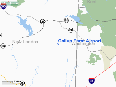
Gallup Farm Airport
Address:
New London County, CT
Tel:
Images
and information placed above are from
http://www.airport-data.com/airport/CT32/
We
thank them for the data!
| General
Info |
| Country |
United
States |
| State |
CONNECTICUT
|
| FAA ID |
CT32
|
| Latitude |
41-32-07.356N
|
| Longitude |
071-50-04.255W
|
| Elevation |
440 feet
|
| Near City |
VOLUNTOWN
|
We don't guarantee the information is fresh and accurate. The data may
be wrong or outdated.
For more up-to-date information please refer to other sources.
|
|


